


FAA L35/36 Instrument Flight Rules (IFR) Enroute Low Altitude Chart - 07/09/26 thru 09/03/26
18724
Benefits
Benefits
Shipping & Delivery
Shipping & Delivery
Returns
Returns
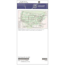
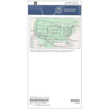
The FAA L35/36 IFR Low Altitude Enroute Chart is the official navigation reference for instrument-rated pilots flying below 18,000 feet in the coastal Mid-Atlantic region.
This FAA-authorized chart delivers the most current and accurate navigational data, ensuring regulatory compliance for all instrument flight operations.
Comprehensive Coverage for Mid-Atlantic IFR Flights
For IFR flights across Virginia, Maryland, Delaware, North Carolina, South Carolina, or the District of Columbia, this L35/36 navigation chart is your essential cockpit companion. It displays critical information such as low altitude flight routes, specific navigation points, ATC reporting points, GPS/satellite navigation routes, Military Training Routes, special use airspace boundaries, and VHF navigational facilities with complete frequency and coordinate data. Whether you're a certified flight instructor, a student pilot, or a professional pilot, this chart answers the crucial question of which IFR chart do I need for Virginia flights and surrounding Mid-Atlantic areas.
Stay Updated with the Latest Aeronautical Information
Published every 56 days, this 4-color chart features scales from 5 to 20 nautical miles per inch for optimal readability. It covers essential portions of the coastal Mid-Atlantic area in a single, convenient format, eliminating the need for multiple charts. Available as a one-time purchase or subscription service, pilots can choose the option that fits their flying frequency and budget, ensuring they never fly with outdated navigation data.
Ensure your Mid-Atlantic IFR flights are safe and compliant with the official FAA L35/36 Low Altitude Chart, your essential source for current, accurate navigation. Order yours today!
-
 SaleVendor:AeroNav Products
FAA L23/24 Instrument Flight Rules (IFR) Enroute Low Altitude Chart - 07/09/26 thru 09/03/26
Regular price $5.00Sale price $5.00 Regular priceUnit price per$5.25 -
 SaleVendor:AeroNav Products
FAA L3/4 Instrument Flight Rules (IFR) Enroute Low Altitude Chart - 07/09/26 thru 09/03/26
Regular price $5.00Sale price $5.00 Regular priceUnit price per$5.25 -
 SaleVendor:AeroNav Products
FAA L21/22 Instrument Flight Rules (IFR) Enroute Low Altitude Chart - 07/09/26 thru 09/03/26
Regular price $5.00Sale price $5.00 Regular priceUnit price per$5.25 -
 SaleVendor:AeroNav Products
FAA L27/28 Instrument Flight Rules (IFR) Enroute Low Altitude Chart - 07/09/26 thru 09/03/26
Regular price $5.00Sale price $5.00 Regular priceUnit price per$5.25 -
 SaleVendor:AeroNav Products
FAA L15/16 Instrument Flight Rules (IFR) Enroute Low Altitude Chart - 07/09/26 thru 09/03/26
Regular price $5.00Sale price $5.00 Regular priceUnit price per$5.25 -
 SaleVendor:AeroNav Products
FAA L1/2 Instrument Flight Rules (IFR) Enroute Low Altitude Chart - 07/09/26 thru 09/03/26
Regular price $5.00Sale price $5.00 Regular priceUnit price per$5.25 -
 SaleVendor:AeroNav Products
FAA L17/18 Instrument Flight Rules (IFR) Enroute Low Altitude Chart - 07/09/26 thru 09/03/26
Regular price $5.00Sale price $5.00 Regular priceUnit price per$5.25 -
 SaleVendor:AeroNav Products
FAA L19/20 Instrument Flight Rules (IFR) Enroute Low Altitude Chart - 07/09/26 thru 09/03/26
Regular price $5.00Sale price $5.00 Regular priceUnit price per$5.25 -
 SaleVendor:AeroNav Products
FAA L25/26 Instrument Flight Rules (IFR) Enroute Low Altitude Chart - 07/09/26 thru 09/03/26
Regular price $5.00Sale price $5.00 Regular priceUnit price per$5.25 -
 SaleVendor:AeroNav Products
FAA L5/6 Instrument Flight Rules (IFR) Enroute Low Altitude Chart - 07/09/26 thru 09/03/26
Regular price $5.00Sale price $5.00 Regular priceUnit price per$5.25


-
 FREE U.S. Shipping (on $100+)Save on outbound delivery!
 -
 Authorized DealerGenuine Gear
 -
 Expert Pilot SupportGear Tested by Real Pilots
 -
 SHIPS TODAY (Order by 3 PM ET)Get It Faster!
- Choosing a selection results in a full page refresh.
- Opens in a new window.