


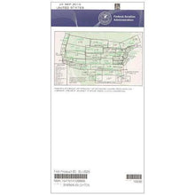
FAA L1/2 Instrument Flight Rules (IFR) Enroute Low Altitude Chart - 07/09/26 thru 09/03/26
10021
Benefits
Benefits
Shipping & Delivery
Shipping & Delivery
Returns
Returns
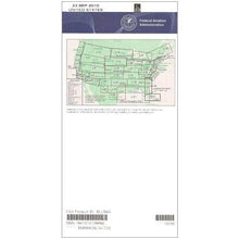
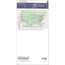
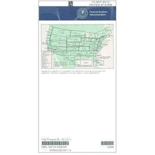
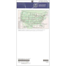
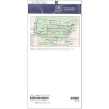
The FAA Enroute Low US L1/2 is the essential low-altitude IFR navigation chart for pilots flying below 18,000 feet along the Pacific Coast.
This chart provides the most current and regulatory-compliant navigation data, ensuring pilots meet all safety standards while navigating complex airspace.
Comprehensive Coverage for Pacific Coast IFR Pilots
When planning an IFR flight through Washington, Oregon, or Northern California, this chart offers all the critical information you need. Its four-color design clearly depicts IFR flight routes, GPS-based navigation routes, controlled airspace boundaries, ATC reporting points, and military training routes. Professional pilots, flight training operators, and aviation dispatchers rely on its detailed coverage of VHF navigational facilities, including frequencies, identification codes, and geographic coordinates. This chart's precise regional focus covers high-traffic corridors where weather conditions and complex airspace demand accurate navigation aids.
Stay Updated with Regular Chart Cycles
Published on the FAA's standard 56-day update cycle, this IFR chart subscription ensures you always have access to the latest airspace changes and navigational data. Whether you choose a one-time purchase or ongoing subscription, you're investing in a resource that transforms challenging Pacific Coast navigation into confident, compliant flight operations. The chart scale varies from 5 to 20 nautical miles per inch, providing the perfect balance of detail and overview for effective flight planning and in-cockpit reference.
Navigate Pacific Coast IFR routes with utmost confidence using the official FAA L1/2 Enroute Chart. Ensure guaranteed safety and compliance with always current data, get yours now!
-
 SaleVendor:AeroNav Products
FAA L23/24 Instrument Flight Rules (IFR) Enroute Low Altitude Chart - 07/09/26 thru 09/03/26
Regular price $5.00Sale price $5.00 Regular priceUnit price per$5.25 -
 SaleVendor:AeroNav Products
FAA L3/4 Instrument Flight Rules (IFR) Enroute Low Altitude Chart - 07/09/26 thru 09/03/26
Regular price $5.00Sale price $5.00 Regular priceUnit price per$5.25 -
 SaleVendor:AeroNav Products
FAA L21/22 Instrument Flight Rules (IFR) Enroute Low Altitude Chart - 07/09/26 thru 09/03/26
Regular price $5.00Sale price $5.00 Regular priceUnit price per$5.25 -
 SaleVendor:AeroNav Products
FAA L27/28 Instrument Flight Rules (IFR) Enroute Low Altitude Chart - 07/09/26 thru 09/03/26
Regular price $5.00Sale price $5.00 Regular priceUnit price per$5.25 -
 SaleVendor:AeroNav Products
FAA L35/36 Instrument Flight Rules (IFR) Enroute Low Altitude Chart - 07/09/26 thru 09/03/26
Regular price $5.00Sale price $5.00 Regular priceUnit price per$5.25 -
 SaleVendor:AeroNav Products
FAA L15/16 Instrument Flight Rules (IFR) Enroute Low Altitude Chart - 07/09/26 thru 09/03/26
Regular price $5.00Sale price $5.00 Regular priceUnit price per$5.25 -
 SaleVendor:AeroNav Products
FAA L17/18 Instrument Flight Rules (IFR) Enroute Low Altitude Chart - 07/09/26 thru 09/03/26
Regular price $5.00Sale price $5.00 Regular priceUnit price per$5.25 -
 SaleVendor:AeroNav Products
FAA L19/20 Instrument Flight Rules (IFR) Enroute Low Altitude Chart - 07/09/26 thru 09/03/26
Regular price $5.00Sale price $5.00 Regular priceUnit price per$5.25 -
 SaleVendor:AeroNav Products
FAA L25/26 Instrument Flight Rules (IFR) Enroute Low Altitude Chart - 07/09/26 thru 09/03/26
Regular price $5.00Sale price $5.00 Regular priceUnit price per$5.25 -
 SaleVendor:AeroNav Products
FAA L5/6 Instrument Flight Rules (IFR) Enroute Low Altitude Chart - 07/09/26 thru 09/03/26
Regular price $5.00Sale price $5.00 Regular priceUnit price per$5.25


-
 FREE U.S. Shipping (on $100+)Save on outbound delivery!
 -
 Authorized DealerGenuine Gear
 -
 Expert Pilot SupportGear Tested by Real Pilots
 -
 SHIPS TODAY (Order by 3 PM ET)Get It Faster!
- Choosing a selection results in a full page refresh.
- Opens in a new window.