


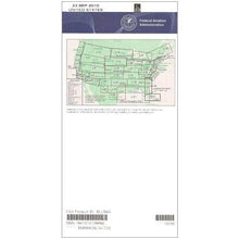
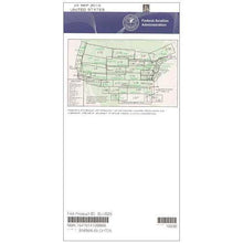
FAA L19/20 Instrument Flight Rules (IFR) Enroute Low Altitude Chart - 07/09/26 thru 09/03/26
10030
Benefits
Benefits
Shipping & Delivery
Shipping & Delivery
Returns
Returns
The FAA L19/20 Instrument Flight Rules (IFR) Enroute Low Altitude Chart is an essential navigational tool for pilots flying below 18,000 feet in Central and South Texas, the US/Mexico border region, and Gulf Coast areas.
This official FAA chart offers the most accurate and current navigational data, ensuring regulatory compliance and flight safety for instrument-rated pilots in complex airspace.
Comprehensive Coverage and Critical Data
Pilots exploring "what areas does the L19 L20 chart cover" find extensive coverage from Houston to the border crossings near Brownsville and McAllen. This low altitude IFR chart includes vital flight data such as established IFR flight paths (Victor Airways), navigational fixes, and mandatory Air Traffic Control (ATC) communication points. It also details Military Training Routes (MTRs), Area Navigation (RNAV) routes, restricted airspace, and VHF radio navigation aids with complete frequency and channel information. The four-color design ensures readability, with scales from 5 to 20 nautical miles per inch for optimal detail.
Indispensable for Border Region Navigation
For those asking "do I need low altitude charts for flying near the Mexican border," this chart is crucial for navigating the unique challenges of border airspace. International boundaries, military areas, and heavy commercial traffic create complex requirements. Published every 56 days, this Texas airspace chart ensures pilots have the latest information for IFR planning. Available as a one-time purchase or subscription, it is an essential investment in flight safety and efficiency for every instrument flight in Texas.
Navigate complex Texas, border, and Gulf Coast airspace with confidence using the official FAA L19/20 IFR chart, ensuring regulatory compliance and safety with data updated every 56 days. Order your essential chart today!
-
 SaleVendor:AeroNav Products
FAA L23/24 Instrument Flight Rules (IFR) Enroute Low Altitude Chart - 07/09/26 thru 09/03/26
Regular price $5.00Sale price $5.00 Regular priceUnit price per$5.25 -
 SaleVendor:AeroNav Products
FAA L3/4 Instrument Flight Rules (IFR) Enroute Low Altitude Chart - 07/09/26 thru 09/03/26
Regular price $5.00Sale price $5.00 Regular priceUnit price per$5.25 -
 SaleVendor:AeroNav Products
FAA L21/22 Instrument Flight Rules (IFR) Enroute Low Altitude Chart - 07/09/26 thru 09/03/26
Regular price $5.00Sale price $5.00 Regular priceUnit price per$5.25 -
 SaleVendor:AeroNav Products
FAA L27/28 Instrument Flight Rules (IFR) Enroute Low Altitude Chart - 07/09/26 thru 09/03/26
Regular price $5.00Sale price $5.00 Regular priceUnit price per$5.25 -
 SaleVendor:AeroNav Products
FAA L35/36 Instrument Flight Rules (IFR) Enroute Low Altitude Chart - 07/09/26 thru 09/03/26
Regular price $5.00Sale price $5.00 Regular priceUnit price per$5.25 -
 SaleVendor:AeroNav Products
FAA L15/16 Instrument Flight Rules (IFR) Enroute Low Altitude Chart - 07/09/26 thru 09/03/26
Regular price $5.00Sale price $5.00 Regular priceUnit price per$5.25 -
 SaleVendor:AeroNav Products
FAA L1/2 Instrument Flight Rules (IFR) Enroute Low Altitude Chart - 07/09/26 thru 09/03/26
Regular price $5.00Sale price $5.00 Regular priceUnit price per$5.25 -
 SaleVendor:AeroNav Products
FAA L17/18 Instrument Flight Rules (IFR) Enroute Low Altitude Chart - 07/09/26 thru 09/03/26
Regular price $5.00Sale price $5.00 Regular priceUnit price per$5.25 -
 SaleVendor:AeroNav Products
FAA L25/26 Instrument Flight Rules (IFR) Enroute Low Altitude Chart - 07/09/26 thru 09/03/26
Regular price $5.00Sale price $5.00 Regular priceUnit price per$5.25 -
 SaleVendor:AeroNav Products
FAA L5/6 Instrument Flight Rules (IFR) Enroute Low Altitude Chart - 07/09/26 thru 09/03/26
Regular price $5.00Sale price $5.00 Regular priceUnit price per$5.25


-
 FREE U.S. Shipping (on $100+)Save on outbound delivery!
 -
 Authorized DealerGenuine Gear
 -
 Expert Pilot SupportGear Tested by Real Pilots
 -
 SHIPS TODAY (Order by 3 PM ET)Get It Faster!
- Choosing a selection results in a full page refresh.
- Opens in a new window.