


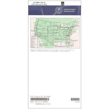
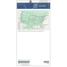
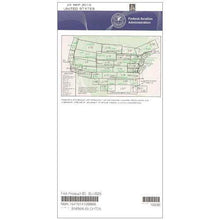
FAA L3/4 Instrument Flight Rules (IFR) Enroute Low Altitude Chart - 07/09/26 thru 09/03/26
10022
Benefits
Benefits
Shipping & Delivery
Shipping & Delivery
Returns
Returns
FAA Enroute Low Altitude Charts provide essential navigation for IFR flights below 18,000 feet in Southern California.
Unmatched Authority and Precision make this L3/4 IFR chart the only official FAA resource for low altitude navigation in the region.
Comprehensive Coverage for Safe Navigation
Ensure your safety with the L3/4 low altitude chart, detailing Victor Airways, navigational fixes, and ATC reporting points. It includes Military Training Routes, Area Navigation routes, and special use airspace. The chart also covers controlled airspace boundaries and VHF radio navigation aids, complete with frequencies, identifiers, and geographic coordinates. Spanning from coastal areas to the California/Mexico border, scales range from 5 to 20 nautical miles per inch, providing precise detail for every flight phase.
Current Cycle Charts for Reliable Planning
Published on a 56-day cycle, the L3/4 chart ensures you have the most current navigation data. Whether you're a professional pilot, flight instructor, or private aviator, this chart simplifies complex flight planning. Available as a one-time purchase or subscription, it is an essential resource for any serious IFR pilot navigating Southern California's airspace.
Master Southern California IFR navigation with the official FAA L3/4 Enroute Low Altitude Chart. It's your authoritative source for the essential, safety-critical data you can't fly without. Upgrade now!
-
 SaleVendor:AeroNav Products
FAA L23/24 Instrument Flight Rules (IFR) Enroute Low Altitude Chart - 07/09/26 thru 09/03/26
Regular price $5.00Sale price $5.00 Regular priceUnit price per$5.25 -
 SaleVendor:AeroNav Products
FAA L21/22 Instrument Flight Rules (IFR) Enroute Low Altitude Chart - 07/09/26 thru 09/03/26
Regular price $5.00Sale price $5.00 Regular priceUnit price per$5.25 -
 SaleVendor:AeroNav Products
FAA L27/28 Instrument Flight Rules (IFR) Enroute Low Altitude Chart - 07/09/26 thru 09/03/26
Regular price $5.00Sale price $5.00 Regular priceUnit price per$5.25 -
 SaleVendor:AeroNav Products
FAA L35/36 Instrument Flight Rules (IFR) Enroute Low Altitude Chart - 07/09/26 thru 09/03/26
Regular price $5.00Sale price $5.00 Regular priceUnit price per$5.25 -
 SaleVendor:AeroNav Products
FAA L15/16 Instrument Flight Rules (IFR) Enroute Low Altitude Chart - 07/09/26 thru 09/03/26
Regular price $5.00Sale price $5.00 Regular priceUnit price per$5.25 -
 SaleVendor:AeroNav Products
FAA L1/2 Instrument Flight Rules (IFR) Enroute Low Altitude Chart - 07/09/26 thru 09/03/26
Regular price $5.00Sale price $5.00 Regular priceUnit price per$5.25 -
 SaleVendor:AeroNav Products
FAA L17/18 Instrument Flight Rules (IFR) Enroute Low Altitude Chart - 07/09/26 thru 09/03/26
Regular price $5.00Sale price $5.00 Regular priceUnit price per$5.25 -
 SaleVendor:AeroNav Products
FAA L19/20 Instrument Flight Rules (IFR) Enroute Low Altitude Chart - 07/09/26 thru 09/03/26
Regular price $5.00Sale price $5.00 Regular priceUnit price per$5.25 -
 SaleVendor:AeroNav Products
FAA L25/26 Instrument Flight Rules (IFR) Enroute Low Altitude Chart - 07/09/26 thru 09/03/26
Regular price $5.00Sale price $5.00 Regular priceUnit price per$5.25 -
 SaleVendor:AeroNav Products
FAA L5/6 Instrument Flight Rules (IFR) Enroute Low Altitude Chart - 07/09/26 thru 09/03/26
Regular price $5.00Sale price $5.00 Regular priceUnit price per$5.25


-
 FREE U.S. Shipping (on $100+)Save on outbound delivery!
 -
 Authorized DealerGenuine Gear
 -
 Expert Pilot SupportGear Tested by Real Pilots
 -
 SHIPS TODAY (Order by 3 PM ET)Get It Faster!
- Choosing a selection results in a full page refresh.
- Opens in a new window.