


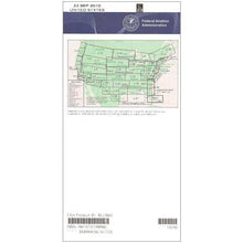
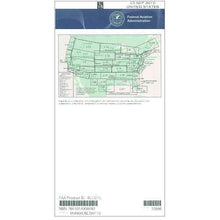
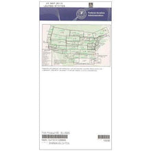
FAA L27/28 Instrument Flight Rules (IFR) Enroute Low Altitude Chart - 07/09/26 thru 09/03/26
10034
Benefits
Benefits
Shipping & Delivery
Shipping & Delivery
Returns
Returns
FAA IFR Low Altitude Chart L27/28 serves as the official navigational foundation for instrument pilots operating below 18,000 feet across the Midwest region.
This official FAA enroute chart provides the most accurate and comprehensive low altitude navigation data available, ensuring complete regulatory compliance for all IFR flight operations.
Essential Midwest IFR Navigation
When planning an instrument flight through America's heartland, the information on an IFR low altitude chart is critical for safety and success. This Midwest IFR chart displays essential Victor Airways, forming the backbone of the low-altitude route system. It includes precise navigational fixes, ATC reporting points for communication with air traffic control, and GPS-based RNAV routes for modern navigation equipment. The chart also marks military training routes, special use airspace boundaries, and controlled airspace limits requiring specific clearances.
Comprehensive Coverage and Utility
Covering nine states, including Illinois, Indiana, Kentucky, Missouri, Ohio, Michigan, Iowa, Wisconsin, and Minnesota, this L-27/28 enroute chart simplifies complex regional navigation. Whether you're a commercial pilot maintaining schedule reliability, a flight instructor teaching proper IFR procedures, or a private pilot exploring unfamiliar territory, the chart's detailed VHF navigational facilities information includes frequencies, identifiers, and precise geographic coordinates. Published on the FAA's standard 56-day cycle and available for individual purchase or subscription, this low altitude enroute chart ensures you always have current data for safe passage through the Midwest's busy airspace corridors.
Navigate the Midwest with official FAA accuracy and ensure complete compliance using the L27/28 IFR Enroute Low Altitude Chart. Get yours now!
-
 SaleVendor:AeroNav Products
FAA L23/24 Instrument Flight Rules (IFR) Enroute Low Altitude Chart - 07/09/26 thru 09/03/26
Regular price $5.00Sale price $5.00 Regular priceUnit price per$5.25 -
 SaleVendor:AeroNav Products
FAA L3/4 Instrument Flight Rules (IFR) Enroute Low Altitude Chart - 07/09/26 thru 09/03/26
Regular price $5.00Sale price $5.00 Regular priceUnit price per$5.25 -
 SaleVendor:AeroNav Products
FAA L21/22 Instrument Flight Rules (IFR) Enroute Low Altitude Chart - 07/09/26 thru 09/03/26
Regular price $5.00Sale price $5.00 Regular priceUnit price per$5.25 -
 SaleVendor:AeroNav Products
FAA L35/36 Instrument Flight Rules (IFR) Enroute Low Altitude Chart - 07/09/26 thru 09/03/26
Regular price $5.00Sale price $5.00 Regular priceUnit price per$5.25 -
 SaleVendor:AeroNav Products
FAA L15/16 Instrument Flight Rules (IFR) Enroute Low Altitude Chart - 07/09/26 thru 09/03/26
Regular price $5.00Sale price $5.00 Regular priceUnit price per$5.25 -
 SaleVendor:AeroNav Products
FAA L1/2 Instrument Flight Rules (IFR) Enroute Low Altitude Chart - 07/09/26 thru 09/03/26
Regular price $5.00Sale price $5.00 Regular priceUnit price per$5.25 -
 SaleVendor:AeroNav Products
FAA L17/18 Instrument Flight Rules (IFR) Enroute Low Altitude Chart - 07/09/26 thru 09/03/26
Regular price $5.00Sale price $5.00 Regular priceUnit price per$5.25 -
 SaleVendor:AeroNav Products
FAA L19/20 Instrument Flight Rules (IFR) Enroute Low Altitude Chart - 07/09/26 thru 09/03/26
Regular price $5.00Sale price $5.00 Regular priceUnit price per$5.25 -
 SaleVendor:AeroNav Products
FAA L25/26 Instrument Flight Rules (IFR) Enroute Low Altitude Chart - 07/09/26 thru 09/03/26
Regular price $5.00Sale price $5.00 Regular priceUnit price per$5.25 -
 SaleVendor:AeroNav Products
FAA L5/6 Instrument Flight Rules (IFR) Enroute Low Altitude Chart - 07/09/26 thru 09/03/26
Regular price $5.00Sale price $5.00 Regular priceUnit price per$5.25


-
 FREE U.S. Shipping (on $100+)Save on outbound delivery!
 -
 Authorized DealerGenuine Gear
 -
 Expert Pilot SupportGear Tested by Real Pilots
 -
 SHIPS TODAY (Order by 3 PM ET)Get It Faster!
- Choosing a selection results in a full page refresh.
- Opens in a new window.