


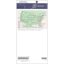
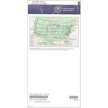
FAA L25/26 Instrument Flight Rules (IFR) Enroute Low Altitude Chart - 07/09/26 thru 09/03/26
10033
Benefits
Benefits
Shipping & Delivery
Shipping & Delivery
Returns
Returns
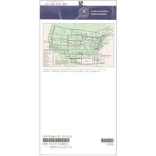
FAA Enroute Low Charts L25/26 are the essential navigation resource for instrument flight operations below 18,000 feet in the Mid-Atlantic region.
These official FAA charts, L-25 and L-26, are the trusted standard for regulatory compliance and flight safety.
Comprehensive Coverage and Critical Information
Pilots seeking to understand "what areas do L-25 L-26 charts cover" will find extensive coverage. These charts span parts of Tennessee, North Carolina, South Carolina, Kentucky, Virginia, and West Virginia, as well as sections of Georgia, Alabama, Indiana, and Ohio. They provide critical safety information, including designated air routes for instrument flight, specific navigation reference points, ATC reporting points, military training routes, area navigation routes, restricted aviation areas, controlled airspace boundaries, and VHF navigational facilities with complete frequency, identification, and coordinate data. The detailed 4-color presentation ensures pilots can quickly identify essential navigation elements during flight planning and execution.
Currency and Flexibility for Professional Use
Published on the FAA's standard 56-day update cycle, these Mid-Atlantic IFR charts maintain the currency that professional pilots, flight training organizations, and corporate aviation departments require for safe instrument flight operations. Whether purchased individually or through a subscription service, pilots gain access to chart scales varying from 5 to 20 nautical miles per inch, providing the precise detail needed for effective IFR navigation throughout this heavily trafficked airspace region.
Ensure safe, compliant IFR flights across the Mid-Atlantic with the official FAA Enroute Low US L25/26 chart, your authentic source for comprehensive navigation. Get yours now!
-
 SaleVendor:AeroNav Products
FAA L23/24 Instrument Flight Rules (IFR) Enroute Low Altitude Chart - 07/09/26 thru 09/03/26
Regular price $5.00Sale price $5.00 Regular priceUnit price per$5.25 -
 SaleVendor:AeroNav Products
FAA L3/4 Instrument Flight Rules (IFR) Enroute Low Altitude Chart - 07/09/26 thru 09/03/26
Regular price $5.00Sale price $5.00 Regular priceUnit price per$5.25 -
 SaleVendor:AeroNav Products
FAA L21/22 Instrument Flight Rules (IFR) Enroute Low Altitude Chart - 07/09/26 thru 09/03/26
Regular price $5.00Sale price $5.00 Regular priceUnit price per$5.25 -
 SaleVendor:AeroNav Products
FAA L27/28 Instrument Flight Rules (IFR) Enroute Low Altitude Chart - 07/09/26 thru 09/03/26
Regular price $5.00Sale price $5.00 Regular priceUnit price per$5.25 -
 SaleVendor:AeroNav Products
FAA L35/36 Instrument Flight Rules (IFR) Enroute Low Altitude Chart - 07/09/26 thru 09/03/26
Regular price $5.00Sale price $5.00 Regular priceUnit price per$5.25 -
 SaleVendor:AeroNav Products
FAA L15/16 Instrument Flight Rules (IFR) Enroute Low Altitude Chart - 07/09/26 thru 09/03/26
Regular price $5.00Sale price $5.00 Regular priceUnit price per$5.25 -
 SaleVendor:AeroNav Products
FAA L1/2 Instrument Flight Rules (IFR) Enroute Low Altitude Chart - 07/09/26 thru 09/03/26
Regular price $5.00Sale price $5.00 Regular priceUnit price per$5.25 -
 SaleVendor:AeroNav Products
FAA L17/18 Instrument Flight Rules (IFR) Enroute Low Altitude Chart - 07/09/26 thru 09/03/26
Regular price $5.00Sale price $5.00 Regular priceUnit price per$5.25 -
 SaleVendor:AeroNav Products
FAA L19/20 Instrument Flight Rules (IFR) Enroute Low Altitude Chart - 07/09/26 thru 09/03/26
Regular price $5.00Sale price $5.00 Regular priceUnit price per$5.25 -
 SaleVendor:AeroNav Products
FAA L5/6 Instrument Flight Rules (IFR) Enroute Low Altitude Chart - 07/09/26 thru 09/03/26
Regular price $5.00Sale price $5.00 Regular priceUnit price per$5.25


-
 FREE U.S. Shipping (on $100+)Save on outbound delivery!
 -
 Authorized DealerGenuine Gear
 -
 Expert Pilot SupportGear Tested by Real Pilots
 -
 SHIPS TODAY (Order by 3 PM ET)Get It Faster!
- Choosing a selection results in a full page refresh.
- Opens in a new window.