


FAA Dutch Harbor VFR Sectional Chart for Alaska Pilots - 07/09/26 thru 09/03/26
10075
Benefits
Benefits
Shipping & Delivery
Shipping & Delivery
Returns
Returns
FAA Dutch Harbor Sectional Chart: The essential navigation tool for pilots in Alaska's Aleutian region.
Official FAA Source: Updated every 56 days, this chart ensures complete accuracy and regulatory compliance.
Comprehensive Data for Safe Aleutian Flying
For VFR navigation in Alaska's challenging Aleutian Islands, you need more than just any aviation map. This specialized chart provides comprehensive data, covering Unalaska Island and surrounding Pacific Ocean and Bering Sea regions. It includes details on remote airports, runway specifications, lighting systems, elevation data, radio navigation aids, airspace dimensions, and terrain features. These are vital for safe operations in this unforgiving environment. The foldable, full-color format includes essential details like ATC frequencies, obstructions, landmarks, and surface types. Bush pilots, charter operators, and recreational aviators depend on these when flying in areas with limited infrastructure and challenging weather conditions.
Optimal Scale for Precise Navigation
The Dutch Harbor sectional chart uses a precise 1:500,000 scale, providing the optimal balance of detail and coverage area. This is crucial for accurate flight planning and in-flight reference. Updated every two months, this Alaska flight planning resource ensures you have the most current airspace information, facility changes, and safety data. In remote Alaskan operations, outdated information isn't just inconvenient; it's dangerous.
Navigate Alaska's uniquely challenging Aleutian airspace with absolute confidence. The official FAA Dutch Harbor Sectional ensures your safety and compliance with the most accurate, current data, direct from the FAA. Secure your official chart now!
-
 SaleVendor:AeroNav Products
FAA Seward VFR Sectional Chart for Alaska Pilots - 07/09/26 thru 09/03/26
Regular price $7.50Sale price $7.50 Regular priceUnit price per$7.55 -
 SaleVendor:AeroNav Products
FAA Mcgrath VFR Sectional Aeronautical Chart - 07/09/26 thru 09/03/26
Regular price $7.50Sale price $7.50 Regular priceUnit price per$7.55 -
 SaleVendor:AeroNav Products
FAA Fairbanks VFR Sectional Chart for Alaska Pilots - 07/09/26 thru 09/03/26
Regular price $7.50Sale price $7.50 Regular priceUnit price per$7.55 -
 SaleVendor:AeroNav Products
FAA Anchorage VFR Sectional Chart for Alaska Pilots - 07/09/26 thru 09/03/26
Regular price $7.50Sale price $7.50 Regular priceUnit price per$7.55 -
 SaleVendor:AeroNav Products
FAA Nome VFR Sectional Chart for Alaska Pilots - 07/09/26 thru 09/03/26
Regular price $7.50Sale price $7.50 Regular priceUnit price per$7.55 -
 SaleVendor:AeroNav Products
FAA Bethel VFR Sectional Chart for Alaska Pilots - 07/09/26 thru 09/03/26
Regular price $7.50Sale price $7.50 Regular priceUnit price per$7.55 -
 SaleVendor:AeroNav Products
FAA Enroute Low Alaska L1/2 Low Altitude IFR Chart for Alaska Pilots - 07/09/26 thru 09/03/26
Regular price $5.00Sale price $5.00 Regular priceUnit price per$5.25 -
 SaleVendor:AeroNav Products
FAA Kodiak VFR Sectional Chart for Alaska Pilots - 07/09/26 thru 09/03/26
Regular price $7.50Sale price $7.50 Regular priceUnit price per$7.55 -
 SaleVendor:AeroNav Products
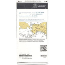
FAA Cape Lisburne VFR Sectional Chart for Alaska Pilots - 07/09/26 thru 09/03/26
Regular price $7.50Sale price $7.50 Regular priceUnit price per$7.55 -
 SaleVendor:AeroNav Products
FAA Cold Bay VFR Sectional Chart for Alaska Pilots - 07/09/26 thru 09/03/26
Regular price $7.50Sale price $7.50 Regular priceUnit price per$7.55


-
 FREE U.S. Shipping (on $100+)Save on outbound delivery!
 -
 Authorized DealerGenuine Gear
 -
 Expert Pilot SupportGear Tested by Real Pilots
 -
 SHIPS TODAY (Order by 3 PM ET)Get It Faster!
- Choosing a selection results in a full page refresh.
- Opens in a new window.