


FAA Kodiak VFR Sectional Chart for Alaska Pilots - 07/09/26 thru 09/03/26
10088
Benefits
Benefits
Shipping & Delivery
Shipping & Delivery
Returns
Returns
The FAA Kodiak Sectional Chart is an essential navigation tool for pilots flying in Southwestern Alaska, providing critical aeronautical data in a standardized format.
Official and Accurate: As the FAA's official chart producer, AeroNav ensures you receive the most current and accurate Alaska VFR sectional chart available, updated every 56 days for safe flight operations.
Comprehensive Coverage for Alaska Pilots
When planning your next flight through Alaska's demanding airspace, this comprehensive Kodiak aviation map provides everything you need for confident VFR navigation. The full-color, foldable chart displays critical flight planning information, including airport details with runway lengths and lighting systems, airspace dimensions, radio navigation aids with frequencies and identifiers, topographic features, and obstruction data. Whether you're a bush pilot navigating remote landing strips or conducting search and rescue operations around Katmai National Park, this Alaska sectional chart covers the southwestern portion of the state with a detailed scale where one inch equals about 7 nautical miles.
Indispensable Information for Bush Flying
What information is on a Kodiak sectional that makes it indispensable for Alaska bush flying? Beyond standard aeronautical data, you'll find landmarks, cities and towns, elevation contours, bodies of water, ATC contact frequencies, and visual checkpoints essential for maintaining situational awareness in areas with minimal infrastructure. The chart encompasses the coastal areas extending from Bristol Bay to the Pacific Ocean, providing comprehensive coverage for both commercial and recreational pilots who prioritize safety when navigating unfamiliar or challenging terrain in this rugged, unforgiving environment.
Ensure your safety and compliance in Southwestern Alaska's demanding airspace with the official FAA Kodiak Sectional Chart, your most accurate and current source for VFR navigation. Order yours today!
-
 SaleVendor:AeroNav Products
FAA Seward VFR Sectional Chart for Alaska Pilots - 07/09/26 thru 09/03/26
Regular price $7.50Sale price $7.50 Regular priceUnit price per$7.55 -
 SaleVendor:AeroNav Products
FAA Mcgrath VFR Sectional Aeronautical Chart - 07/09/26 thru 09/03/26
Regular price $7.50Sale price $7.50 Regular priceUnit price per$7.55 -
 SaleVendor:AeroNav Products
FAA Fairbanks VFR Sectional Chart for Alaska Pilots - 07/09/26 thru 09/03/26
Regular price $7.50Sale price $7.50 Regular priceUnit price per$7.55 -
 SaleVendor:AeroNav Products
FAA Anchorage VFR Sectional Chart for Alaska Pilots - 07/09/26 thru 09/03/26
Regular price $7.50Sale price $7.50 Regular priceUnit price per$7.55 -
 SaleVendor:AeroNav Products
FAA Bethel VFR Sectional Chart for Alaska Pilots - 07/09/26 thru 09/03/26
Regular price $7.50Sale price $7.50 Regular priceUnit price per$7.55 -
 SaleVendor:AeroNav Products
FAA Enroute Low Alaska L3/4 Low Altitude IFR Chart for Alaska Pilots - 07/09/26 thru 09/03/26
Regular price $5.00Sale price $5.00 Regular priceUnit price per$5.25 -
 SaleVendor:AeroNav Products
FAA Nome VFR Sectional Chart for Alaska Pilots - 07/09/26 thru 09/03/26
Regular price $7.50Sale price $7.50 Regular priceUnit price per$7.55 -
 SaleVendor:AeroNav Products
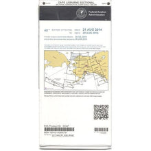
FAA Cape Lisburne VFR Sectional Chart for Alaska Pilots - 07/09/26 thru 09/03/26
Regular price $7.50Sale price $7.50 Regular priceUnit price per$7.55 -
 SaleVendor:AeroNav Products
FAA Dawson VFR Sectional Chart for Alaska Pilots - 07/09/26 thru 09/03/26
Regular price $7.50Sale price $7.50 Regular priceUnit price per$7.55 -
 SaleVendor:AeroNav Products
FAA Cold Bay VFR Sectional Chart for Alaska Pilots - 07/09/26 thru 09/03/26
Regular price $7.50Sale price $7.50 Regular priceUnit price per$7.55


-
 FREE U.S. Shipping (on $100+)Save on outbound delivery!
 -
 Authorized DealerGenuine Gear
 -
 Expert Pilot SupportGear Tested by Real Pilots
 -
 SHIPS TODAY (Order by 3 PM ET)Get It Faster!
- Choosing a selection results in a full page refresh.
- Opens in a new window.