


FAA Cold Bay VFR Sectional Chart for Alaska Pilots - 07/09/26 thru 09/03/26
10070
Benefits
Benefits
Shipping & Delivery
Shipping & Delivery
Returns
Returns
The Cold Bay VFR sectional chart is the authoritative navigation resource for pilots operating in Alaska's remote Aleutian Peninsula region.
This official FAA Alaska sectional chart provides the most current and comprehensive aeronautical information available. It is updated every 56 days to ensure complete accuracy for this challenging flying environment.
Comprehensive Coverage of the Aleutian Peninsula
Pilots often ask, "What area does the Cold Bay sectional cover?" They find extensive coverage of the Alaska Peninsula around the Aleutians East Borough. This includes significant Pacific Ocean airspace at the standard 1:500,000 scale, where one inch equals approximately 6.9 nautical miles. This foldable, full-color chart delivers essential aviation data, including Cold Bay airport navigation details with runway lengths, lighting systems, elevation markers, and available services. Bush pilots and commercial operators rely on the detailed airspace dimensions, VHF and LF/MF navigational facilities with frequencies and identification codes, plus comprehensive topographic information showing landmarks, cities, towns, and critical obstruction data.
Reliable Navigation for Challenging Conditions
Whether you're planning remote Alaska flight operations or need reliable VFR navigation tools for Aleutian flying, this current Alaska VFR chart addresses the unique challenges of operating in one of America's most demanding aviation environments. The chart includes vital ATC entity information with associated contact frequencies, bodies of water references, and elevation data that proves invaluable when weather conditions change rapidly in this remote region.
Navigate Alaska's challenging Aleutian airspace with confidence using the official FAA Cold Bay Sectional Chart, your essential guide for safe, compliant flights, always current with 56-day updates and detailed regional coverage. Order yours today!
-
 SaleVendor:AeroNav Products
FAA Seward VFR Sectional Chart for Alaska Pilots - 07/09/26 thru 09/03/26
Regular price $7.50Sale price $7.50 Regular priceUnit price per$7.55 -
 SaleVendor:AeroNav Products
FAA Mcgrath VFR Sectional Aeronautical Chart - 07/09/26 thru 09/03/26
Regular price $7.50Sale price $7.50 Regular priceUnit price per$7.55 -
 SaleVendor:AeroNav Products
FAA Fairbanks VFR Sectional Chart for Alaska Pilots - 07/09/26 thru 09/03/26
Regular price $7.50Sale price $7.50 Regular priceUnit price per$7.55 -
 SaleVendor:AeroNav Products
FAA Anchorage VFR Sectional Chart for Alaska Pilots - 07/09/26 thru 09/03/26
Regular price $7.50Sale price $7.50 Regular priceUnit price per$7.55 -
 SaleVendor:AeroNav Products
FAA Bethel VFR Sectional Chart for Alaska Pilots - 07/09/26 thru 09/03/26
Regular price $7.50Sale price $7.50 Regular priceUnit price per$7.55 -
 SaleVendor:AeroNav Products
FAA Kodiak VFR Sectional Chart for Alaska Pilots - 07/09/26 thru 09/03/26
Regular price $7.50Sale price $7.50 Regular priceUnit price per$7.55 -
 SaleVendor:AeroNav Products
FAA Enroute Low Alaska L3/4 Low Altitude IFR Chart for Alaska Pilots - 07/09/26 thru 09/03/26
Regular price $5.00Sale price $5.00 Regular priceUnit price per$5.25 -
 SaleVendor:AeroNav Products
FAA Nome VFR Sectional Chart for Alaska Pilots - 07/09/26 thru 09/03/26
Regular price $7.50Sale price $7.50 Regular priceUnit price per$7.55 -
 SaleVendor:AeroNav Products
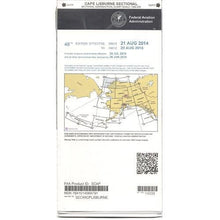
FAA Cape Lisburne VFR Sectional Chart for Alaska Pilots - 07/09/26 thru 09/03/26
Regular price $7.50Sale price $7.50 Regular priceUnit price per$7.55 -
 SaleVendor:AeroNav Products
FAA Dawson VFR Sectional Chart for Alaska Pilots - 07/09/26 thru 09/03/26
Regular price $7.50Sale price $7.50 Regular priceUnit price per$7.55


-
 FREE U.S. Shipping (on $100+)Save on outbound delivery!
 -
 Authorized DealerGenuine Gear
 -
 Expert Pilot SupportGear Tested by Real Pilots
 -
 SHIPS TODAY (Order by 3 PM ET)Get It Faster!
- Choosing a selection results in a full page refresh.
- Opens in a new window.