


FAA Seward VFR Sectional Chart for Alaska Pilots - 07/09/26 thru 09/03/26
10106
Benefits
Benefits
Shipping & Delivery
Shipping & Delivery
Returns
Returns
The FAA Seward Sectional Chart is the definitive VFR navigation tool for pilots exploring Alaska's southern coastline.
Updated every 56 days, this official FAA Alaska sectional ensures you have the most current aeronautical data for safe flight operations in one of America's most challenging airspace environments.
Comprehensive Coverage for Southern Alaska
Covering the breathtaking Kenai Fjords National Park, Prince William Sound, and the Gulf of Alaska, this chart is indispensable for southern Alaska flying. Precise navigation here can mean the difference between a memorable flight and a dangerous situation. Whether you're a bush pilot navigating remote airstrips or a recreational aviator seeking scenic wonders, this chart provides complete airport details, including runway lengths, lighting systems, and elevation data.
Essential Data for All Pilots
The full-color design clearly displays airspace dimensions, radio navigation aids with all frequencies and identifiers, air traffic control contacts, topographic information, and obstruction data. Printed on durable paper, it withstands repeated cockpit use. Professional pilots rely on this map for regulatory compliance and operational safety, while recreational pilots appreciate its readability and confidence-building guidance.
Navigate Alaska's challenging southern coast with confidence and safety using the official FAA Seward Sectional, updated every 56 days with comprehensive VFR data. Order your essential chart today!
-
 SaleVendor:AeroNav Products
FAA Mcgrath VFR Sectional Aeronautical Chart - 07/09/26 thru 09/03/26
Regular price $7.50Sale price $7.50 Regular priceUnit price per$7.55 -
 SaleVendor:AeroNav Products
FAA Fairbanks VFR Sectional Chart for Alaska Pilots - 07/09/26 thru 09/03/26
Regular price $7.50Sale price $7.50 Regular priceUnit price per$7.55 -
 SaleVendor:AeroNav Products
FAA Anchorage VFR Sectional Chart for Alaska Pilots - 07/09/26 thru 09/03/26
Regular price $7.50Sale price $7.50 Regular priceUnit price per$7.55 -
 SaleVendor:AeroNav Products
FAA Bethel VFR Sectional Chart for Alaska Pilots - 07/09/26 thru 09/03/26
Regular price $7.50Sale price $7.50 Regular priceUnit price per$7.55 -
 SaleVendor:AeroNav Products
FAA Kodiak VFR Sectional Chart for Alaska Pilots - 07/09/26 thru 09/03/26
Regular price $7.50Sale price $7.50 Regular priceUnit price per$7.55 -
 SaleVendor:AeroNav Products
FAA Enroute Low Alaska L3/4 Low Altitude IFR Chart for Alaska Pilots - 07/09/26 thru 09/03/26
Regular price $5.00Sale price $5.00 Regular priceUnit price per$5.25 -
 SaleVendor:AeroNav Products
FAA Nome VFR Sectional Chart for Alaska Pilots - 07/09/26 thru 09/03/26
Regular price $7.50Sale price $7.50 Regular priceUnit price per$7.55 -
 SaleVendor:AeroNav Products
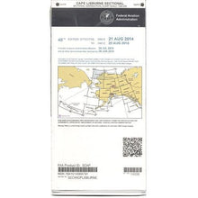
FAA Cape Lisburne VFR Sectional Chart for Alaska Pilots - 07/09/26 thru 09/03/26
Regular price $7.50Sale price $7.50 Regular priceUnit price per$7.55 -
 SaleVendor:AeroNav Products
FAA Dawson VFR Sectional Chart for Alaska Pilots - 07/09/26 thru 09/03/26
Regular price $7.50Sale price $7.50 Regular priceUnit price per$7.55 -
 SaleVendor:AeroNav Products
FAA Cold Bay VFR Sectional Chart for Alaska Pilots - 07/09/26 thru 09/03/26
Regular price $7.50Sale price $7.50 Regular priceUnit price per$7.55


-
 FREE U.S. Shipping (on $100+)Save on outbound delivery!
 -
 Authorized DealerGenuine Gear
 -
 Expert Pilot SupportGear Tested by Real Pilots
 -
 SHIPS TODAY (Order by 3 PM ET)Get It Faster!
- Choosing a selection results in a full page refresh.
- Opens in a new window.