


FAA Anchorage VFR Sectional Chart for Alaska Pilots - 07/09/26 thru 09/03/26
10060
Benefits
Benefits
Shipping & Delivery
Shipping & Delivery
Returns
Returns
The FAA Anchorage sectional chart is Alaska's most trusted aeronautical chart for Visual Flight Rules navigation in one of America's most challenging aviation environments.
This official FAA Anchorage sectional provides the accuracy and regulatory compliance that Alaska pilots depend on, updated every 56 days to reflect the latest airspace and airport information changes.
Comprehensive Data for Safe Navigation
Pilots flying in Alaska's demanding terrain need more than just any aviation map, they need comprehensive data that can mean the difference between a safe flight and a dangerous situation. This Alaska VFR sectional chart offers detailed topographic information, airspace dimensions, airport data including runway lengths and lighting systems, navigational facilities with frequencies and identifiers, landmarks, elevation details, air traffic control contacts, and obstruction information. Its foldable design is practical for cockpit use, while the standard scale covers large areas with the detailed information essential for flight planning Anchorage operations. Whether you're a general aviation pilot exploring Alaska's wilderness, a flight instructor training students in challenging conditions, or a commercial operator serving remote communities, this sectional aeronautical chart addresses the critical question of what information pilots need for safe VFR navigation in Alaska's unique environment.
Reliability for Diverse Aviation Needs
Bush pilots, air tour operators, and emergency responders throughout Alaska rely on this Anchorage aeronautical chart because it provides the most current and comprehensive visual flight reference available. The chart's regular revision cycle ensures pilots always have access to the latest airspace changes, new obstructions, and updated airport information that could impact flight safety. From the challenging approaches around Anchorage International to the remote airstrips scattered throughout the region, this chart covers the essential navigation data that makes Alaska flying possible.
Fly with confidence in Alaska's challenging airspace: get the official FAA Anchorage Sectional Chart, updated every 56 days for maximum safety and compliance. Order yours today!
-
 SaleVendor:AeroNav Products
FAA Seward VFR Sectional Chart for Alaska Pilots - 07/09/26 thru 09/03/26
Regular price $7.50Sale price $7.50 Regular priceUnit price per$7.55 -
 SaleVendor:AeroNav Products
FAA Mcgrath VFR Sectional Aeronautical Chart - 07/09/26 thru 09/03/26
Regular price $7.50Sale price $7.50 Regular priceUnit price per$7.55 -
 SaleVendor:AeroNav Products
FAA Fairbanks VFR Sectional Chart for Alaska Pilots - 07/09/26 thru 09/03/26
Regular price $7.50Sale price $7.50 Regular priceUnit price per$7.55 -
 SaleVendor:AeroNav Products
FAA Nome VFR Sectional Chart for Alaska Pilots - 07/09/26 thru 09/03/26
Regular price $7.50Sale price $7.50 Regular priceUnit price per$7.55 -
 SaleVendor:AeroNav Products
FAA Bethel VFR Sectional Chart for Alaska Pilots - 07/09/26 thru 09/03/26
Regular price $7.50Sale price $7.50 Regular priceUnit price per$7.55 -
 SaleVendor:AeroNav Products
FAA Enroute Low Alaska L1/2 Low Altitude IFR Chart for Alaska Pilots - 07/09/26 thru 09/03/26
Regular price $5.00Sale price $5.00 Regular priceUnit price per$5.25 -
 SaleVendor:AeroNav Products
FAA Kodiak VFR Sectional Chart for Alaska Pilots - 07/09/26 thru 09/03/26
Regular price $7.50Sale price $7.50 Regular priceUnit price per$7.55 -
 SaleVendor:AeroNav Products
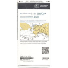
FAA Cape Lisburne VFR Sectional Chart for Alaska Pilots - 07/09/26 thru 09/03/26
Regular price $7.50Sale price $7.50 Regular priceUnit price per$7.55 -
 SaleVendor:AeroNav Products
FAA Cold Bay VFR Sectional Chart for Alaska Pilots - 07/09/26 thru 09/03/26
Regular price $7.50Sale price $7.50 Regular priceUnit price per$7.55 -
 SaleVendor:AeroNav Products
FAA Enroute Low Alaska L3/4 Low Altitude IFR Chart for Alaska Pilots - 07/09/26 thru 09/03/26
Regular price $5.00Sale price $5.00 Regular priceUnit price per$5.25


-
 FREE U.S. Shipping (on $100+)Save on outbound delivery!
 -
 Authorized DealerGenuine Gear
 -
 Expert Pilot SupportGear Tested by Real Pilots
 -
 SHIPS TODAY (Order by 3 PM ET)Get It Faster!
- Choosing a selection results in a full page refresh.
- Opens in a new window.