


FAA Nome VFR Sectional Chart for Alaska Pilots - 07/09/26 thru 09/03/26
10098
Benefits
Benefits
Shipping & Delivery
Shipping & Delivery
Returns
Returns
The FAA Nome Sectional Chart is a critical navigational tool designed for visual flight operations in Western Alaska, providing comprehensive aeronautical data at a 1:500,000 scale to support safe aviation in this challenging region.
This official government-issued aeronautical chart uniquely covers the Seward Peninsula, Norton Sound, Bering Strait, and even portions of eastern Russia, making it the only sectional chart pilots need for safe operations in this remote region.
Essential Navigation for Western Alaska
When bush pilots and private aviators ask, "Which chart do I need for flying in Western Alaska?" the answer is clear: this comprehensive Alaska sectional chart delivers critical aviation map information at a 1:500,000 scale, where 1 inch represents about 7 nautical miles. The full-color, foldable chart contains detailed airport information, including runway lengths, lighting systems, elevation data, available services, and surface types. It also includes airspace dimensions, VHF and low/medium frequency navigation aids with frequencies and identifiers, landmarks, cities and towns, topographic details, ATC contact frequencies, bodies of water, and obstruction data. Commercial bush pilots operating daily flights to remote villages rely on this current Alaska sectional for understanding their aircraft's position and surroundings throughout every phase of flight. Tourism operators use it to plan safe routes for aerial sightseeing and adventure excursions across the International Date Line.
Regular Updates for Safety Assurance
Updated every 56 days as part of the FAA's standard revision cycle, this Western Alaska flight chart ensures pilots always have the most current navigational information for operations in areas with limited infrastructure and rapidly changing conditions. Flight training organizations depend on these regularly updated Alaska aviation charts to maintain educational standards and prepare students for the unique challenges of Arctic flying. Search and rescue coordinators use the precise geographical data for mission planning in emergency situations.
Navigate Western Alaska's challenging airspace safely with the official FAA Nome Sectional Chart, your source for comprehensive, current, and critical navigation data essential for this unique region. Get yours now!
-
 SaleVendor:AeroNav Products
FAA Seward VFR Sectional Chart for Alaska Pilots - 07/09/26 thru 09/03/26
Regular price $7.50Sale price $7.50 Regular priceUnit price per$7.55 -
 SaleVendor:AeroNav Products
FAA Mcgrath VFR Sectional Aeronautical Chart - 07/09/26 thru 09/03/26
Regular price $7.50Sale price $7.50 Regular priceUnit price per$7.55 -
 SaleVendor:AeroNav Products
FAA Fairbanks VFR Sectional Chart for Alaska Pilots - 07/09/26 thru 09/03/26
Regular price $7.50Sale price $7.50 Regular priceUnit price per$7.55 -
 SaleVendor:AeroNav Products
FAA Anchorage VFR Sectional Chart for Alaska Pilots - 07/09/26 thru 09/03/26
Regular price $7.50Sale price $7.50 Regular priceUnit price per$7.55 -
 SaleVendor:AeroNav Products
FAA Bethel VFR Sectional Chart for Alaska Pilots - 07/09/26 thru 09/03/26
Regular price $7.50Sale price $7.50 Regular priceUnit price per$7.55 -
 SaleVendor:AeroNav Products
FAA Kodiak VFR Sectional Chart for Alaska Pilots - 07/09/26 thru 09/03/26
Regular price $7.50Sale price $7.50 Regular priceUnit price per$7.55 -
 SaleVendor:AeroNav Products
FAA Enroute Low Alaska L3/4 Low Altitude IFR Chart for Alaska Pilots - 07/09/26 thru 09/03/26
Regular price $5.00Sale price $5.00 Regular priceUnit price per$5.25 -
 SaleVendor:AeroNav Products
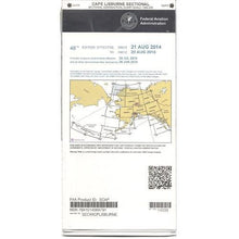
FAA Cape Lisburne VFR Sectional Chart for Alaska Pilots - 07/09/26 thru 09/03/26
Regular price $7.50Sale price $7.50 Regular priceUnit price per$7.55 -
 SaleVendor:AeroNav Products
FAA Dawson VFR Sectional Chart for Alaska Pilots - 07/09/26 thru 09/03/26
Regular price $7.50Sale price $7.50 Regular priceUnit price per$7.55 -
 SaleVendor:AeroNav Products
FAA Cold Bay VFR Sectional Chart for Alaska Pilots - 07/09/26 thru 09/03/26
Regular price $7.50Sale price $7.50 Regular priceUnit price per$7.55


-
 FREE U.S. Shipping (on $100+)Save on outbound delivery!
 -
 Authorized DealerGenuine Gear
 -
 Expert Pilot SupportGear Tested by Real Pilots
 -
 SHIPS TODAY (Order by 3 PM ET)Get It Faster!
- Choosing a selection results in a full page refresh.
- Opens in a new window.