


FAA Mcgrath VFR Sectional Aeronautical Chart - 07/09/26 thru 09/03/26
10092
Benefits
Benefits
Shipping & Delivery
Shipping & Delivery
Returns
Returns
The FAA McGrath Sectional Chart is an essential aeronautical navigation tool for pilots operating in Southwestern Alaska.
This chart provides the most authoritative and current navigation information, produced by the FAA as the trusted source for Alaska sectional charts.
Comprehensive Navigation Data for Alaska
Pilots seeking "where to buy McGrath sectional chart" for flights between Anchorage and Bethel will find this Southwest Alaska aviation map invaluable. It offers critical flight planning data, including detailed airport information with runway specifications, lighting systems, elevation data, and available services. The full-color, foldable chart features VHF and Low Frequency/Medium Frequency navigational facilities with complete frequency and identification details, airspace dimensions, landmarks, topographic information, Air Traffic Control entities with radio frequencies, water bodies, and obstruction data. Bush pilots navigating Alaska's remote regions depend on this level of detail to identify safe landing areas and avoid terrain hazards in areas where GPS signals may be unreliable.
Updated and Reliable Aeronautical Information
This current McGrath sectional utilizes the standard 1:500,000 scale, providing a 6.86 nautical miles per inch resolution. It is updated every 56 days to ensure pilots have access to the latest aeronautical information. Flight instructors training students in Alaska bush flying conditions and search and rescue operations rely on this navigation chart's comprehensive coverage of the region's unique geographical features and aviation infrastructure. It is an essential component of any pilot's flight bag for operations in this demanding airspace.
Fly confidently and safely through Southwestern Alaska's demanding airspace with the official FAA McGrath Sectional Chart, offering the most accurate, current, and detailed navigation data. Secure your essential flight tool today!
-
 SaleVendor:AeroNav Products
FAA Seward VFR Sectional Chart for Alaska Pilots - 07/09/26 thru 09/03/26
Regular price $7.50Sale price $7.50 Regular priceUnit price per$7.55 -
 SaleVendor:AeroNav Products
FAA Fairbanks VFR Sectional Chart for Alaska Pilots - 07/09/26 thru 09/03/26
Regular price $7.50Sale price $7.50 Regular priceUnit price per$7.55 -
 SaleVendor:AeroNav Products
FAA Anchorage VFR Sectional Chart for Alaska Pilots - 07/09/26 thru 09/03/26
Regular price $7.50Sale price $7.50 Regular priceUnit price per$7.55 -
 SaleVendor:AeroNav Products
FAA Bethel VFR Sectional Chart for Alaska Pilots - 07/09/26 thru 09/03/26
Regular price $7.50Sale price $7.50 Regular priceUnit price per$7.55 -
 SaleVendor:AeroNav Products
FAA Kodiak VFR Sectional Chart for Alaska Pilots - 07/09/26 thru 09/03/26
Regular price $7.50Sale price $7.50 Regular priceUnit price per$7.55 -
 SaleVendor:AeroNav Products
FAA Enroute Low Alaska L3/4 Low Altitude IFR Chart for Alaska Pilots - 07/09/26 thru 09/03/26
Regular price $5.00Sale price $5.00 Regular priceUnit price per$5.25 -
 SaleVendor:AeroNav Products
FAA Nome VFR Sectional Chart for Alaska Pilots - 07/09/26 thru 09/03/26
Regular price $7.50Sale price $7.50 Regular priceUnit price per$7.55 -
 SaleVendor:AeroNav Products
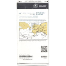
FAA Cape Lisburne VFR Sectional Chart for Alaska Pilots - 07/09/26 thru 09/03/26
Regular price $7.50Sale price $7.50 Regular priceUnit price per$7.55 -
 SaleVendor:AeroNav Products
FAA Dawson VFR Sectional Chart for Alaska Pilots - 07/09/26 thru 09/03/26
Regular price $7.50Sale price $7.50 Regular priceUnit price per$7.55 -
 SaleVendor:AeroNav Products
FAA Cold Bay VFR Sectional Chart for Alaska Pilots - 07/09/26 thru 09/03/26
Regular price $7.50Sale price $7.50 Regular priceUnit price per$7.55


-
 FREE U.S. Shipping (on $100+)Save on outbound delivery!
 -
 Authorized DealerGenuine Gear
 -
 Expert Pilot SupportGear Tested by Real Pilots
 -
 SHIPS TODAY (Order by 3 PM ET)Get It Faster!
- Choosing a selection results in a full page refresh.
- Opens in a new window.