


FAA Enroute Low Alaska L1/2 Low Altitude IFR Chart for Alaska Pilots - 07/09/26 thru 09/03/26
10040
Benefits
Benefits
Shipping & Delivery
Shipping & Delivery
Returns
Returns
The FAA Enroute Low Alaska L1/2 chart provides essential low altitude navigation data for instrument-rated pilots flying in Southern Alaska.
This official FAA chart is updated every 56 days, ensuring pilots have the most current safety data for reliable instrument navigation.
Comprehensive Coverage for Southern Alaska
Accurate aeronautical charts are crucial for safe arrivals in Southern Alaska's challenging terrain. The FAA Alaska L-1/L-2 chart covers the entire Southern coastal region, including the Aleutian Islands. It details designated instrument flight routes, navigation beacons, ATC reporting points, military training routes, and controlled airspace boundaries. The L-1 section includes specialized area charts for high-traffic zones around Juneau and Vancouver. The L-2 side covers the Aleutian Islands chain with detailed insets for East/King Salmon, Central/Cold Bay, and West/Adak Island regions.
Indispensable Navigation Aids
This chart includes VHF navigational facilities with complete frequency, identification, and coordinate data. It offers critical safety information for flight planning in remote areas where alternate airports are far apart. Whether you're a commercial operator, cargo pilot, or private pilot, this four-color chart provides the detailed aeronautical information needed for confident IFR flight planning. Available as both a single purchase and subscription option, it serves everyone from recreational flyers to daily commercial operations.
Fly with confidence across Southern Alaska using the official FAA L-1/L-2 chart, updated every 56 days with the latest safety data for comprehensive IFR navigation. Order yours today!
-
 SaleVendor:AeroNav Products
FAA Seward VFR Sectional Chart for Alaska Pilots - 07/09/26 thru 09/03/26
Regular price $7.50Sale price $7.50 Regular priceUnit price per$7.55 -
 SaleVendor:AeroNav Products
FAA Mcgrath VFR Sectional Aeronautical Chart - 07/09/26 thru 09/03/26
Regular price $7.50Sale price $7.50 Regular priceUnit price per$7.55 -
 SaleVendor:AeroNav Products
FAA Fairbanks VFR Sectional Chart for Alaska Pilots - 07/09/26 thru 09/03/26
Regular price $7.50Sale price $7.50 Regular priceUnit price per$7.55 -
 SaleVendor:AeroNav Products
FAA Anchorage VFR Sectional Chart for Alaska Pilots - 07/09/26 thru 09/03/26
Regular price $7.50Sale price $7.50 Regular priceUnit price per$7.55 -
 SaleVendor:AeroNav Products
FAA Nome VFR Sectional Chart for Alaska Pilots - 07/09/26 thru 09/03/26
Regular price $7.50Sale price $7.50 Regular priceUnit price per$7.55 -
 SaleVendor:AeroNav Products
FAA Bethel VFR Sectional Chart for Alaska Pilots - 07/09/26 thru 09/03/26
Regular price $7.50Sale price $7.50 Regular priceUnit price per$7.55 -
 SaleVendor:AeroNav Products
FAA Kodiak VFR Sectional Chart for Alaska Pilots - 07/09/26 thru 09/03/26
Regular price $7.50Sale price $7.50 Regular priceUnit price per$7.55 -
 SaleVendor:AeroNav Products
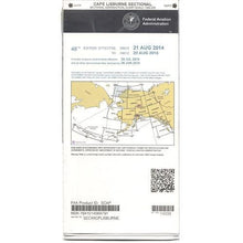
FAA Cape Lisburne VFR Sectional Chart for Alaska Pilots - 07/09/26 thru 09/03/26
Regular price $7.50Sale price $7.50 Regular priceUnit price per$7.55 -
 SaleVendor:AeroNav Products
FAA Cold Bay VFR Sectional Chart for Alaska Pilots - 07/09/26 thru 09/03/26
Regular price $7.50Sale price $7.50 Regular priceUnit price per$7.55 -
 SaleVendor:AeroNav Products
FAA Enroute Low Alaska L3/4 Low Altitude IFR Chart for Alaska Pilots - 07/09/26 thru 09/03/26
Regular price $5.00Sale price $5.00 Regular priceUnit price per$5.25


-
 FREE U.S. Shipping (on $100+)Save on outbound delivery!
 -
 Authorized DealerGenuine Gear
 -
 Expert Pilot SupportGear Tested by Real Pilots
 -
 SHIPS TODAY (Order by 3 PM ET)Get It Faster!
- Choosing a selection results in a full page refresh.
- Opens in a new window.