


FAA Enroute Low Alaska L3/4 Low Altitude IFR Chart for Alaska Pilots - 07/09/26 thru 09/03/26
10041
Benefits
Benefits
Shipping & Delivery
Shipping & Delivery
Returns
Returns
Alaska IFR charts are essential for navigating the state's vast wilderness with precision.
This FAA enroute low Alaska L-3/L-4 chart provides the most current navigation data for instrument pilots flying below 18,000 feet in challenging airspace.
Comprehensive Coverage for Alaska Pilots
When professional charter pilots, bush operators, and flight departments ask, "What is covered on the FAA Alaska low altitude chart?" they find critical information that transforms risky flights into confident operations. The L-3/L-4 covers most of Alaska, featuring detailed IFR routes, GPS-based navigation paths, military training routes, special use airspace boundaries, and radio navigation aids with precise frequencies and coordinates. The L-3 section includes a specialized Anchorage area chart, while the L-4 side provides essential Fairbanks area chart coverage, offering pilots the large-scale detail needed for Alaska's busiest airports and surrounding terrain.
Reliable and Up-to-Date Navigation
Whether flying remote supply runs to isolated communities or managing a corporate flight department's Alaska operations, this aeronautical chart eliminates guesswork in unforgiving conditions. Updated every 56 days on the FAA's standard cycle, it ensures you always have the latest airspace changes, route modifications, and safety-critical data. Available as both a single purchase for occasional Alaska flights or through convenient subscription options for regular operators, this IFR low altitude Alaska resource adapts to your operational needs while maintaining the accuracy that keeps you compliant and safe in Alaska's demanding environment.
Fly Alaska IFR with confidence. The official FAA L3/4 Low Altitude Chart ensures safe, compliant navigation in demanding airspace below 18,000 feet, always up-to-date. Get your essential chart now!
-
 SaleVendor:AeroNav Products
FAA Seward VFR Sectional Chart for Alaska Pilots - 07/09/26 thru 09/03/26
Regular price $7.50Sale price $7.50 Regular priceUnit price per$7.55 -
 SaleVendor:AeroNav Products
FAA Mcgrath VFR Sectional Aeronautical Chart - 07/09/26 thru 09/03/26
Regular price $7.50Sale price $7.50 Regular priceUnit price per$7.55 -
 SaleVendor:AeroNav Products
FAA Fairbanks VFR Sectional Chart for Alaska Pilots - 07/09/26 thru 09/03/26
Regular price $7.50Sale price $7.50 Regular priceUnit price per$7.55 -
 SaleVendor:AeroNav Products
FAA Anchorage VFR Sectional Chart for Alaska Pilots - 07/09/26 thru 09/03/26
Regular price $7.50Sale price $7.50 Regular priceUnit price per$7.55 -
 SaleVendor:AeroNav Products
FAA Bethel VFR Sectional Chart for Alaska Pilots - 07/09/26 thru 09/03/26
Regular price $7.50Sale price $7.50 Regular priceUnit price per$7.55 -
 SaleVendor:AeroNav Products
FAA Kodiak VFR Sectional Chart for Alaska Pilots - 07/09/26 thru 09/03/26
Regular price $7.50Sale price $7.50 Regular priceUnit price per$7.55 -
 SaleVendor:AeroNav Products
FAA Nome VFR Sectional Chart for Alaska Pilots - 07/09/26 thru 09/03/26
Regular price $7.50Sale price $7.50 Regular priceUnit price per$7.55 -
 SaleVendor:AeroNav Products
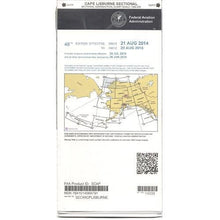
FAA Cape Lisburne VFR Sectional Chart for Alaska Pilots - 07/09/26 thru 09/03/26
Regular price $7.50Sale price $7.50 Regular priceUnit price per$7.55 -
 SaleVendor:AeroNav Products
FAA Dawson VFR Sectional Chart for Alaska Pilots - 07/09/26 thru 09/03/26
Regular price $7.50Sale price $7.50 Regular priceUnit price per$7.55 -
 SaleVendor:AeroNav Products
FAA Cold Bay VFR Sectional Chart for Alaska Pilots - 07/09/26 thru 09/03/26
Regular price $7.50Sale price $7.50 Regular priceUnit price per$7.55


-
 FREE U.S. Shipping (on $100+)Save on outbound delivery!
 -
 Authorized DealerGenuine Gear
 -
 Expert Pilot SupportGear Tested by Real Pilots
 -
 SHIPS TODAY (Order by 3 PM ET)Get It Faster!
- Choosing a selection results in a full page refresh.
- Opens in a new window.