


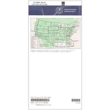
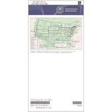
FAA L29/30 Instrument Flight Rules (IFR) Enroute Low Altitude Chart - 07/09/26 thru 09/03/26
18721
Benefits
Benefits
Shipping & Delivery
Shipping & Delivery
Returns
Returns
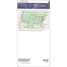
The FAA Enroute Low Altitude Chart L29/30 is an essential tool for instrument-rated pilots navigating below 18,000 feet in Southern New England and surrounding areas.
This official FAA chart guarantees regulatory compliance and unmatched accuracy, providing pilots with the most reliable IFR navigation data available.
Comprehensive Coverage and Features
Pilots exploring "what does the L29/30 chart cover" will find extensive coverage of Southern New England, parts of Ohio, West Virginia, Pennsylvania, Virginia, Maryland, the District of Columbia, New York, and Ontario, Canada. This detailed IFR L-29/30 chart includes Victor Airways, RNAV routes, military training routes, special use airspace, controlled airspace boundaries, and radio navigation beacons with frequencies, identifiers, and coordinates. The 4-color design enhances readability, and chart scales from 5 to 20 nautical miles per inch provide precise detail for safe navigation.
Subscription Options for Continuous Updates
Flight schools, corporate aviation departments, and charter operators appreciate the subscription option, ensuring they always have current editions published on the FAA's standard 56-day cycle. Whether for a one-time purchase or an ongoing subscription, this cost-effective chart is indispensable for pilots. It eliminates guesswork in route planning by clearly marking air traffic control checkpoints, approach fixes, and airports suitable for instrument operations throughout this busy northeastern corridor.
Fly safe, compliant IFR routes below 18,000 feet across Southern New England with the official, always-current FAA L29/30 chart. Order yours today!
-
 SaleVendor:AeroNav Products
FAA L23/24 Instrument Flight Rules (IFR) Enroute Low Altitude Chart - 07/09/26 thru 09/03/26
Regular price $5.00Sale price $5.00 Regular priceUnit price per$5.25 -
 SaleVendor:AeroNav Products
FAA L3/4 Instrument Flight Rules (IFR) Enroute Low Altitude Chart - 07/09/26 thru 09/03/26
Regular price $5.00Sale price $5.00 Regular priceUnit price per$5.25 -
 SaleVendor:AeroNav Products
FAA L21/22 Instrument Flight Rules (IFR) Enroute Low Altitude Chart - 07/09/26 thru 09/03/26
Regular price $5.00Sale price $5.00 Regular priceUnit price per$5.25 -
 SaleVendor:AeroNav Products
FAA L27/28 Instrument Flight Rules (IFR) Enroute Low Altitude Chart - 07/09/26 thru 09/03/26
Regular price $5.00Sale price $5.00 Regular priceUnit price per$5.25 -
 SaleVendor:AeroNav Products
FAA L35/36 Instrument Flight Rules (IFR) Enroute Low Altitude Chart - 07/09/26 thru 09/03/26
Regular price $5.00Sale price $5.00 Regular priceUnit price per$5.25 -
 SaleVendor:AeroNav Products
FAA L17/18 Instrument Flight Rules (IFR) Enroute Low Altitude Chart - 07/09/26 thru 09/03/26
Regular price $5.00Sale price $5.00 Regular priceUnit price per$5.25 -
 SaleVendor:AeroNav Products
FAA L7/8 Instrument Flight Rules (IFR) Enroute Low Altitude Chart - 07/09/26 thru 09/03/26
Regular price $5.00Sale price $5.00 Regular priceUnit price per$5.25 -
 SaleVendor:AeroNav Products
FAA L15/16 Instrument Flight Rules (IFR) Enroute Low Altitude Chart - 07/09/26 thru 09/03/26
Regular price $5.00Sale price $5.00 Regular priceUnit price per$5.25 -
 SaleVendor:AeroNav Products
FAA L33/34 Instrument Flight Rules (IFR) Enroute Low Altitude Chart - 07/09/26 thru 09/03/26
Regular price $5.00Sale price $5.00 Regular priceUnit price per$5.25 -
 SaleVendor:AeroNav Products
FAA L19/20 Instrument Flight Rules (IFR) Enroute Low Altitude Chart - 07/09/26 thru 09/03/26
Regular price $5.00Sale price $5.00 Regular priceUnit price per$5.25


-
 FREE U.S. Shipping (on $100+)Save on outbound delivery!
 -
 Authorized DealerGenuine Gear
 -
 Expert Pilot SupportGear Tested by Real Pilots
 -
 SHIPS TODAY (Order by 3 PM ET)Get It Faster!
- Choosing a selection results in a full page refresh.
- Opens in a new window.