


FAA San Diego VFR Terminal Area Chart - 07/09/26 thru 09/03/26
10138
Benefits
Benefits
Shipping & Delivery
Shipping & Delivery
Returns
Returns
The FAA San Diego Terminal Area Chart (TAC) is a specialized aeronautical navigation tool designed to provide detailed visual flight information for pilots operating in and around the San Diego Class B airspace.
This San Diego TAC VFR Chart offers unmatched detail at a 1:250,000 scale, providing nearly twice the precision of standard sectional charts. It is essential for flight planning in congested airspace.
Comprehensive Coverage for Safe Navigation
Pilots often ask, "What is the difference between TAC and sectional charts?" The answer is evident in San Diego's intricate controlled airspace around major airports. This official FAA publication transforms challenging navigation scenarios into manageable operations. It covers overlapping military and civilian airspace sectors, revealing essential landmarks, radio frequencies, and aeronautical data that sectional charts cannot accommodate. The exclusive VFR Flyway Planning Chart on the reverse side offers proven flight paths and altitudes, helping pilots avoid conflicts with faster air traffic. Flight instructors rely on this current San Diego aviation chart to teach students proper Class B airspace navigation, while commercial operators depend on its precision for regulatory compliance and efficient route planning.
Regular Updates for Current Information
Understanding how often San Diego terminal charts are updated is crucial for maintaining situational awareness. This chart follows the standard 56-day revision cycle, ensuring pilots access the most current airspace information. Whether you're a recreational pilot exploring America's Finest City, a flight school maintaining training standards, or a commercial operator requiring detailed VFR navigation tools, this official AeroNav publication delivers the comprehensive coverage and reliability that professional aviators trust for safe operations in San Diego's challenging airspace environment.
Fly confidently and compliantly through San Diego's intricate Class B airspace with the official FAA Terminal Area Chart, offering comprehensive coverage, a unique VFR Flyway Planning Chart, and critical 56-day updates. Get yours now!
-
 SaleVendor:AeroNav Products
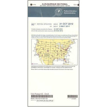
FAA Albuquerque VFR Sectional Aeronautical Chart - 07/09/26 thru 09/03/26
Regular price $8.50Sale price $8.50 Regular priceUnit price per$9.75 -
 SaleVendor:AeroNav Products
FAA Anchorage VFR Sectional Chart for Alaska Pilots - 07/09/26 thru 09/03/26
Regular price $7.50Sale price $7.50 Regular priceUnit price per$7.55 -
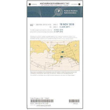 SaleVendor:AeroNav Products
FAA Anchorage/Fairbanks Terminal Area Chart for Alaska Pilots - 07/09/26 thru 09/03/26
Regular price $5.99Sale price $5.99 Regular priceUnit price per$6.20 -
 SaleVendor:AeroNav Products
FAA Atlanta VFR Sectional Aeronautical Chart - 07/09/26 thru 09/03/26
Regular price $8.50Sale price $8.50 Regular priceUnit price per$9.75 -
 SaleVendor:AeroNav Products
FAA Atlanta VFR Terminal Area Chart - 07/09/26 thru 09/03/26
Regular price $5.99Sale price $5.99 Regular priceUnit price per$6.20 -
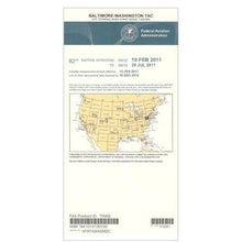 SaleVendor:AeroNav Products
FAA Baltimore - Washington VFR Terminal Area Chart - 07/09/26 thru 09/03/26
Regular price $5.99Sale price $5.99 Regular priceUnit price per$6.20 -
 SaleVendor:AeroNav Products
FAA Bethel VFR Sectional Chart for Alaska Pilots - 07/09/26 thru 09/03/26
Regular price $7.50Sale price $7.50 Regular priceUnit price per$7.55 -
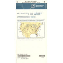 SaleVendor:AeroNav Products
FAA Billings VFR Sectional Aeronautical Chart - 07/09/26 thru 09/03/26
Regular price $8.50Sale price $8.50 Regular priceUnit price per$9.75 -
 SaleVendor:AeroNav Products
FAA Boston VFR Terminal Area Chart - 07/09/26 thru 09/03/26
Regular price $5.99Sale price $5.99 Regular priceUnit price per$6.20 -
 SaleVendor:AeroNav Products
FAA Brownsville VFR Sectional Aeronautical Chart - 07/09/26 thru 09/03/26
Regular price $8.50Sale price $8.50 Regular priceUnit price per$9.75


-
 FREE U.S. Shipping (on $100+)Save on outbound delivery!
 -
 Authorized DealerGenuine Gear
 -
 Expert Pilot SupportGear Tested by Real Pilots
 -
 SHIPS TODAY (Order by 3 PM ET)Get It Faster!
- Choosing a selection results in a full page refresh.
- Opens in a new window.