


FAA Atlanta VFR Terminal Area Chart - 05/14/26 thru 07/09/26
10114
Benefits
Benefits
Shipping & Delivery
Shipping & Delivery
Returns
Returns
Atlanta VFR Terminal Area Chart: Essential for navigating Atlanta's busy airspace.
Unmatched Detail and Safety: The FAA Atlanta Terminal Area Chart (TAC) offers unparalleled detail with its larger 1:250,000 scale, surpassing standard sectional charts.
The Atlanta VFR Terminal Area Chart is crucial for pilots operating near Hartsfield-Jackson International Airport. This official FAA chart provides detailed navigation support, enhancing situational awareness in one of the world's most congested airspaces.
Enhanced Navigation for VFR Pilots
When pilots ask, "What chart do I need to fly VFR near Atlanta airport?" the answer is clear. The Atlanta Terminal Area Chart transforms complex airspace navigation into confident flight planning. Its enhanced scale reveals additional waypoints, radio frequencies, and aviation landmarks, helping pilots maintain awareness alongside heavy commercial traffic. Student pilots and instructors value the clear presentation of Class B airspace boundaries, easing training flight anxiety.
VFR Flyway Planning for Safe Routes
The reverse side's VFR Flyway Planning Chart highlights recommended flight paths and altitudes, helping Visual Flight Rules aircraft avoid major airliner traffic flows. This feature is invaluable for local pilots and transient aviators navigating Atlanta's complex airspace. Updated every 56 days, this chart ensures pilots have current data for regulatory compliance and safety during Hartsfield-Jackson airport navigation.
Conquer Atlanta's complex Class B airspace safely and efficiently with the official FAA Terminal Area Chart. Get unparalleled detail and VFR Flyway Planning for enhanced situational awareness and confident navigation. Order yours today!
-
 SaleVendor:AeroNav Products
FAA Chart Supplement EC (Airport/Facility Directory East Central) - 05/14/26 thru 07/09/26
Regular price $7.50Sale price $7.50 Regular priceUnit price per$8.00 -
 SaleVendor:AeroNav Products
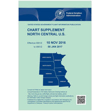
FAA Chart Supplement NC (Airport/Facility Directory North Central) - 05/14/26 thru 07/09/26
Regular price $7.50Sale price $7.50 Regular priceUnit price per$8.00 -
 SaleVendor:AeroNav Products
FAA Chart Supplement NE (Airport/Facility Directory North East) - 05/14/26 thru 07/09/26
Regular price $7.50Sale price $7.50 Regular priceUnit price per$8.00 -
 SaleVendor:AeroNav Products
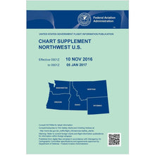
FAA Chart Supplement NW (Airport/Facility Directory North West) - 05/14/26 thru 07/09/26
Regular price $7.50Sale price $7.50 Regular priceUnit price per$8.00 -
 SaleVendor:AeroNav Products
FAA Chart Supplement SE (Airport/Facility Directory South East) - 05/14/26 thru 07/09/26
Regular price $7.50Sale price $7.50 Regular priceUnit price per$8.00 -
 SaleVendor:AeroNav Products
FAA Detroit VFR Sectional Aeronautical Chart - 05/14/26 thru 07/09/26
Regular price $8.50Sale price $8.50 Regular priceUnit price per$9.75 -
 SaleVendor:AeroNav Products
FAA Green Bay VFR Sectional Aeronautical Chart - 05/14/26 thru 07/09/26
Regular price $8.50Sale price $8.50 Regular priceUnit price per$9.75


-
 FREE U.S. Shipping (on $100+)Save on outbound delivery!
 -
 4.8/5 StarsReviewed by 26,000+ Fellow Pilots
 -
 Expert Pilot SupportGear Tested by Real Pilots
 -
SHIPS TODAY (Order by 3 PM ET)Get It Faster!
- Choosing a selection results in a full page refresh.
- Opens in a new window.