

-
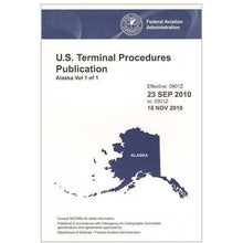 SaleVendor:AeroNav Products
FAA Alaska Terminal Procedures Bound for Alaska Pilots - 07/09/26 thru 09/03/26
Regular price $12.50Sale price $12.50 Regular priceUnit price per$13.00 -
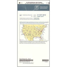 SaleVendor:AeroNav Products
FAA Albuquerque VFR Sectional Aeronautical Chart - 07/09/26 thru 09/03/26
Regular price $8.50Sale price $8.50 Regular priceUnit price per$9.75 -

Fresh from The Hangar
The latest from top aviation brands. -
 SaleVendor:AeroNav Products
FAA Anchorage VFR Sectional Chart for Alaska Pilots - 07/09/26 thru 09/03/26
Regular price $7.50Sale price $7.50 Regular priceUnit price per$7.55 -
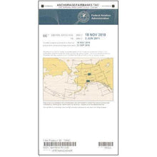 SaleVendor:AeroNav Products
FAA Anchorage/Fairbanks Terminal Area Chart for Alaska Pilots - 07/09/26 thru 09/03/26
Regular price $5.99Sale price $5.99 Regular priceUnit price per$6.20 -
 SaleVendor:AeroNav Products
FAA Atlanta VFR Sectional Aeronautical Chart - 07/09/26 thru 09/03/26
Regular price $8.50Sale price $8.50 Regular priceUnit price per$9.75 -
 SaleVendor:AeroNav Products
FAA Atlanta VFR Terminal Area Chart - 07/09/26 thru 09/03/26
Regular price $5.99Sale price $5.99 Regular priceUnit price per$6.20 -
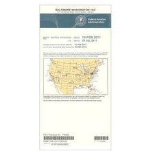 SaleVendor:AeroNav Products
FAA Baltimore - Washington VFR Terminal Area Chart - 07/09/26 thru 09/03/26
Regular price $5.99Sale price $5.99 Regular priceUnit price per$6.20 -
 SaleVendor:AeroNav Products
FAA Bethel VFR Sectional Chart for Alaska Pilots - 07/09/26 thru 09/03/26
Regular price $7.50Sale price $7.50 Regular priceUnit price per$7.55 -
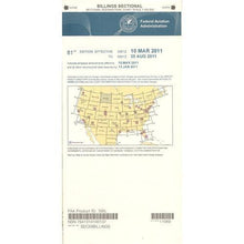 SaleVendor:AeroNav Products
FAA Billings VFR Sectional Aeronautical Chart - 07/09/26 thru 09/03/26
Regular price $8.50Sale price $8.50 Regular priceUnit price per$9.75 -
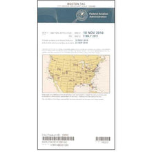 SaleVendor:AeroNav Products
FAA Boston VFR Terminal Area Chart - 07/09/26 thru 09/03/26
Regular price $5.99Sale price $5.99 Regular priceUnit price per$6.20 -
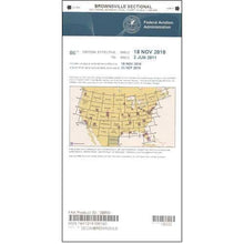 SaleVendor:AeroNav Products
FAA Brownsville VFR Sectional Aeronautical Chart - 07/09/26 thru 09/03/26
Regular price $8.50Sale price $8.50 Regular priceUnit price per$9.75 -
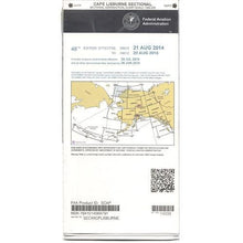 SaleVendor:AeroNav Products
FAA Cape Lisburne VFR Sectional Chart for Alaska Pilots - 07/09/26 thru 09/03/26
Regular price $7.50Sale price $7.50 Regular priceUnit price per$7.55 -
 SaleVendor:AeroNav Products
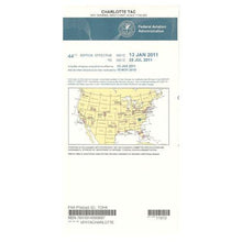
FAA Charlotte VFR Sectional Aeronautical Chart - 07/09/26 thru 09/03/26
Regular price $8.50Sale price $8.50 Regular priceUnit price per$9.75 -
 SaleVendor:AeroNav Products
FAA Charlotte VFR Terminal Area Chart - 07/09/26 thru 09/03/26
Regular price $5.99Sale price $5.99 Regular priceUnit price per$6.20 -
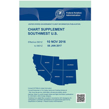
 SaleVendor:AeroNav Products
FAA Chart Supplement EC (Airport/Facility Directory East Central) - 07/09/26 thru 09/03/26
Regular price $7.50Sale price $7.50 Regular priceUnit price per$8.00 -
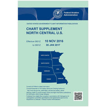 SaleVendor:AeroNav Products
FAA Chart Supplement NC (Airport/Facility Directory North Central) - 07/09/26 thru 09/03/26
Regular price $7.50Sale price $7.50 Regular priceUnit price per$8.00 -
 SaleVendor:AeroNav Products
FAA Chart Supplement NE (Airport/Facility Directory North East) - 07/09/26 thru 09/03/26
Regular price $7.50Sale price $7.50 Regular priceUnit price per$8.00 -
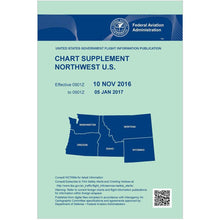 SaleVendor:AeroNav Products
FAA Chart Supplement NW (Airport/Facility Directory North West) - 07/09/26 thru 09/03/26
Regular price $7.50Sale price $7.50 Regular priceUnit price per$8.00 -
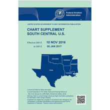 SaleVendor:AeroNav Products
FAA Chart Supplement SC (Airport/Facility Directory South Central) - 07/09/26 thru 09/03/26
Regular price $7.50Sale price $7.50 Regular priceUnit price per$8.00 -
 SaleVendor:AeroNav Products
FAA Chart Supplement SE (Airport/Facility Directory South East) - 07/09/26 thru 09/03/26
Regular price $7.50Sale price $7.50 Regular priceUnit price per$8.00 -
 SaleVendor:AeroNav Products
FAA Chart Supplement Set (Airport/Facility Directory) - 07/09/26 thru 09/03/26
Regular price $50.00Sale price $50.00 Regular priceUnit price per$56.00 -
 SaleVendor:AeroNav Products
FAA Chart Supplement SW (Airport/Facility Directory South West) - 07/09/26 thru 09/03/26
Regular price $7.50Sale price $7.50 Regular priceUnit price per$8.00 -
 SaleVendor:AeroNav Products
FAA Cheyenne VFR Sectional Aeronautical Chart - 07/09/26 thru 09/03/26
Regular price $8.50Sale price $8.50 Regular priceUnit price per$9.75 -
 SaleVendor:AeroNav Products
FAA Chicago VFR Sectional Aeronautical Chart - 07/09/26 thru 09/03/26
Regular price $8.50Sale price $8.50 Regular priceUnit price per$9.75


Frequently Asked Questions
What is a VFR sectional chart and what does it show?
A VFR sectional chart is the FAA's standard map for visual navigation, drawn at a 1:500,000 scale. It shows terrain and elevation, airports, airspace boundaries by class, navigation aids, obstructions, and visual landmarks, giving slow to medium speed pilots the information needed to plan and fly a cross-country route under visual flight rules.
How often are FAA sectional charts and Chart Supplements updated?
FAA VFR charts and Chart Supplements are revised on a 56-day cycle. Each edition prints an effective date and an expiration date, and a new edition replaces it when that range ends. Pilots should fly the current edition and replace charts as they expire so airspace, frequency, and obstruction data stays accurate.
What is the FAA Chart Supplement (formerly the Airport/Facility Directory)?
The FAA Chart Supplement is the renamed Airport/Facility Directory (A/FD), a regional reference book of airport and facility data. It lists public-use and joint-use airports, seaplane bases, heliports, VFR airport sketches, NAVAIDs, communications frequencies, runway and lighting details, and available services, organized by geographic region.
What is the difference between a sectional chart and a terminal area chart?
A sectional chart covers a large area at a 1:500,000 scale for general VFR navigation, while a terminal area chart covers a major airport's Class B airspace at a more detailed 1:250,000 scale. The TAC shows the same kind of information as the sectional but with much greater detail for busy metro operations.
What does a blue versus magenta airport symbol mean on a sectional?
On a VFR sectional, a blue airport symbol marks an airport with an operating control tower, while a magenta symbol marks a non-towered airport. The color coding lets pilots tell at a glance whether two-way radio communication with a tower is required before operating at that field.
Do I still need paper charts if I use ForeFlight or an EFB?
Many pilots fly with an electronic flight bag, but a current paper sectional remains a valuable backup if a tablet overheats, loses power, or fails in flight. Carrying a current chart and a kneeboard keeps essential navigation information available regardless of whether your device is working.
No questions match your search. Try another term or ask our team.
