FAA Charlotte VFR Terminal Area Chart - 11/27/25 thru 01/22/26
10117
Benefits
Benefits
- Enhanced Navigation: Full-color Charlotte Terminal Area Chart designed for VFR flight ops.
- Detailed Information: Large scale (1:250,000; 3.43 nm per inch) for crucial landmarks and altitudes.
- Safety in Congestion: Specifically tailored for flying in Class B airspace, ensuring safer operations.
- VFR Flyway Planning: Reverse side features charts to help avoid larger traffic for low, slow flyers.
- Regular Updates: Revised every 56 days for the most current aeronautical data.
Shipping & Delivery
Shipping & Delivery
- Free Shipping: Enjoy FREE Ground Shipping on all Continental U.S. orders over $100. (That's money saved that you can put toward your next flight!)
- Rapid Dispatch: Orders placed by 3 PM ET (Mon-Fri) ship the same business day, ensuring the fastest possible delivery.
- Control Your Delivery: Select your ideal delivery speed, from cost-effective economy options to guaranteed express delivery, directly at checkout.
- No Hidden Costs: See all final shipping costs and estimated delivery dates upfront-no surprises will be added after you purchase.
- Stay Informed: A tracking link is automatically emailed to you the moment your package leaves our warehouse, so you can monitor its journey.
- We're Here to Help: Have questions about delivery times or specific shipping needs? Our expert support team is ready to assist you.
Returns
Returns
- Easy 30-Day Returns: Return most items within 30 days for a full refund (excludes shipping and handling). Read Return Policy
- Free Exchange Shipping: Exchange items or get store credit with free return shipping in the continental US (Excluding Flight Sim, Luggage & Oversize Items).
- Simple Process: Contact us for an RMA number to start your return, with a 7-day window to postmark your item.
- Condition Requirements: Returns must be in new, original packaging, including all accessories and promotional items.
Cleared for Clear Skies
A smooth journey from cart to checkout. Your transaction is protected every step of the way.
The FAA Charlotte Terminal Area Chart is an essential navigation tool for pilots operating in the complex airspace around Charlotte, North Carolina.
Unmatched Detail and Precision at a 1:250,000 scale make this chart three times more precise than standard sectional charts, crucial for navigating Charlotte's Class B airspace.
Comprehensive Coverage of Charlotte Airspace
Pilots often ask, "What area does the Charlotte TAC cover?" This chart encompasses the entire controlled airspace around Charlotte/Douglas International Airport (CLT). It includes critical landmarks, radio frequencies, and altitude restrictions that are not available on regional aviation charts. The large-scale format reveals essential aeronautical data, such as approach corridors and restricted zones. This information transforms the challenge of Class B airspace navigation into a manageable process for professional pilots, flight instructors, and student aviators.
Dual-Purpose Design for Enhanced Safety
Beyond primary navigation, many Charlotte TAC charts include VFR Flyway Planning Charts on the reverse side. These charts suggest flight paths and altitudes to help slower aircraft avoid conflicts with commercial traffic. This dual-purpose design provides both detailed terminal area information and strategic routing guidance. Updated every 56 days, this FAA-certified chart ensures regulatory compliance and operational safety. Whether for flight training or cross-country trips, it offers the authoritative aeronautical information needed for confident decision-making.
Master Charlotte's Class B airspace with the official FAA Terminal Area Chart, offering superior detail and VFR Flyway planning for safe, compliant navigation. Order yours today!
Our Clear Skies Security Promise
We believe your shopping experience should be as smooth and worry-free as a flight on a perfect day. Here’s a look at the instruments and procedures we use to guarantee your security from takeoff to touchdown.
1. Private Channel Encryption
All personal and payment information you share is transmitted over a secure, encrypted channel (SSL). This ensures your data is kept private and safe, just like a confidential radio communication.
2. First-Class Payment Partners
We only work with major, trusted payment providers. They are the experts who handle every transaction with the highest level of security and professional care.
3. Your Information Stays in the Cockpit
Your personal details are for our flight log only. We have a strict policy to never share or sell your information. Your privacy is paramount.
4. A Rock-Solid Airframe
Our online store is built on a leading, globally secure platform. It's constantly monitored and updated to protect against threats, ensuring a stable and safe environment for your journey with us.
5. No Turbulence Policy
We are a passionate team of aviation lovers committed to quality gear and honest service. Our return, refund, and shipping policies are straightforward and easy to find, ensuring no surprises along your route.
6. Your Friendly Control Tower
Have a question? Our support team is standing by to help guide you. We're fellow enthusiasts ready to ensure your experience is a great one.
Thank you for flying with PilotMall. Shop with confidence, knowing you're cleared for a safe and secure experience.
Best Sellers
-
 Vendor:David Clark
David Clark H10-13S Stereo Aviation Headset: Unmatched Comfort & Superior Clarity for Pilots 40422G-01
4.93 / 5.0
(30) 30 total reviews
Regular price $369.95Sale price $369.95 Regular priceUnit price / per$410.45 -
 Vendor:David Clark
David Clark One-X Bluetooth ANR Aviation Headset: Bluetooth Wireless Advanced Comfort Features 41307G-01
4.83 / 5.0
(6) 6 total reviews
Regular price $995.00Sale price $995.00 Regular priceUnit price / per$995.00 -
 NewVendor:Garmin
Garmin D2 Mach 2 Aviator Smartwatch: Titanium with Oxford Brown Leather Band (47 mm)
Regular price $1,349.99Sale price $1,349.99 Regular priceUnit price / per$1,349.99 -
 Vendor:Aerocoast
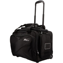
Aerocoast Pro Crew I Wheeled Pilot Flight Bag
4.71 / 5.0
(17) 17 total reviews
Regular price $244.95Sale price $244.95 Regular priceUnit price / per$299.95 -
 Vendor:Travelpro
Travelpro FlightCrew5 22" Expandable Rollaboard: Durable Luggage for Aviation Professionals
4.87 / 5.0
(31) 31 total reviews
Regular price $209.00Sale price $209.00 Regular priceUnit price / per$330.00 -
 Vendor:Icom
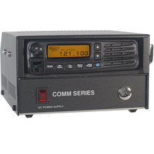
Icom IC-A120B VHF Air Band Transceiver - Base Station
Regular price $1,449.95Sale price $1,449.95 Regular priceUnit price / per$2,099.00
Over 850,000 Orders Shipped
After 27 years in business and 25,000+ reviews, see what our aviation family has to say.
-
 FREE U.S. Shipping (on $100+)Only At Pilot Mall!
 -
 30 Day Money Back GuaranteeNo Hassle Returns
 -
 SHIPS TODAY (Order by 3 PM ET)Get It Faster!
- Choosing a selection results in a full page refresh.
- Opens in a new window.


