



How to Use a VFR Plotter (and Which One to Buy)


An aviation plotter is a clear straightedge that combines a protractor with chart distance scales. It does exactly two jobs in VFR cross-country planning: it measures the true course of each leg you draw on a sectional chart, and it measures the distance of that leg. Those two numbers feed everything else in your flight plan, so the plotter is the first tool you pick up and the one you cannot fake your way around.
Quick verdict: buy a rotating plotter. It does everything a fixed plotter does, reads true course directly off a rotating azimuth card, and removes the most common plotting mistake, reading the reciprocal of your course. The one we point students to is the ASA Rotating Plotter.
Pilot Mall carries plotters alongside manual and electronic E6B flight computers. Browse them all in the Pilot Flight Computers and Plotters collection.
Get your VFR plotter
The ASA Rotating Plotter reads true course straight off the azimuth card, no reciprocal math.
Click for Price →What a plotter is for
Every leg of a VFR flight plan starts with two measurements taken off the sectional: true course, the angle of your course line measured against true north, and leg distance. A plotter is purpose-built for both. The straightedge draws and measures the line, and the protractor reads its angle against a line of longitude or latitude printed on the chart.
That is the whole job. The plotter does not correct for wind, magnetic variation, or compass deviation; that math belongs to your E6B. Think of the pair as a team: the plotter measures, the E6B computes. Master both and a paper cross-country plan takes minutes, which is exactly the skill your instructor and examiner expect to see before any panel GPS or tablet enters the picture.
Anatomy of a rotating plotter
Pick up a rotating plotter and you will find four working parts:
- The straightedge: the long ruler body you draw course lines with. Its edges carry distance scales, and most plotters print nautical miles along one side and statute miles along the other, matched to common chart scales.
- The azimuth card: a rotating compass rose marked in degrees. This is the part a fixed plotter lacks, and it is what turns course measurement into a direct readout instead of a mental exercise.
- The grid lines: parallel north-south reference lines printed on the card. You align these with a meridian on the chart to orient the card to true north.
- The center grommet: the pivot at the middle of the card. It marks the exact point where the card's readings are referenced, so it goes over the meridian when you measure.
One caution that applies to every plotter, fixed or rotating: the scales print reciprocal bearings and both nautical and statute distances. The tool will happily hand you a course 180 degrees off or a distance in the wrong unit if you read the wrong edge, so sanity-check every number against the general direction and length of the leg.
How to measure true course on a sectional
Here is the full procedure with a rotating plotter, start to finish:
- Draw the course line from departure to destination using the straightedge.
- Lay the long edge along the line and slide the plotter until the center grommet of the azimuth card sits over a meridian, a line of longitude.
- Rotate only the azimuth card, keeping the edge on the course line, until the card's north-south grid lines run parallel to the meridian with north up.
- Read true course directly off the card where the meridian passes under it, in your direction of flight. Glance at the reciprocal on the opposite side as a sanity check.
- For near north-south legs that do not cross a meridian conveniently, use a line of latitude and the card's east-west reference instead.
- Measure leg distance with the sectional nautical-mile scale on the straightedge.
That is one alignment and one readout per leg. With a fixed plotter, steps 3 and 4 are replaced by reading a fixed protractor scale where the meridian crosses it, then deciding which of the two printed numbers applies and correcting in your head. It works, but it is slower and it is where wrong-direction errors creep in.
Fixed vs rotating: which to buy
Both types measure the same two numbers, so this comes down to workload and error rate.
| What matters | Fixed plotter | Rotating plotter |
|---|---|---|
| Course readout | Read the scale where a meridian crosses the protractor, then correct mentally | Direct readout off the azimuth card, no calculation |
| Reciprocal error risk | Higher; two printed numbers invite a 180 degree mistake | Lower; the card is oriented to north before you read |
| Speed per leg | Slower, more mental steps | Faster, align once and read |
| Moving parts | None | Rotating card to keep aligned while you read |
| Best for | Pilots who already plot confidently | Students and anyone who plots a few times a year |
Our recommendation is the rotating type for nearly everyone, and especially for student pilots. When you are juggling a new skill, the direct readout removes a whole category of checkride-day errors. The ASA Rotating Plotter gives you that direct course readout for plotting true headings and distances on any sectional. Click for Price.
The plotter plus E6B workflow
A complete VFR cross-country plan runs the two tools in sequence, leg by leg:
- Measure with the plotter. True course and distance for each leg, straight off the sectional as described above.
- Compute with the E6B. Apply the winds aloft to get your wind correction angle, heading, and groundspeed. Our E6B flight computer guide walks through the wind side step by step.
- Time and fuel. Use the E6B's time-speed-distance and fuel functions to turn groundspeed and leg distance into time en route and fuel burned per leg.
- Record it on a navlog. Every number gets a box, so nothing is left in your head when the workload picks up in flight.
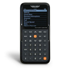
You can run the whole computing half of this workflow in a browser for free: Pilot Mall's web E6B flight computer handles the wind, time, and fuel math, and the free VFR Navigation Log gives you a proper navlog to record it all on. If you prefer a dedicated electronic unit for the knowledge test and the cockpit, the ASA CX-3 Flight Computer covers time-speed-distance, heading and wind, and fuel management in one device.
Frequently asked questions
What is an aviation plotter?
An aviation plotter is a clear straightedge that combines a protractor with chart distance scales. Pilots use it to measure the true course and the distance of each leg on a VFR sectional chart during cross-country planning.
Should a student pilot buy a fixed or a rotating plotter?
Buy a rotating plotter. The rotating azimuth card gives a direct true course readout with no reciprocal math, which removes the most common plotting error student pilots make with fixed plotters.
Why does my plotter show two different numbers for the same course?
Plotter protractors print reciprocal bearings, the outbound course and its opposite, on the same scale. Always check the readout against the general direction of flight; a leg that heads roughly east should read near 090, not 270.
Do I use the nautical or statute mile scale on a sectional?
Use the nautical-mile side that matches the sectional chart scale. Most plotters print both nautical and statute scales, so confirm which edge you are reading before you measure distance.
Do I still need a plotter if I fly with a tablet or GPS?
Yes, at least through training. Manual cross-country planning on a paper sectional with a plotter and an E6B is a core skill your instructor and examiner will expect, and it remains your backup when batteries or screens fail.