


FAA Klamath Falls VFR Sectional Aeronautical Chart - 07/09/26 thru 09/03/26
10087
Benefits
Benefits
Shipping & Delivery
Shipping & Delivery
Returns
Returns
The FAA Klamath Falls Sectional is the definitive VFR sectional chart for pilots navigating the Pacific Northwest.
Produced by AeroNav for the FAA, this chart provides the most accurate and current aeronautical navigation data, updated every 56 days.
Comprehensive Coverage for Pilots
Pilots exploring the Klamath Falls sectional find extensive coverage of Northern California, Northwestern Nevada, and Southern Oregon. This VFR sectional chart, trusted by Oregon pilots, includes essential airport runway data like lengths, lighting systems, and elevation details. It also provides precise airspace classifications and radio navigation aids with frequencies for seamless communication. The chart's detailed topographic features help pilots identify landmarks, cities, and elevation changes, while clearly marking towers and obstacles that could impact flight safety. Whether planning cross-country flights or local training exercises, this Pacific Northwest flight chart offers critical information for confident navigation through complex terrain.
Reliable and User-Friendly Design
Built on the standard 1:500,000 scale, this aeronautical navigation map transforms flight planning from guesswork into precision. Flight schools rely on its intuitive layout for training efficiency, while professional operators depend on its up-to-date airspace and frequency data for regulatory compliance. The chart's comprehensive coverage eliminates the need for multiple navigation resources, making it an affordable yet indispensable tool for every Pacific pilot's flight bag.
Fly with confidence using the official FAA Klamath Falls Sectional, your FAA-produced source for the most accurate and current VFR navigation across the Pacific Northwest, updated every 56 days. Get yours now!
-
 SaleVendor:AeroNav Products
FAA Atlanta VFR Sectional Aeronautical Chart - 07/09/26 thru 09/03/26
Regular price $8.50Sale price $8.50 Regular priceUnit price per$9.75 -
 SaleVendor:AeroNav Products
FAA Detroit VFR Sectional Aeronautical Chart - 07/09/26 thru 09/03/26
Regular price $8.50Sale price $8.50 Regular priceUnit price per$9.75 -
 SaleVendor:AeroNav Products
FAA New York VFR Sectional Aeronautical Chart - 07/09/26 thru 09/03/26
Regular price $8.50Sale price $8.50 Regular priceUnit price per$9.75 -
 SaleVendor:AeroNav Products
FAA Jacksonville VFR Sectional Aeronautical Chart - 07/09/26 thru 09/03/26
Regular price $8.50Sale price $8.50 Regular priceUnit price per$9.75 -
 SaleVendor:AeroNav Products
FAA Los Angeles VFR Sectional Aeronautical Chart - 07/09/26 thru 09/03/26
Regular price $8.50Sale price $8.50 Regular priceUnit price per$9.75 -
 SaleVendor:AeroNav Products
FAA San Francisco VFR Sectional Aeronautical Chart - 07/09/26 thru 09/03/26
Regular price $8.50Sale price $8.50 Regular priceUnit price per$9.75 -
 SaleVendor:AeroNav Products
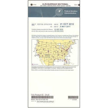
FAA Albuquerque VFR Sectional Aeronautical Chart - 07/09/26 thru 09/03/26
Regular price $8.50Sale price $8.50 Regular priceUnit price per$9.75 -
 SaleVendor:AeroNav Products
FAA Miami VFR Sectional Aeronautical Chart - 07/09/26 thru 09/03/26
Regular price $8.50Sale price $8.50 Regular priceUnit price per$9.75 -
 SaleVendor:AeroNav Products
FAA Chicago VFR Sectional Aeronautical Chart - 07/09/26 thru 09/03/26
Regular price $8.50Sale price $8.50 Regular priceUnit price per$9.75 -
 SaleVendor:AeroNav Products
FAA St Louis VFR Sectional Aeronautical Chart - 07/09/26 thru 09/03/26
Regular price $8.50Sale price $8.50 Regular priceUnit price per$9.75


-
 FREE U.S. Shipping (on $100+)Save on outbound delivery!
 -
 Authorized DealerGenuine Gear
 -
 Expert Pilot SupportGear Tested by Real Pilots
 -
 SHIPS TODAY (Order by 3 PM ET)Get It Faster!
- Choosing a selection results in a full page refresh.
- Opens in a new window.