


FAA Detroit VFR Terminal Area Chart - 05/14/26 thru 07/09/26
10123
Benefits
Benefits
Shipping & Delivery
Shipping & Delivery
Returns
Returns
The FAA Detroit Terminal Area Chart provides pilots with detailed navigation information for safe flight operations in the congested Class B airspace around Detroit Metropolitan Wayne County Airport (DTW).
Large-Scale Precision at 1:250,000 reveals critical landmarks, altitudes, and aeronautical data not found on standard sectional charts.
Navigate Detroit's Complex Airspace
Flying VFR into Detroit's busy airspace is challenging. This full-color VFR chart depicts the intricate Class B airspace structure around DTW with clarity. It shows radio frequencies, traffic patterns, and restricted zones, keeping you safely separated from commercial traffic. The enhanced scale helps flight training schools and student pilots identify visual checkpoints and understand airspace boundaries. Commercial pilots and charter operators rely on its precision for efficient route planning and regulatory compliance.
Essential VFR Flyway Planning
The Detroit TAC FAA chart is indispensable due to the VFR Flyway Planning Chart on the reverse side. It presents recommended flight paths and altitudes to help general aviation aircraft avoid high-density traffic areas. Updated every 56 days, this chart ensures you have the latest airspace information, frequency changes, and navigational aids. Whether you're a private pilot exploring Michigan's aviation landscape, an instructor teaching airspace procedures, or a professional pilot conducting Part 91 operations, this navigation tool transforms complex airspace into manageable, safe flight operations around Motor City.
Confidently navigate Detroit's complex Class B airspace with the official FAA Terminal Area Chart, featuring large-scale precision, crucial VFR Flyway Planning, and vital 56-day updates for maximum safety. Get your current edition now!
-
 SaleVendor:AeroNav Products
FAA Atlanta VFR Terminal Area Chart - 05/14/26 thru 07/09/26
Regular price $5.99Sale price $5.99 Regular priceUnit price per$6.20 -
 SaleVendor:AeroNav Products
FAA Chart Supplement EC (Airport/Facility Directory East Central) - 05/14/26 thru 07/09/26
Regular price $7.50Sale price $7.50 Regular priceUnit price per$8.00 -
 SaleVendor:AeroNav Products
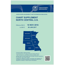
FAA Chart Supplement NC (Airport/Facility Directory North Central) - 05/14/26 thru 07/09/26
Regular price $7.50Sale price $7.50 Regular priceUnit price per$8.00 -
 SaleVendor:AeroNav Products
FAA Chart Supplement NE (Airport/Facility Directory North East) - 05/14/26 thru 07/09/26
Regular price $7.50Sale price $7.50 Regular priceUnit price per$8.00 -
 SaleVendor:AeroNav Products
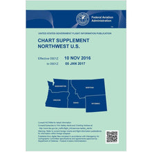
FAA Chart Supplement NW (Airport/Facility Directory North West) - 05/14/26 thru 07/09/26
Regular price $7.50Sale price $7.50 Regular priceUnit price per$8.00 -
 SaleVendor:AeroNav Products
FAA Chart Supplement SE (Airport/Facility Directory South East) - 05/14/26 thru 07/09/26
Regular price $7.50Sale price $7.50 Regular priceUnit price per$8.00 -
 SaleVendor:AeroNav Products
FAA Detroit VFR Sectional Aeronautical Chart - 05/14/26 thru 07/09/26
Regular price $8.50Sale price $8.50 Regular priceUnit price per$9.75


-
 FREE U.S. Shipping (on $100+)Save on outbound delivery!
 -
 4.8/5 StarsReviewed by 26,000+ Fellow Pilots
 -
 Expert Pilot SupportGear Tested by Real Pilots
 -
SHIPS TODAY (Order by 3 PM ET)Get It Faster!
- Choosing a selection results in a full page refresh.
- Opens in a new window.