


FAA Minneapolis VFR Terminal Area Chart - 07/09/26 thru 09/03/26
10130
Benefits
Benefits
Shipping & Delivery
Shipping & Delivery
Returns
Returns
The FAA Minneapolis Terminal Area Chart is an essential navigation tool for pilots operating in the Minneapolis-St. Paul metropolitan area.
This chart offers unmatched detail with its large-scale 1:250,000 format, providing three times more precision than standard sectional charts for safe Class B airspace navigation.
Navigate Minneapolis Class B Airspace Safely
When planning your approach to Minneapolis-St. Paul International Airport, this MSP TAC chart is your most trusted companion. Its enhanced scale reveals critical landmarks, radio frequencies, and aeronautical data that sectional charts cannot fit. Flight instructors use this chart to teach proper airspace procedures, while commercial operators rely on its accuracy for route planning and compliance. The VFR flyway planning features on the reverse side help pilots identify optimal flight paths and altitudes, ensuring separation from faster aircraft while maintaining situational awareness in this high-traffic environment.
Stay Updated with Current Aeronautical Information
The Minneapolis airspace navigation tool is particularly valuable due to its 56-day revision cycle, ensuring you always have current aeronautical information. As an official FAA publication, this chart represents the definitive source for terminal area navigation around MSP airport. It gives pilots confidence in their navigation decisions, whether conducting training flights, charter operations, or personal aviation activities in the City of Lakes region.
Ensure your safety and compliance in Minneapolis Class B airspace with the official FAA Terminal Area Chart, offering superior detail and crucial 56-day updates. Get your authoritative chart now!
-
 SaleVendor:AeroNav Products
FAA Atlanta VFR Terminal Area Chart - 07/09/26 thru 09/03/26
Regular price $5.99Sale price $5.99 Regular priceUnit price per$6.20 -
 SaleVendor:AeroNav Products
FAA Chart Supplement EC (Airport/Facility Directory East Central) - 07/09/26 thru 09/03/26
Regular price $7.50Sale price $7.50 Regular priceUnit price per$8.00 -
 SaleVendor:AeroNav Products
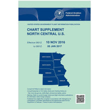
FAA Chart Supplement NC (Airport/Facility Directory North Central) - 07/09/26 thru 09/03/26
Regular price $7.50Sale price $7.50 Regular priceUnit price per$8.00 -
 SaleVendor:AeroNav Products
FAA Chart Supplement NE (Airport/Facility Directory North East) - 07/09/26 thru 09/03/26
Regular price $7.50Sale price $7.50 Regular priceUnit price per$8.00 -
 SaleVendor:AeroNav Products
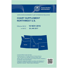
FAA Chart Supplement NW (Airport/Facility Directory North West) - 07/09/26 thru 09/03/26
Regular price $7.50Sale price $7.50 Regular priceUnit price per$8.00 -
 SaleVendor:AeroNav Products
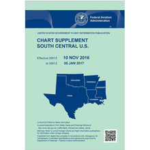
FAA Chart Supplement SC (Airport/Facility Directory South Central) - 07/09/26 thru 09/03/26
Regular price $7.50Sale price $7.50 Regular priceUnit price per$8.00 -
 SaleVendor:AeroNav Products
FAA Chart Supplement SE (Airport/Facility Directory South East) - 07/09/26 thru 09/03/26
Regular price $7.50Sale price $7.50 Regular priceUnit price per$8.00 -
 SaleVendor:AeroNav Products
FAA Chart Supplement Set (Airport/Facility Directory) - 07/09/26 thru 09/03/26
Regular price $50.00Sale price $50.00 Regular priceUnit price per$56.00 -
 SaleVendor:AeroNav Products
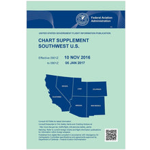
FAA Chart Supplement SW (Airport/Facility Directory South West) - 07/09/26 thru 09/03/26
Regular price $7.50Sale price $7.50 Regular priceUnit price per$8.00 -
 SaleVendor:AeroNav Products
FAA Detroit VFR Sectional Aeronautical Chart - 07/09/26 thru 09/03/26
Regular price $8.50Sale price $8.50 Regular priceUnit price per$9.75


-
 FREE U.S. Shipping (on $100+)Save on outbound delivery!
 -
 Authorized DealerGenuine Gear
 -
 Expert Pilot SupportGear Tested by Real Pilots
 -
 SHIPS TODAY (Order by 3 PM ET)Get It Faster!
- Choosing a selection results in a full page refresh.
- Opens in a new window.