


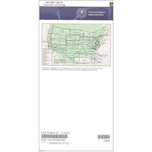
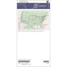
FAA L31/32 Instrument Flight Rules (IFR) Enroute Low Altitude Chart - 07/09/26 thru 09/03/26
18722
Benefits
Benefits
Shipping & Delivery
Shipping & Delivery
Returns
Returns
The FAA Enroute Low Charts L31/32 is the essential IFR navigation chart for pilots operating below 18,000 feet MSL in Northern New England and the US-Canada border region.
This official FAA-certified chart offers comprehensive IFR low altitude coverage, spanning multiple states and Canadian provinces in one authoritative resource.
Comprehensive Coverage and Key Features
Designed for flights below 18,000 feet Mean Sea Level (MSL), this detailed chart covers Michigan, Wisconsin, New York, Vermont, New Hampshire, and Maine, plus Ontario, Quebec, New Brunswick, and Nova Scotia. It includes low-altitude flight routes (Victor Airways), GPS navigation routes (RNAV), Air Traffic Control checkpoints, Military Training Routes, special use airspace boundaries, and radio navigation aids with complete frequency and coordinate information. For pilots asking, "Do I need L31 L32 for flying to Canada?" this chart is indispensable for safe cross-border operations.
Stay Current with Regular Updates
Published on the FAA's 56-day cycle, the current L31 L32 chart ensures pilots maintain regulatory compliance with up-to-date airspace information. Whether you're a commercial pilot navigating northeastern corridors, a flight instructor teaching cross-border procedures, or a private pilot exploring the region, this chart subscription guarantees you'll never operate with outdated navigation data. The multi-color format presents critical safety information with clarity, featuring chart scales from 5 to 20 nautical miles per inch for optimal flight planning and in-flight reference.
Navigate the sensitive US/Canada border and Northern New England airspace with full IFR compliance and confidence using the official FAA L31/32 Low Altitude Chart. Order your current, FAA-certified edition today!
-
 SaleVendor:AeroNav Products
FAA L23/24 Instrument Flight Rules (IFR) Enroute Low Altitude Chart - 07/09/26 thru 09/03/26
Regular price $5.00Sale price $5.00 Regular priceUnit price per$5.25 -
 SaleVendor:AeroNav Products
FAA L3/4 Instrument Flight Rules (IFR) Enroute Low Altitude Chart - 07/09/26 thru 09/03/26
Regular price $5.00Sale price $5.00 Regular priceUnit price per$5.25 -
 SaleVendor:AeroNav Products
FAA L21/22 Instrument Flight Rules (IFR) Enroute Low Altitude Chart - 07/09/26 thru 09/03/26
Regular price $5.00Sale price $5.00 Regular priceUnit price per$5.25 -
 SaleVendor:AeroNav Products
FAA L27/28 Instrument Flight Rules (IFR) Enroute Low Altitude Chart - 07/09/26 thru 09/03/26
Regular price $5.00Sale price $5.00 Regular priceUnit price per$5.25 -
 SaleVendor:AeroNav Products
FAA L35/36 Instrument Flight Rules (IFR) Enroute Low Altitude Chart - 07/09/26 thru 09/03/26
Regular price $5.00Sale price $5.00 Regular priceUnit price per$5.25 -
 SaleVendor:AeroNav Products
FAA L17/18 Instrument Flight Rules (IFR) Enroute Low Altitude Chart - 07/09/26 thru 09/03/26
Regular price $5.00Sale price $5.00 Regular priceUnit price per$5.25 -
 SaleVendor:AeroNav Products
FAA L7/8 Instrument Flight Rules (IFR) Enroute Low Altitude Chart - 07/09/26 thru 09/03/26
Regular price $5.00Sale price $5.00 Regular priceUnit price per$5.25 -
 SaleVendor:AeroNav Products
FAA L15/16 Instrument Flight Rules (IFR) Enroute Low Altitude Chart - 07/09/26 thru 09/03/26
Regular price $5.00Sale price $5.00 Regular priceUnit price per$5.25 -
 SaleVendor:AeroNav Products
FAA L33/34 Instrument Flight Rules (IFR) Enroute Low Altitude Chart - 07/09/26 thru 09/03/26
Regular price $5.00Sale price $5.00 Regular priceUnit price per$5.25 -
 SaleVendor:AeroNav Products
FAA L19/20 Instrument Flight Rules (IFR) Enroute Low Altitude Chart - 07/09/26 thru 09/03/26
Regular price $5.00Sale price $5.00 Regular priceUnit price per$5.25


-
 FREE U.S. Shipping (on $100+)Save on outbound delivery!
 -
 Authorized DealerGenuine Gear
 -
 Expert Pilot SupportGear Tested by Real Pilots
 -
 SHIPS TODAY (Order by 3 PM ET)Get It Faster!
- Choosing a selection results in a full page refresh.
- Opens in a new window.