


FAA Great Falls VFR Sectional Aeronautical Chart - 07/09/26 thru 09/03/26
10078
Benefits
Benefits
Shipping & Delivery
Shipping & Delivery
Returns
Returns
The FAA Great Falls sectional chart is your essential VFR navigation tool for Western Montana and Northern Idaho, especially near the US/Canada border.
Stay current and safe with this FAA-authorized aeronautical chart, updated every 56 days to provide the latest aviation data.
Comprehensive Navigation for Challenging Terrain
When planning flights through Montana's rugged landscapes or Idaho's backcountry airstrips, rely on this foldable, full-color chart. It offers detailed airport information, including runway lengths, lighting systems, and elevation data. Critical airspace dimensions and air traffic control facilities with radio frequencies are clearly marked. Topographic details reveal terrain features, landmarks, cities, towns, and bodies of water, serving as essential visual references during VFR flight operations.
Indispensable for All Pilots
The Great Falls sectional chart is indispensable for recreational private pilots and commercial operators needing precise obstacle data for towers and antennas. Whether you're a flight instructor teaching chart reading or an experienced bush pilot accessing remote strips, this chart provides the detail required for confident decision-making. The standard 1:500,000 scale ensures readability, covering expansive airspace where reliable navigation data is crucial for safety.
Navigate Montana & Idaho's rugged terrain with ultimate confidence and safety using the official, always current FAA Great Falls Sectional Chart, packed with every VFR essential for your flight. Order yours today!
-
 SaleVendor:AeroNav Products
FAA Detroit VFR Sectional Aeronautical Chart - 07/09/26 thru 09/03/26
Regular price $8.50Sale price $8.50 Regular priceUnit price per$9.75 -
 SaleVendor:AeroNav Products
FAA New York VFR Sectional Aeronautical Chart - 07/09/26 thru 09/03/26
Regular price $8.50Sale price $8.50 Regular priceUnit price per$9.75 -
 SaleVendor:AeroNav Products
FAA San Francisco VFR Sectional Aeronautical Chart - 07/09/26 thru 09/03/26
Regular price $8.50Sale price $8.50 Regular priceUnit price per$9.75 -
 SaleVendor:AeroNav Products
FAA Los Angeles VFR Sectional Aeronautical Chart - 07/09/26 thru 09/03/26
Regular price $8.50Sale price $8.50 Regular priceUnit price per$9.75 -
 SaleVendor:AeroNav Products
FAA Jacksonville VFR Sectional Aeronautical Chart - 07/09/26 thru 09/03/26
Regular price $8.50Sale price $8.50 Regular priceUnit price per$9.75 -
 SaleVendor:AeroNav Products
FAA St Louis VFR Sectional Aeronautical Chart - 07/09/26 thru 09/03/26
Regular price $8.50Sale price $8.50 Regular priceUnit price per$9.75 -
 SaleVendor:AeroNav Products
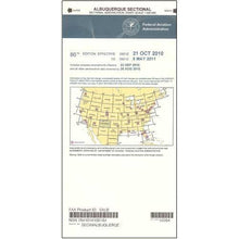
FAA Albuquerque VFR Sectional Aeronautical Chart - 07/09/26 thru 09/03/26
Regular price $8.50Sale price $8.50 Regular priceUnit price per$9.75 -
 SaleVendor:AeroNav Products
FAA Miami VFR Sectional Aeronautical Chart - 07/09/26 thru 09/03/26
Regular price $8.50Sale price $8.50 Regular priceUnit price per$9.75 -
 SaleVendor:AeroNav Products
FAA Chicago VFR Sectional Aeronautical Chart - 07/09/26 thru 09/03/26
Regular price $8.50Sale price $8.50 Regular priceUnit price per$9.75 -
 SaleVendor:AeroNav Products
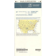
FAA Dallas VFR Sectional Aeronautical Chart - 07/09/26 thru 09/03/26
Regular price $8.50Sale price $8.50 Regular priceUnit price per$9.75


-
 FREE U.S. Shipping (on $100+)Save on outbound delivery!
 -
 Authorized DealerGenuine Gear
 -
 Expert Pilot SupportGear Tested by Real Pilots
 -
 SHIPS TODAY (Order by 3 PM ET)Get It Faster!
- Choosing a selection results in a full page refresh.
- Opens in a new window.