

-
 SaleVendor:AeroNav Products
FAA Kansas City VFR Sectional Aeronautical Chart - 07/09/26 thru 09/03/26
Regular price $8.50Sale price $8.50 Regular priceUnit price per$9.75 -
 SaleVendor:AeroNav Products
FAA Omaha VFR Sectional Aeronautical Chart - 07/09/26 thru 09/03/26
Regular price $8.50Sale price $8.50 Regular priceUnit price per$9.75 -
 SaleVendor:AeroNav Products
FAA Great Falls VFR Sectional Aeronautical Chart - 07/09/26 thru 09/03/26
Regular price $8.50Sale price $8.50 Regular priceUnit price per$9.75 -
 SaleVendor:AeroNav Products
FAA Green Bay VFR Sectional Aeronautical Chart - 07/09/26 thru 09/03/26
Regular price $8.50Sale price $8.50 Regular priceUnit price per$9.75 -
 SaleVendor:AeroNav Products
FAA Phoenix VFR Sectional Aeronautical Chart - 07/09/26 thru 09/03/26
Regular price $8.50Sale price $8.50 Regular priceUnit price per$9.75 -
 SaleVendor:AeroNav Products
FAA Las Vegas VFR Sectional Aeronautical Chart - 07/09/26 thru 09/03/26
Regular price $8.50Sale price $8.50 Regular priceUnit price per$9.75 -
 SaleVendor:AeroNav Products
FAA Halifax VFR Sectional Aeronautical Chart - 07/09/26 thru 09/03/26
Regular price $8.50Sale price $8.50 Regular priceUnit price per$9.75 -
 SaleVendor:AeroNav Products
FAA Hawaiian Islands VFR Sectional Aeronautical Chart - 07/09/26 thru 09/03/26
Regular price $8.50Sale price $8.50 Regular priceUnit price per$9.75 -
 SaleVendor:AeroNav Products
FAA Klamath Falls VFR Sectional Aeronautical Chart - 07/09/26 thru 09/03/26
Regular price $8.50Sale price $8.50 Regular priceUnit price per$9.75 -
 SaleVendor:AeroNav Products
FAA Montreal VFR Sectional Aeronautical Chart - 07/09/26 thru 09/03/26
Regular price $8.50Sale price $8.50 Regular priceUnit price per$9.75 -
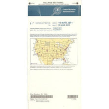 SaleVendor:AeroNav Products
FAA Billings VFR Sectional Aeronautical Chart - 07/09/26 thru 09/03/26
Regular price $8.50Sale price $8.50 Regular priceUnit price per$9.75 -
 SaleVendor:AeroNav Products
FAA Denver VFR Sectional Aeronautical Chart - 07/09/26 thru 09/03/26
Regular price $8.50Sale price $8.50 Regular priceUnit price per$9.75 -
 SaleVendor:AeroNav Products
FAA San Antonio VFR Sectional Aeronautical Chart - 07/09/26 thru 09/03/26
Regular price $8.50Sale price $8.50 Regular priceUnit price per$9.75 -
 SaleVendor:AeroNav Products
FAA Wichita Sectional - 07/09/26 thru 09/03/26
Regular price $8.50Sale price $8.50 Regular priceUnit price per$9.75 -
 SaleVendor:AeroNav Products
FAA Cheyenne VFR Sectional Aeronautical Chart - 07/09/26 thru 09/03/26
Regular price $8.50Sale price $8.50 Regular priceUnit price per$9.75


Find Your Region at a Glance
Each sectional is named for a major city near its center and covers the surrounding region. Pick the title that contains your route; a longer cross-country may span two adjoining charts.
| Sectional Chart | Coverage Centered On |
|---|---|
| Atlanta Sectional | Georgia and the Southeast |
| New York Sectional | New York and the Northeast |
| Chicago Sectional | Illinois and the Upper Midwest |
| Dallas Sectional | North Texas |
| Los Angeles Sectional | Southern California |
| Seattle Sectional | Washington and the Pacific Northwest |
| Miami Sectional | South Florida |
| Houston Sectional | Southeast Texas and the Gulf Coast |
Why Buy From Pilot Mall
- Aviation-only focus: we stock pilot gear and FAA charts, nothing else.
- Trusted by pilots for more than 25 years.
- Free U.S. shipping over $100.
- Expert guidance from a team that flies and knows the products.
Frequently Asked Questions
What are VFR sectional charts used for?
VFR sectional charts are used for visual navigation under Visual Flight Rules, giving pilots detailed terrain, obstacle, airspace, navaid, and airport information on a single 1:500,000-scale sheet so they can plan and fly a route while staying oriented and clear of controlled airspace.
How often are VFR sectional charts updated?
The FAA revises VFR sectional charts on a 56-day cycle, and the effective dates printed on the cover define the window the chart is current for, so pilots should always fly with the edition that covers the dates of their flight.
Which sectional chart should I buy for my region?
Buy the sectional titled for the major city nearest your route, since each chart is named for a city at its center and covers the surrounding region; a longer cross-country that crosses a chart boundary requires both adjoining sectionals.
What is the difference between a sectional chart and a terminal area chart?
A sectional chart shows a wide region at 1:500,000 scale for general VFR planning, while a terminal area chart zooms in to 1:250,000 around the busiest Class B airports for finer detail, and many pilots carry both for flights into congested airspace.
Can I use a VFR sectional chart for flight planning?
Yes, the VFR sectional chart is the foundational flight-planning tool for visual navigation, providing the topographic, airspace, and navigational detail needed to build a route, brief the airspace, and maintain situational awareness in flight.
