


FAA Las Vegas VFR Sectional Aeronautical Chart - 07/09/26 thru 09/03/26
10090
Benefits
Benefits
Shipping & Delivery
Shipping & Delivery
Returns
Returns
The FAA Las Vegas Sectional Aeronautical Chart is an essential navigation tool for VFR pilots flying in the Las Vegas region, offering critical aeronautical data on a 1:500,000 scale map updated every 56 days.
This chart provides authentic, government-issued aeronautical data, ensuring pilots receive the most accurate and authoritative flight planning information available.
Comprehensive Coverage Across Multiple States
Pilots find exceptional value in this Nevada VFR sectional, which spans Nevada, Utah, northwestern Arizona, and parts of California. This extensive coverage is indispensable for cross-country flights and regional operations. The chart includes detailed airport information, such as runway lengths, lighting systems, and elevation data. It also provides critical airspace dimensions and Air Traffic Control facility frequencies.
Enhanced Situational Awareness
Pilots benefit from comprehensive topographic details, landmarks, cities, and towns, as well as radio navigation aids and obstruction data. These features enhance situational awareness from takeoff to touchdown. The standard 1:500,000 scale format ensures clear readability, making flight planning and in-cockpit navigation straightforward and reliable.
Reliable Resource for Diverse Pilot Needs
Flight schools, recreational pilots, and commercial operators rely on this FAA aeronautical chart for training, leisure flying, and business operations. With updates published every 56 days, pilots can confidently answer "when is the Las Vegas sectional chart updated," knowing they have the most current airspace information for maximum safety and compliance.
Stay current, fly safe, and ensure compliance with the official FAA Las Vegas Sectional Chart, your essential guide for comprehensive regional coverage, updated every 56 days. Order yours today!
-
 SaleVendor:AeroNav Products
FAA Atlanta VFR Sectional Aeronautical Chart - 07/09/26 thru 09/03/26
Regular price $8.50Sale price $8.50 Regular priceUnit price per$9.75 -
 SaleVendor:AeroNav Products
FAA Detroit VFR Sectional Aeronautical Chart - 07/09/26 thru 09/03/26
Regular price $8.50Sale price $8.50 Regular priceUnit price per$9.75 -
 SaleVendor:AeroNav Products
FAA New York VFR Sectional Aeronautical Chart - 07/09/26 thru 09/03/26
Regular price $8.50Sale price $8.50 Regular priceUnit price per$9.75 -
 SaleVendor:AeroNav Products
FAA Jacksonville VFR Sectional Aeronautical Chart - 07/09/26 thru 09/03/26
Regular price $8.50Sale price $8.50 Regular priceUnit price per$9.75 -
 SaleVendor:AeroNav Products
FAA Los Angeles VFR Sectional Aeronautical Chart - 07/09/26 thru 09/03/26
Regular price $8.50Sale price $8.50 Regular priceUnit price per$9.75 -
 SaleVendor:AeroNav Products
FAA San Francisco VFR Sectional Aeronautical Chart - 07/09/26 thru 09/03/26
Regular price $8.50Sale price $8.50 Regular priceUnit price per$9.75 -
 SaleVendor:AeroNav Products
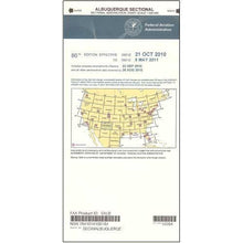
FAA Albuquerque VFR Sectional Aeronautical Chart - 07/09/26 thru 09/03/26
Regular price $8.50Sale price $8.50 Regular priceUnit price per$9.75 -
 SaleVendor:AeroNav Products
FAA Miami VFR Sectional Aeronautical Chart - 07/09/26 thru 09/03/26
Regular price $8.50Sale price $8.50 Regular priceUnit price per$9.75 -
 SaleVendor:AeroNav Products
FAA Chicago VFR Sectional Aeronautical Chart - 07/09/26 thru 09/03/26
Regular price $8.50Sale price $8.50 Regular priceUnit price per$9.75 -
 SaleVendor:AeroNav Products
FAA St Louis VFR Sectional Aeronautical Chart - 07/09/26 thru 09/03/26
Regular price $8.50Sale price $8.50 Regular priceUnit price per$9.75


-
 FREE U.S. Shipping (on $100+)Save on outbound delivery!
 -
 Authorized DealerGenuine Gear
 -
 Expert Pilot SupportGear Tested by Real Pilots
 -
 SHIPS TODAY (Order by 3 PM ET)Get It Faster!
- Choosing a selection results in a full page refresh.
- Opens in a new window.