FAA Twin Cities VFR Sectional Aeronautical Chart - 11/27/25 thru 01/22/26
10108
Benefits
Benefits
- Comprehensive Data: Contains vital information on airports, including runway lengths and services.
- Detailed Airspace Info: Includes airspace dimensions and navigational facilities for safe flying.
- User-Friendly Format: Foldable, full-color design for easy reference in the cockpit.
- Standard Scale: Uses a 1:500,000 scale (6.86 nm per inch) for accurate navigation.
- Regular Updates: Updated every 56 days to ensure you have the latest aeronautical data.
Shipping & Delivery
Shipping & Delivery
- Free Shipping: Enjoy FREE Ground Shipping on all Continental U.S. orders over $100. (That's money saved that you can put toward your next flight!)
- Rapid Dispatch: Orders placed by 3 PM ET (Mon-Fri) ship the same business day, ensuring the fastest possible delivery.
- Control Your Delivery: Select your ideal delivery speed, from cost-effective economy options to guaranteed express delivery, directly at checkout.
- No Hidden Costs: See all final shipping costs and estimated delivery dates upfront-no surprises will be added after you purchase.
- Stay Informed: A tracking link is automatically emailed to you the moment your package leaves our warehouse, so you can monitor its journey.
- We're Here to Help: Have questions about delivery times or specific shipping needs? Our expert support team is ready to assist you.
Returns
Returns
- Easy 30-Day Returns: Return most items within 30 days for a full refund (excludes shipping and handling). Read Return Policy
- Free Exchange Shipping: Exchange items or get store credit with free return shipping in the continental US (Excluding Flight Sim, Luggage & Oversize Items).
- Simple Process: Contact us for an RMA number to start your return, with a 7-day window to postmark your item.
- Condition Requirements: Returns must be in new, original packaging, including all accessories and promotional items.
Cleared for Clear Skies
A smooth journey from cart to checkout. Your transaction is protected every step of the way.
The FAA Twin Cities VFR Sectional Aeronautical Chart provides pilots with comprehensive visual navigation coverage across Minnesota, North Dakota, South Dakota, and the US/Canada border region.
This official FAA sectional chart delivers authoritative aeronautical data directly from the Federal Aviation Administration, ensuring you have the most current and reliable navigation information for safe flight operations.
Comprehensive Navigation Tool for Pilots
Pilots seeking the Twin Cities sectional chart for North Central US flights need more than just a map. This full-color, foldable chart is a complete aviation navigation tool. It includes essential airport information such as runway lengths, lighting systems, elevation data, available services, and surface types. Detailed airspace boundaries and Air Traffic Control frequencies are also featured. The comprehensive coverage eliminates the need for multiple charts when flying cross-country routes through this expansive region. The standard 1:500,000 scale (6.86 nautical miles per inch) provides the precise detail pilots require for Visual Flight Rules navigation.
Updated and Reliable Aeronautical Data
Updated every 56 days, this current VFR sectional chart includes radio navigation aids with frequencies and identifiers, topographic information, landmarks, cities and towns, obstructions, and bodies of water. It is an indispensable resource for flight planning and in-flight reference. Whether you're a private pilot conducting recreational flights, a flight instructor teaching navigation fundamentals, or a commercial operator maintaining regulatory compliance, this Minnesota aviation chart serves as both your primary navigation tool and essential backup for electronic systems, ensuring flight safety across the region's diverse terrain and complex airspace.
Ensure safe and compliant VFR navigation across the North Central US with the official FAA Twin Cities Sectional, your comprehensive and authoritative chart direct from the FAA. Get yours now!
Our Clear Skies Security Promise
We believe your shopping experience should be as smooth and worry-free as a flight on a perfect day. Here’s a look at the instruments and procedures we use to guarantee your security from takeoff to touchdown.
1. Private Channel Encryption
All personal and payment information you share is transmitted over a secure, encrypted channel (SSL). This ensures your data is kept private and safe, just like a confidential radio communication.
2. First-Class Payment Partners
We only work with major, trusted payment providers. They are the experts who handle every transaction with the highest level of security and professional care.
3. Your Information Stays in the Cockpit
Your personal details are for our flight log only. We have a strict policy to never share or sell your information. Your privacy is paramount.
4. A Rock-Solid Airframe
Our online store is built on a leading, globally secure platform. It's constantly monitored and updated to protect against threats, ensuring a stable and safe environment for your journey with us.
5. No Turbulence Policy
We are a passionate team of aviation lovers committed to quality gear and honest service. Our return, refund, and shipping policies are straightforward and easy to find, ensuring no surprises along your route.
6. Your Friendly Control Tower
Have a question? Our support team is standing by to help guide you. We're fellow enthusiasts ready to ensure your experience is a great one.
Thank you for flying with PilotMall. Shop with confidence, knowing you're cleared for a safe and secure experience.
Best darned sectional chart I ever used. Nicely printed. Very accurate. Nice odor if you have a paper smelling fetish. I am a retired FAA air traffic controller and these are the sectionals we always used.
Best Sellers
-
 Vendor:Lift Aviation
Lift Aviation Flextech Professional Pilot Short Sleeve Shirt
5.0 / 5.0
(2) 2 total reviews
Regular price $36.99Sale price $36.99 Regular priceUnit price / per$37.99 -
 On SaleVendor:Bose
Bose A30 ANR Aviation Headset 5 Pin XLR Flex Power with Bluetooth 857641-3170
Regular price $1,299.00Sale price $1,299.00 Regular priceUnit price / per -
 NewVendor:Garmin
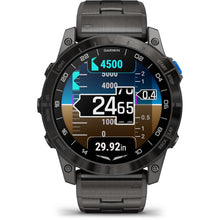
Garmin D2 Mach 2 Aviator Smartwatch: Carbon Gray DLC Titanium with Vented Titanium Bracelet (51 mm)
3.0 / 5.0
(2) 2 total reviews
Regular price $1,499.99Sale price $1,499.99 Regular priceUnit price / per$1,499.99 -
 Vendor:David Clark
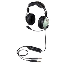
David Clark One-X Bluetooth ANR Aviation Headset: Bluetooth Wireless Advanced Comfort Features 41307G-01
4.83 / 5.0
(6) 6 total reviews
Regular price $995.00Sale price $995.00 Regular priceUnit price / per$995.00 -
 On SaleVendor:Garmin
Garmin D2 Mach 1 Pro Aviator Smartwatch: Elevate Your Flight with Advanced Features & Extended Battery Life
5.0 / 5.0
(3) 3 total reviews
Regular price $1,249.99Sale price $1,249.99 Regular priceUnit price / per$1,399.99 -
 On SaleVendor:Bose
Bose ProFlight Series 2 ANR Aviation Headset Dual Plug, Battery Powered with Bluetooth 789812-5020
Regular price $1,099.00Sale price $1,099.00 Regular priceUnit price / per
Over 850,000 Orders Shipped
After 27 years in business and 25,000+ reviews, see what our aviation family has to say.
-
 FREE U.S. Shipping (on $100+)Only At Pilot Mall!
 -
 30 Day Money Back GuaranteeNo Hassle Returns
 -
 SHIPS TODAY (Order by 3 PM ET)Get It Faster!
- Choosing a selection results in a full page refresh.
- Opens in a new window.


