


FAA Puerto Rico VFR Terminal Area Chart - 07/09/26 thru 09/03/26
10136
Benefits
Benefits
Shipping & Delivery
Shipping & Delivery
Returns
Returns
The FAA Puerto Rico Terminal Area Chart is an essential aviation tool offering detailed Visual Flight Rules (VFR) guidance for pilots in Puerto Rico and the U.S. Virgin Islands.
Comprehensive Dual-Region Coverage: This chart uniquely covers both Puerto Rico and the U.S. Virgin Islands, providing unmatched value for Caribbean operations.
Detailed Navigation for Caribbean Pilots
When planning your Caribbean flying adventure, this specialized aeronautical chart offers critical advantages over sectional charts. Its large-scale 1:250,000 format, showing 3.43 nautical miles per inch, highlights essential landmarks, radio frequencies, and important altitudes around San Juan's busy terminal airspace and throughout the Virgin Islands. Do I need a TAC chart for flying to Puerto Rico? Absolutely, this detailed portrayal becomes your lifeline when navigating between islands, identifying visual checkpoints over water, and maintaining safe separation from commercial traffic in one of the Caribbean's most congested aviation corridors.
Enhanced Safety and Current Information
The chart's reverse side includes specialized VFR flyway planning information, offering recommended flight paths and altitudes to help smaller aircraft avoid conflicts with faster, larger traffic. With updates every 56 days, this current TAC chart ensures you're operating with the most recent airspace changes, frequency updates, and procedural modifications. Whether you're island hopping between St. Thomas and San Juan, conducting aerial tours around El Yunque, or simply seeking the confidence that comes from having government-grade navigational accuracy, this full-color cockpit tool transforms complex Caribbean navigation into manageable, safe flight operations.
Navigate Puerto Rico and the U.S. Virgin Islands with ultimate confidence using the official FAA TAC. It uniquely provides comprehensive dual-region coverage, VFR flyway planning, and critical 56-day updates, ensuring you always have the most current information for your safety. Get yours now!
-
 SaleVendor:AeroNav Products
FAA Atlanta VFR Terminal Area Chart - 07/09/26 thru 09/03/26
Regular price $5.99Sale price $5.99 Regular priceUnit price per$6.20 -
 SaleVendor:AeroNav Products
FAA Chart Supplement EC (Airport/Facility Directory East Central) - 07/09/26 thru 09/03/26
Regular price $7.50Sale price $7.50 Regular priceUnit price per$8.00 -
 SaleVendor:AeroNav Products
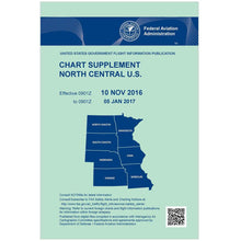
FAA Chart Supplement NC (Airport/Facility Directory North Central) - 07/09/26 thru 09/03/26
Regular price $7.50Sale price $7.50 Regular priceUnit price per$8.00 -
 SaleVendor:AeroNav Products
FAA Chart Supplement NE (Airport/Facility Directory North East) - 07/09/26 thru 09/03/26
Regular price $7.50Sale price $7.50 Regular priceUnit price per$8.00 -
 SaleVendor:AeroNav Products
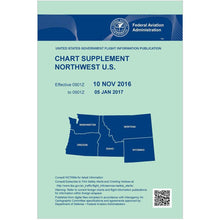
FAA Chart Supplement NW (Airport/Facility Directory North West) - 07/09/26 thru 09/03/26
Regular price $7.50Sale price $7.50 Regular priceUnit price per$8.00 -
 SaleVendor:AeroNav Products
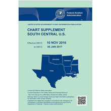
FAA Chart Supplement SC (Airport/Facility Directory South Central) - 07/09/26 thru 09/03/26
Regular price $7.50Sale price $7.50 Regular priceUnit price per$8.00 -
 SaleVendor:AeroNav Products
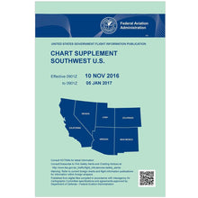
FAA Chart Supplement SE (Airport/Facility Directory South East) - 07/09/26 thru 09/03/26
Regular price $7.50Sale price $7.50 Regular priceUnit price per$8.00 -
 SaleVendor:AeroNav Products
FAA Chart Supplement Set (Airport/Facility Directory) - 07/09/26 thru 09/03/26
Regular price $50.00Sale price $50.00 Regular priceUnit price per$56.00 -
 SaleVendor:AeroNav Products
FAA Chart Supplement SW (Airport/Facility Directory South West) - 07/09/26 thru 09/03/26
Regular price $7.50Sale price $7.50 Regular priceUnit price per$8.00 -
 SaleVendor:AeroNav Products
FAA Detroit VFR Sectional Aeronautical Chart - 07/09/26 thru 09/03/26
Regular price $8.50Sale price $8.50 Regular priceUnit price per$9.75


-
 FREE U.S. Shipping (on $100+)Save on outbound delivery!
 -
 Authorized DealerGenuine Gear
 -
 Expert Pilot SupportGear Tested by Real Pilots
 -
 SHIPS TODAY (Order by 3 PM ET)Get It Faster!
- Choosing a selection results in a full page refresh.
- Opens in a new window.