

AIRMET vs SIGMET: Everything You Need to Know (Guide)


Last updated June 2026
Quick answer: An AIRMET (Airman's Meteorological Information) warns of moderate weather that mainly threatens lighter aircraft, while a SIGMET (Significant Meteorological Information) warns of severe weather hazardous to all aircraft. Both cover areas of at least 3,000 square miles. With an AIRMET you can often modify your route and continue; a SIGMET signals conditions severe enough to seriously consider canceling the flight.
Pilots count on accurate and timely weather data to make informed decisions both before and during their flights.
Good pilots never go anywhere without checking and rechecking the weather. It may be clear and calm on the ground, but we know that things could look much different en route, especially during a long cross-country flight.
AIRMETs and SIGMETs are important tools during the flight planning process and while underway. Think of them as the aviation version of the local weather report and the Emergency Broadcast System (EBS) used on TV and radio to alert citizens of severe weather conditions on the ground.
Both AIRMETs and SIGMETs provide pilots with abbreviated in-flight weather advisories for both existing and predicted adverse conditions.
Conditions must be widespread, affecting an area of at least 3,000 square miles, to trigger an AIRMET or SIGMET. Forecasts are issued when the Aviation Weather Center (AWC) determines that the conditions pose a degree of risk to aircraft safety.
AIRMET vs SIGMET at a glance
| Feature | AIRMET (WA) | SIGMET (WS / WST) |
|---|---|---|
| Severity | Moderate; mainly affects lighter aircraft | Severe; hazardous to all aircraft regardless of size |
| Minimum area | At least 3,000 square miles | At least 3,000 square miles |
| Issuance cadence | Routine; text AIRMETs every 6 hours starting at 0245 UTC. Graphical G-AIRMETs every 3 hours (00, 03, 06, 09, 12-hour periods) | Non-convective: unscheduled, as needed. Convective: hourly at 55 minutes past the hour |
| Validity period | 6 hours | Non-convective: 4 hours (6 hours for hurricanes). Convective: 2 hours |
| Types | Sierra (IFR / mountain obscuration), Tango (turbulence / strong surface winds / LLWS), Zulu (icing) | Non-convective (WS): severe icing, severe/extreme turbulence, dust or sandstorms, volcanic ash. Convective (WST): severe thunderstorms, tornadoes, large hail, embedded or lines of storms |
| Example thresholds | Surface winds 30 knots or higher; ceilings under 1,000 ft; visibility under 3 miles | Surface winds greater than 50 knots; hail 3/4 inch or larger; tornadoes |
| Typical pilot decision | Often can modify the route and continue around the hazard | Seriously consider canceling or delaying the flight |
But what is the difference between the two? What types of AIRMET can be issued and what does each mean? How do you read a graphical AIRMET? Is one type more dangerous than the other?
Read on to get answers and learn everything you need to know!
AIRMET
An AIRMET, or Airman's Meteorological Information, is an in-flight weather bulletin that is issued when there are weather phenomena or conditions present which may affect the safety of lighter aircraft, though the information they contain is relevant for all aircraft.
What is an AIRMET?
The types of conditions that may trigger the issuance of an AIRMET are divided into three categories, each with a unique designation. Pilots whose flight plans take them into an area with an active AIRMET may wish to consider modifying their flight plans to avoid the inclement weather.
Since it is unlikely that the weather condition in question will impact the entire 3,000 square mile area at once, it may be possible to navigate around the hazards.

The three types of AIRMETs, otherwise known as WAs, are:
- AIRMET Sierra
An AIRMET Sierra (S) is issued for mountain obscuration and/or IFR conditions with ceilings that are less than 1,000' and/or visibility of under 3 miles over a range of at least 50% of the area covered by the AIRMET.
- AIRMET Tango
An AIRMET Tango (T) is issued for light to moderate turbulence, sustained surface winds at 30 knots or higher, or low-level windshear.
- AIRMET ZULU
An AIRMET Zulu (Z) is issued when weather conditions are at freezing levels making light to moderate icing a possibility.
Graphical AIRMETs, or G-AIRMETs, are used to plot conditions on a map for visual reference. Six unique colors and types of boundary lines depict the various conditions.
Review the Aviation Weather Center's What is an AIRMET? document to learn more about their graphical symbols and usage.
How often are AIRMETs issued?
Textual AIRMETs are issued every six hours by the AWC starting at 0245 UTC (Zulu time). A textual AIRMET is valid for the period of six hours until the next regularly scheduled release, although the AWC can terminate it earlier if the condition causing the AIRMET resolves.
Graphical AIRMETs (G-AIRMETs) are issued more frequently, at three-hour intervals (covering 00, 03, 06, 09, and 12-hour forecast periods), and are the modern, primary way the AWC depicts AIRMET hazards. The issuance can also be extended if inclement conditions persist past the standard expiration time, so make sure to check an official national weather service resource for the most up-to-date information.

SIGMET
A SIGMET, or Significant Meteorological Information, is an in-flight weather bulletin that is issued when there are extreme weather conditions present which may affect the safety of all aircraft in the vicinity.
What is a SIGMET?
The weather conditions that precipitate a SIGMET are substantially more severe than those that trigger an AIRMET. Pilots whose flight plans take them into an area with an active SIGMET should highly consider canceling the flight since conditions pose a significant threat.
Weather phenomena in an area under a SIGMET advisory is highly volatile and the rapidly evolving nature of the threat means that modifying the flight plan to simply skirt the adverse conditions is often not as feasible or prudent as it is with AIRMETs.
There are two categories of SIGMETs, one for weather patterns with more stable overall atmospheric conditions and the other for weather patterns characterized by rapid air movement, otherwise known as convection.

The two categories of SIGMETs are:
- Non-Convective SIGMET (WS)
This type of SIGMET is issued for conditions similar to but more severe than those of the three types of AIRMETs. A non-convective SIGMET can be issued for severe icing, severe to extreme turbulence, dust storms or sandstorms that lower visibility to less than three miles, and for volcanic ash.
The dust, sand, and ash are significant causes for concern because they can incapacitate engines.
- Convective SIGMET (WST)
This type of SIGMET is issued for the most dangerous of conditions with atmospheric instability. They cover severe thunderstorms with surface winds of greater than 50 knots, surface hail 3/4 inch or larger in diameter, tornadoes, embedded thunderstorms, lines of thunderstorms (or thunderstorms with heavy precipitation affecting at least 40% of a region) and low level wind shear.

How often are SIGMETs issued?
Non-convective SIGMETs are an unscheduled forecast, and as such they are simply issued as needed when significant meteorological conditions that meet non-convective SIGMET criteria exist.
Once a non-convective SIGMET is issued, it is valid for 4 hours, except for non-convective SIGMETs relating to hurricanes. Hurricane-related non-convective SIGMETs are valid for 6 hours.
Convective SIGMETs are routinely issued at 55 minutes past the hour and remain valid for two hours, though additional unscheduled SIGMETs may be issued in the interim as conditions evolve.
If no severe or extreme weather is forecast or existing when a scheduled convective SIGMET is due to be released, the SIGMET will simply read: "CONVECTIVE SIGMET...NONE."
For purposes of issuance, the contiguous United States is divided into three zones: Eastern, Central, and Western.
Reading and Decoding SIGMETs
For information on how to read/decode SIGMETs and find out if there were cancellations or renewals, check out Wikipedia's breakdown on the structure of SIGMETs.
How do you Find AIRMETs and SIGMETs?
Finding information on ForeFlight

Finding information on SkyVector

Finding information on AWC

Takeaway
The main thing to remember is that AIRMETs are issued when there is weather that may impact aircraft safety, especially that of smaller, lighter aircraft.
Weather conditions that prompt the issuance of a SIGMET are more severe and affect the safety of all aircraft regardless of size.
While you may be able to fly during an AIRMET by slight modifications to your flight plan, a SIGMET should be cause for seriously considering canceling your flight.
Check official national weather service resources to find when and where updated SIGMETs are issued.
Looking for some guidance and fresh perspective on making go/no-go flight decisions in inclement weather? Consult your copy of the ASA's Navigating Weather resources.
Frequently Asked Questions
What is the main difference between an AIRMET and a SIGMET?
An AIRMET warns of moderate weather that primarily affects lighter aircraft, such as moderate turbulence, IFR ceilings, mountain obscuration, and light to moderate icing. A SIGMET warns of severe weather that is hazardous to all aircraft regardless of size, such as severe icing, severe or extreme turbulence, dust or sandstorms, volcanic ash, and convective storms.
How long is an AIRMET valid?
A textual AIRMET is valid for 6 hours and is issued on a routine schedule starting at 0245 UTC. Graphical G-AIRMETs are issued every 3 hours and forecast conditions out to 12 hours.
How long is a SIGMET valid?
A non-convective SIGMET is valid for 4 hours (6 hours when it relates to a hurricane). A convective SIGMET is valid for 2 hours and is issued hourly at 55 minutes past the hour.
Is a SIGMET more dangerous than an AIRMET?
Yes. A SIGMET indicates significantly more severe and volatile weather than an AIRMET. You can often continue a flight during an AIRMET by modifying your route around the hazard, but a SIGMET is cause to seriously consider canceling or delaying the flight.
What are the three types of AIRMETs?
The three AIRMET types are Sierra (IFR conditions and mountain obscuration), Tango (turbulence, strong surface winds, and low-level wind shear), and Zulu (icing and freezing levels).
|
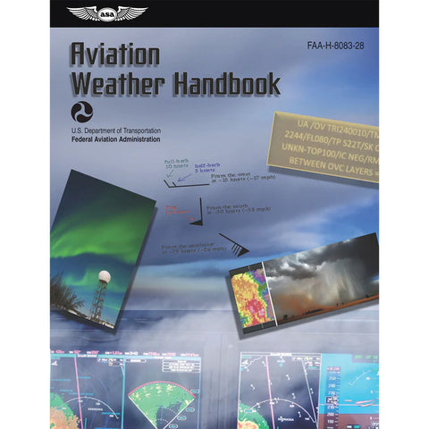
ASA Aviation Weather HandbookThe ASA Aviation Weather Handbook is the definitive FAA weather reference, consolidating six critical Advisory Circulars into one comprehensive volume. All pilots deal with weather. They must learn to appreciate good weather; to recognize and respect marginal or hazardous weather; and to avoid violent weather. Recognizing these patterns and making the appropriate go/no-go decisions, including how to interpret AIRMETs and SIGMETs, is critical to the successful outcome of every flight. Price: $33.99
|

Want to learn more about Aviation Weather?
Our guides are designed to help student pilots become professional pilots and for private pilots to brush up on their knowledge and skills.
-
7 Types of Turbulence Every Pilot Should Know (What Causes It)
-
Ditch the Rough Ride: How to Avoid Turbulence (And What to Do if You Can't)
-
12 Types of Clouds Pilots Must Recognize [#12 Can be Deadly]
Did you find this article helpful?
Do you think we missed anything important? Let us know in the comments below!


