


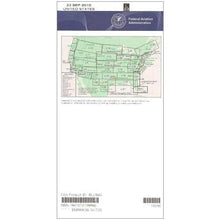
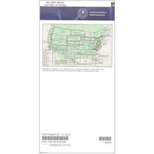
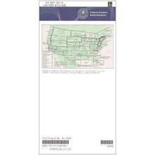
FAA L13/14 Instrument Flight Rules (IFR) Enroute Low Altitude Chart - 07/09/26 thru 09/03/26
10027
Benefits
Benefits
Shipping & Delivery
Shipping & Delivery
Returns
Returns
The official FAA L13/14 enroute chart provides instrument-rated pilots with comprehensive navigation coverage for low altitude IFR operations across the Northwest and North Central United States.
Complete regional coverage from Washington and Oregon to Wisconsin and Michigan eliminates the need for multiple navigation resources during extended cross-country flights.
Comprehensive IFR Navigation Tool
When pilots ask, "What areas do L13 and L14 charts cover?" they discover this essential navigation tool spans the entire Northwest US IFR navigation corridor. It includes portions of Idaho, Montana, North Dakota, South Dakota, Minnesota, and Wyoming. The enhanced four-color presentation makes critical flight information immediately accessible. It displays low-altitude flight routes, navigation fixes, ATC reporting points, Military Training Routes, GPS/satellite navigation routes, special use airspace, and controlled airspace boundaries with exceptional clarity. Designed specifically for operations below 18,000 feet, this current FAA low enroute chart includes VHF navigational facilities with complete frequency, identification, and coordinate data that professional and private pilots rely on for safe instrument flight rules compliance.
Stay Current with Subscription Options
Published on the FAA's standard 56-day cycle, pilots wondering "When do L13/L14 charts expire?" can maintain currency through convenient subscription options that automatically deliver updated charts. This ensures they always have the most current aeronautical information for low altitude IFR operations. Whether planning a single cross-country flight or managing ongoing regional operations, this chart subscription service eliminates the risk of flying with outdated navigation data. It provides exceptional value for flight schools, charter operators, and instrument-rated private pilots throughout the region.
Ensure safe, compliant IFR navigation across the Northwest & North Central US with the official FAA L13/14 chart, featuring enhanced four-color readability. Get complete coverage and stay always current with our convenient subscription, order yours today!
-
 SaleVendor:AeroNav Products
FAA L23/24 Instrument Flight Rules (IFR) Enroute Low Altitude Chart - 07/09/26 thru 09/03/26
Regular price $5.00Sale price $5.00 Regular priceUnit price per$5.25 -
 SaleVendor:AeroNav Products
FAA L3/4 Instrument Flight Rules (IFR) Enroute Low Altitude Chart - 07/09/26 thru 09/03/26
Regular price $5.00Sale price $5.00 Regular priceUnit price per$5.25 -
 SaleVendor:AeroNav Products
FAA L21/22 Instrument Flight Rules (IFR) Enroute Low Altitude Chart - 07/09/26 thru 09/03/26
Regular price $5.00Sale price $5.00 Regular priceUnit price per$5.25 -
 SaleVendor:AeroNav Products
FAA L27/28 Instrument Flight Rules (IFR) Enroute Low Altitude Chart - 07/09/26 thru 09/03/26
Regular price $5.00Sale price $5.00 Regular priceUnit price per$5.25 -
 SaleVendor:AeroNav Products
FAA L35/36 Instrument Flight Rules (IFR) Enroute Low Altitude Chart - 07/09/26 thru 09/03/26
Regular price $5.00Sale price $5.00 Regular priceUnit price per$5.25 -
 SaleVendor:AeroNav Products
FAA L17/18 Instrument Flight Rules (IFR) Enroute Low Altitude Chart - 07/09/26 thru 09/03/26
Regular price $5.00Sale price $5.00 Regular priceUnit price per$5.25 -
 SaleVendor:AeroNav Products
FAA L7/8 Instrument Flight Rules (IFR) Enroute Low Altitude Chart - 07/09/26 thru 09/03/26
Regular price $5.00Sale price $5.00 Regular priceUnit price per$5.25 -
 SaleVendor:AeroNav Products
FAA L15/16 Instrument Flight Rules (IFR) Enroute Low Altitude Chart - 07/09/26 thru 09/03/26
Regular price $5.00Sale price $5.00 Regular priceUnit price per$5.25 -
 SaleVendor:AeroNav Products
FAA L33/34 Instrument Flight Rules (IFR) Enroute Low Altitude Chart - 07/09/26 thru 09/03/26
Regular price $5.00Sale price $5.00 Regular priceUnit price per$5.25 -
 SaleVendor:AeroNav Products
FAA L19/20 Instrument Flight Rules (IFR) Enroute Low Altitude Chart - 07/09/26 thru 09/03/26
Regular price $5.00Sale price $5.00 Regular priceUnit price per$5.25


-
 FREE U.S. Shipping (on $100+)Save on outbound delivery!
 -
 Authorized DealerGenuine Gear
 -
 Expert Pilot SupportGear Tested by Real Pilots
 -
 SHIPS TODAY (Order by 3 PM ET)Get It Faster!
- Choosing a selection results in a full page refresh.
- Opens in a new window.