


FAA Ketchikan VFR Sectional Chart for Alaska Pilots - 07/09/26 thru 09/03/26
10086
Benefits
Benefits
Shipping & Delivery
Shipping & Delivery
Returns
Returns
The FAA Ketchikan sectional chart is the gold standard for VFR navigation in Southeast Alaska's challenging airspace.
This official Alaska VFR chart offers unmatched accuracy with updates every 56 days, ensuring you have the most current aeronautical data for safe flight operations.
Comprehensive Coverage for Alaska Pilots
When pilots ask, "What are the best VFR charts for flying in Southeast Alaska?" experienced aviators consistently recommend this comprehensive sectional map. Trusted by Alaska professionals, the chart covers the extreme southeastern portion of Alaska, Pacific coastal areas, the Alaska-Canada border region, and parts of British Columbia at the standard 1:500,000 scale. Whether you're a bush pilot navigating remote landing strips, a flight instructor preparing students for checkrides, or conducting search and rescue operations, this aviation chart provides essential details. It includes complete airport and runway information, airspace dimensions, radio navigational aids and frequencies, landmarks, elevation data, air traffic control frequencies, and terrain hazards. The detailed coverage extends from Ketchikan's busy commercial routes to the most remote backcountry airstrips, giving pilots the situational awareness needed in Alaska's unpredictable weather and challenging terrain.
Critical Safety Data and Frequent Updates
What's included in the Alaska Ketchikan sectional goes far beyond basic navigation, incorporating critical safety data that can mean the difference between a routine flight and an emergency situation. This VFR navigation chart Alaska pilots depend on features comprehensive obstacle information, updated weather reporting station locations, emergency landing sites, and cross-border procedures for flights into Canadian airspace. The chart's frequent revision cycle ensures that temporary flight restrictions, new obstacles, airport changes, and airspace modifications are reflected promptly, giving you confidence that your flight planning is based on the most reliable information available.
Fly safely and legally over Southeast Alaska's unique terrain with the official FAA Ketchikan Sectional Chart, your most accurate VFR guide, updated every 56 days. Get yours now!
-
 SaleVendor:AeroNav Products
FAA Seward VFR Sectional Chart for Alaska Pilots - 07/09/26 thru 09/03/26
Regular price $7.50Sale price $7.50 Regular priceUnit price per$7.55 -
 SaleVendor:AeroNav Products
FAA Mcgrath VFR Sectional Aeronautical Chart - 07/09/26 thru 09/03/26
Regular price $7.50Sale price $7.50 Regular priceUnit price per$7.55 -
 SaleVendor:AeroNav Products
FAA Fairbanks VFR Sectional Chart for Alaska Pilots - 07/09/26 thru 09/03/26
Regular price $7.50Sale price $7.50 Regular priceUnit price per$7.55 -
 SaleVendor:AeroNav Products
FAA Anchorage VFR Sectional Chart for Alaska Pilots - 07/09/26 thru 09/03/26
Regular price $7.50Sale price $7.50 Regular priceUnit price per$7.55 -
 SaleVendor:AeroNav Products
FAA Nome VFR Sectional Chart for Alaska Pilots - 07/09/26 thru 09/03/26
Regular price $7.50Sale price $7.50 Regular priceUnit price per$7.55 -
 SaleVendor:AeroNav Products
FAA Bethel VFR Sectional Chart for Alaska Pilots - 07/09/26 thru 09/03/26
Regular price $7.50Sale price $7.50 Regular priceUnit price per$7.55 -
 SaleVendor:AeroNav Products
FAA Enroute Low Alaska L1/2 Low Altitude IFR Chart for Alaska Pilots - 07/09/26 thru 09/03/26
Regular price $5.00Sale price $5.00 Regular priceUnit price per$5.25 -
 SaleVendor:AeroNav Products
FAA Kodiak VFR Sectional Chart for Alaska Pilots - 07/09/26 thru 09/03/26
Regular price $7.50Sale price $7.50 Regular priceUnit price per$7.55 -
 SaleVendor:AeroNav Products
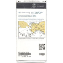
FAA Cape Lisburne VFR Sectional Chart for Alaska Pilots - 07/09/26 thru 09/03/26
Regular price $7.50Sale price $7.50 Regular priceUnit price per$7.55 -
 SaleVendor:AeroNav Products
FAA Cold Bay VFR Sectional Chart for Alaska Pilots - 07/09/26 thru 09/03/26
Regular price $7.50Sale price $7.50 Regular priceUnit price per$7.55


-
 FREE U.S. Shipping (on $100+)Save on outbound delivery!
 -
 Authorized DealerGenuine Gear
 -
 Expert Pilot SupportGear Tested by Real Pilots
 -
 SHIPS TODAY (Order by 3 PM ET)Get It Faster!
- Choosing a selection results in a full page refresh.
- Opens in a new window.