


FAA Kansas City VFR Terminal Area Chart - 07/09/26 thru 09/03/26
10125
Benefits
Benefits
Shipping & Delivery
Shipping & Delivery
Returns
Returns
The FAA Kansas City Terminal Area Chart (TAC) is an essential tool for pilots navigating the complex airspace around Kansas City International Airport.
This chart offers unmatched detail at a 1:250,000 scale, providing 3.43 nautical miles per inch for precise navigation that standard sectional charts cannot match.
Enhanced Situational Awareness for Pilots
When seeking the latest Kansas City VFR chart for safe Class B airspace operations, this Terminal Area Chart is your trusted companion. It reveals critical landmarks, radio frequencies, altitude restrictions, and airspace boundaries. This helps avoid violations and maintain safety around Kansas City International. Unlike standard sectional charts, this Kansas City Class B airspace chart focuses on the complex controlled airspace where precision is crucial. Flight training schools, student pilots, and seasoned aviators rely on its clear depiction of airspace boundaries and local aeronautical information, making navigation safer and more efficient.
VFR Flyway Planning Chart for Optimized Routing
The chart includes a VFR Flyway Planning Chart on the reverse side, presenting optimized flight paths and recommended altitudes for Kansas City flyway planning. This feature helps you avoid faster, larger aircraft while maintaining safe separation in congested airspace. Updated every 56 days, this FAA-compliant chart ensures you have current frequency information, temporary flight restrictions, and the latest airspace modifications. Whether you're a private pilot, a flight instructor, or a corporate pilot, this chart enhances your situational awareness and operational confidence in one of America's busiest terminal areas.
Navigate Kansas City's complex Class B airspace with total confidence. The official FAA Terminal Area Chart delivers unmatched detail and always-current data for maximum situational awareness, plus a VFR Flyway Planning Chart, ensuring safe, violation-free flights. Get your updated chart now!
-
 SaleVendor:AeroNav Products
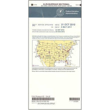
FAA Albuquerque VFR Sectional Aeronautical Chart - 07/09/26 thru 09/03/26
Regular price $8.50Sale price $8.50 Regular priceUnit price per$9.75 -
 SaleVendor:AeroNav Products
FAA Anchorage VFR Sectional Chart for Alaska Pilots - 07/09/26 thru 09/03/26
Regular price $7.50Sale price $7.50 Regular priceUnit price per$7.55 -
 SaleVendor:AeroNav Products
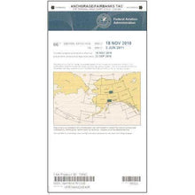
FAA Anchorage/Fairbanks Terminal Area Chart for Alaska Pilots - 07/09/26 thru 09/03/26
Regular price $5.99Sale price $5.99 Regular priceUnit price per$6.20 -
 SaleVendor:AeroNav Products
FAA Atlanta VFR Sectional Aeronautical Chart - 07/09/26 thru 09/03/26
Regular price $8.50Sale price $8.50 Regular priceUnit price per$9.75 -
 SaleVendor:AeroNav Products
FAA Atlanta VFR Terminal Area Chart - 07/09/26 thru 09/03/26
Regular price $5.99Sale price $5.99 Regular priceUnit price per$6.20 -
 SaleVendor:AeroNav Products
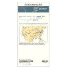
FAA Baltimore - Washington VFR Terminal Area Chart - 07/09/26 thru 09/03/26
Regular price $5.99Sale price $5.99 Regular priceUnit price per$6.20 -
 SaleVendor:AeroNav Products
FAA Bethel VFR Sectional Chart for Alaska Pilots - 07/09/26 thru 09/03/26
Regular price $7.50Sale price $7.50 Regular priceUnit price per$7.55 -
 SaleVendor:AeroNav Products
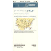
FAA Billings VFR Sectional Aeronautical Chart - 07/09/26 thru 09/03/26
Regular price $8.50Sale price $8.50 Regular priceUnit price per$9.75 -
 SaleVendor:AeroNav Products
FAA Boston VFR Terminal Area Chart - 07/09/26 thru 09/03/26
Regular price $5.99Sale price $5.99 Regular priceUnit price per$6.20 -
 SaleVendor:AeroNav Products
FAA Brownsville VFR Sectional Aeronautical Chart - 07/09/26 thru 09/03/26
Regular price $8.50Sale price $8.50 Regular priceUnit price per$9.75


-
 FREE U.S. Shipping (on $100+)Save on outbound delivery!
 -
 Authorized DealerGenuine Gear
 -
 Expert Pilot SupportGear Tested by Real Pilots
 -
 SHIPS TODAY (Order by 3 PM ET)Get It Faster!
- Choosing a selection results in a full page refresh.
- Opens in a new window.