FAA H11/12 Instrument Flight Rules (IFR) Enroute High Altitude Chart - 11/27/25 thru 01/22/26
14671
Benefits
Benefits
- Essential Navigation Tool: Provides vital aeronautical info for safe operations above 18,000 feet.
- Comprehensive Coverage: Includes key areas of the Eastern US and parts of Canada.
- Detailed Information: Features VHF navigational facilities, Jet Routes, and IFR reporting points.
- Standardized Scale: Utilizes a scale of 20 nm per inch for accurate navigation.
- Regular Updates: Revised every 56 days to ensure current and reliable information.
Shipping & Delivery
Shipping & Delivery
- Free Shipping: Enjoy FREE Ground Shipping on all Continental U.S. orders over $100. (That's money saved that you can put toward your next flight!)
- Rapid Dispatch: Orders placed by 3 PM ET (Mon-Fri) ship the same business day, ensuring the fastest possible delivery.
- Control Your Delivery: Select your ideal delivery speed, from cost-effective economy options to guaranteed express delivery, directly at checkout.
- No Hidden Costs: See all final shipping costs and estimated delivery dates upfront-no surprises will be added after you purchase.
- Stay Informed: A tracking link is automatically emailed to you the moment your package leaves our warehouse, so you can monitor its journey.
- We're Here to Help: Have questions about delivery times or specific shipping needs? Our expert support team is ready to assist you.
Returns
Returns
- Easy 30-Day Returns: Return most items within 30 days for a full refund (excludes shipping and handling). Read Return Policy
- Free Exchange Shipping: Exchange items or get store credit with free return shipping in the continental US (Excluding Flight Sim, Luggage & Oversize Items).
- Simple Process: Contact us for an RMA number to start your return, with a 7-day window to postmark your item.
- Condition Requirements: Returns must be in new, original packaging, including all accessories and promotional items.
Cleared for Clear Skies
A smooth journey from cart to checkout. Your transaction is protected every step of the way.
The FAA H11/12 Instrument Flight Rules (IFR) Enroute High Altitude Chart is the definitive navigation resource for pilots flying at or above 18,000 feet across the Eastern United States and parts of Canada.
This official FAA chart offers unmatched coverage of the Eastern Seaboard and several Canadian provinces, making it essential for long-haul and international flights in Class A airspace.
Comprehensive Aeronautical Information
When pilots ask, "What is included in the H-11/12 enroute chart?" they find a comprehensive four-color publication with all critical aeronautical information for safe high-altitude operations. The IFR high altitude chart Eastern US coverage includes detailed jet routes, high-altitude GPS-based flight paths (RNAV Q-Routes), radio navigation stations with frequencies and coordinates, in-flight check-in locations, and selected airports across portions of Georgia, North Carolina, South Carolina, Virginia, West Virginia, the District of Columbia, Maryland, Delaware, Pennsylvania, New York, New Jersey, Massachusetts, Connecticut, Rhode Island, Vermont, New Hampshire, Maine, and Michigan, plus the Canadian provinces of Ontario, Quebec, New Brunswick, and Nova Scotia.
Precision and Reliability
Professional airline pilots, corporate flight departments, and flight training organizations rely on this chart's precision cartography at the standard scale of 20 nautical miles per inch. Updated every 56 days to ensure accuracy, this FAA high altitude enroute chart eliminates guesswork from instrument flight planning while maintaining regulatory compliance. Available as both a one-time purchase and subscription, it is an indispensable aviation resource for anyone operating in the busy airspace corridors of the Eastern United States.
Fly the Eastern US high routes with confidence using the official FAA H11/12 chart—always current, incredibly detailed, and ensuring your compliance. Get yours now!
Our Clear Skies Security Promise
We believe your shopping experience should be as smooth and worry-free as a flight on a perfect day. Here’s a look at the instruments and procedures we use to guarantee your security from takeoff to touchdown.
1. Private Channel Encryption
All personal and payment information you share is transmitted over a secure, encrypted channel (SSL). This ensures your data is kept private and safe, just like a confidential radio communication.
2. First-Class Payment Partners
We only work with major, trusted payment providers. They are the experts who handle every transaction with the highest level of security and professional care.
3. Your Information Stays in the Cockpit
Your personal details are for our flight log only. We have a strict policy to never share or sell your information. Your privacy is paramount.
4. A Rock-Solid Airframe
Our online store is built on a leading, globally secure platform. It's constantly monitored and updated to protect against threats, ensuring a stable and safe environment for your journey with us.
5. No Turbulence Policy
We are a passionate team of aviation lovers committed to quality gear and honest service. Our return, refund, and shipping policies are straightforward and easy to find, ensuring no surprises along your route.
6. Your Friendly Control Tower
Have a question? Our support team is standing by to help guide you. We're fellow enthusiasts ready to ensure your experience is a great one.
Thank you for flying with PilotMall. Shop with confidence, knowing you're cleared for a safe and secure experience.
Fast shipping. Good price.No problems
Best Sellers
-
 Vendor:Travelpro
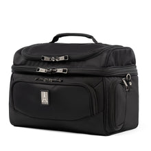
Travelpro FlightCrew5 Large Crew Cooler: Ultimate Insulated Storage for Pilots' Meals and Beverages
4.64 / 5.0
(11) 11 total reviews
Regular price $79.00Sale price $79.00 Regular priceUnit price / per$110.00 -
 Vendor:Thrustmaster
Thrustmaster TCA Captain Pack X Airbus Edition (Xbox Series X|S, One, PC)
Regular price $299.99Sale price $299.99 Regular priceUnit price / per -
 Vendor:Citizen Watch
Citizen Promaster Skyhawk A-T Blue Dial Stainless Steel Bracelet Watch (Internal E6B) JY8125-54L
5.0 / 5.0
(8) 8 total reviews
Regular price $649.00Sale price $649.00 Regular priceUnit price / per$895.00 -
 Vendor:ASA
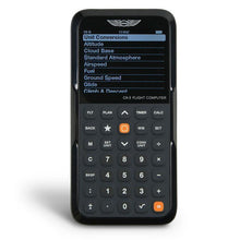
ASA CX-3 Flight Computer: Ultimate Electronic E6-B Calculator
4.85 / 5.0
(55) 55 total reviews
Regular price $127.99Sale price $127.99 Regular priceUnit price / per$149.95 -
 Vendor:PilotMall.com
PilotMall.com Next Gen Sound Silencer ANR Aviation Headset with Bluetooth
4.0 / 5.0
(2) 2 total reviews
Regular price $399.00Sale price $399.00 Regular priceUnit price / per$495.00 -
 On SaleVendor:Lightspeed
Lightspeed Zulu 3 Premium ANR Bluetooth Aviation Headset
4.8 / 5.0
(20) 20 total reviews
Regular price $849.00Sale price $849.00 Regular priceUnit price / per$949.00
Over 850,000 Orders Shipped
After 27 years in business and 25,000+ reviews, see what our aviation family has to say.
-
 FREE U.S. Shipping (on $100+)Only At Pilot Mall!
 -
 30 Day Money Back GuaranteeNo Hassle Returns
 -
 SHIPS TODAY (Order by 3 PM ET)Get It Faster!
- Choosing a selection results in a full page refresh.
- Opens in a new window.


