FAA Area 1/2 Instrument Flight Rules (IFR) Enroute Low Altitude Chart - 11/27/25 thru 01/22/26
FAA Area 1/2 Instrument Flight Rules (IFR) Enroute Low Altitude Chart - 11/27/25 thru 01/22/26
10038
Benefits
Benefits
- Enhanced Situational Awareness: Detailed IFR Area Charts provide critical information for instrument pilots flying in congested areas.
- Comprehensive Safety Data: Includes vital safety-of-flight data such as Victor Airways, navigational fixes, and ATC reporting points.
- Larger Scale for Clarity: Area Charts feature a larger scale, with A-1 side at 1" = 6 NM for major terminal airspaces, ensuring better visibility.
- Versatile Coverage: A-2 side covers key cities like Chicago, Dallas, and Los Angeles, with scales ranging from 1" = 5 NM to 1" = 8.5 NM.
- Affordable Access: Available as a one-time purchase or subscription, making it a valuable resource for every instrument-rated pilot.
Shipping & Delivery
Shipping & Delivery
- Free Shipping: Enjoy FREE Ground Shipping on all Continental U.S. orders over $100. (That's money saved that you can put toward your next flight!)
- Rapid Dispatch: Orders placed by 3 PM ET (Mon-Fri) ship the same business day, ensuring the fastest possible delivery.
- Control Your Delivery: Select your ideal delivery speed, from cost-effective economy options to guaranteed express delivery, directly at checkout.
- No Hidden Costs: See all final shipping costs and estimated delivery dates upfront-no surprises will be added after you purchase.
- Stay Informed: A tracking link is automatically emailed to you the moment your package leaves our warehouse, so you can monitor its journey.
- We're Here to Help: Have questions about delivery times or specific shipping needs? Our expert support team is ready to assist you.
Returns
Returns
- Easy 30-Day Returns: Return most items within 30 days for a full refund (excludes shipping and handling). Read Return Policy
- Free Exchange Shipping: Exchange items or get store credit with free return shipping in the continental US (Excluding Flight Sim, Luggage & Oversize Items).
- Simple Process: Contact us for an RMA number to start your return, with a 7-day window to postmark your item.
- Condition Requirements: Returns must be in new, original packaging, including all accessories and promotional items.
Cleared for Clear Skies
A smooth journey from cart to checkout. Your transaction is protected every step of the way.
Instrument pilots operating in America's most congested terminal airspace rely on FAA IFR Area Charts for the detailed situational awareness that standard charts simply cannot provide.
This official FAA Area 1/2 Enroute Low Altitude Chart delivers unmatched terminal area navigation detail through larger-scale representations that reveal critical information invisible on conventional low enroute charts.
Essential Navigation for Major Terminal Areas
When you're wondering what charts do I need for flying into Chicago airspace or navigating the complex terminal environments around Los Angeles, Denver, or Miami, this dual-sided chart becomes your essential flight planning companion. The A-1 side covers seven major eastern terminals including Atlanta, Detroit, Jacksonville, Miami, Minneapolis/St. Paul, St. Louis, and Washington D.C., while the A-2 side depicts seven western hubs: Chicago/Milwaukee, Dallas/Fort Worth, Denver, Kansas City, Los Angeles, Phoenix, and San Francisco. Each terminal area is presented at scales ranging from 1 inch equals 5 nautical miles to 1 inch equals 8.5 nautical miles, providing the enhanced visibility needed to identify IFR navigation routes, air traffic control checkpoints, GPS-based navigation routes, military training routes, restricted flight areas, controlled airspace boundaries, and VHF navigational facilities with their frequencies and coordinates.
Designed for Instrument Navigation
Designed for instrument navigation up to but not including 18,000 feet above sea level, these current IFR terminal charts eliminate the guesswork when flying into unfamiliar busy airspace. Whether you're a commercial pilot managing tight schedules into major hubs, a corporate pilot ensuring passenger safety in complex terminal environments, or an instrument-rated private pilot building confidence for cross-country flights, this single chart consolidates 14 of America's most challenging terminal areas into one comprehensive resource. Available as both a one-time purchase and through convenient chart subscription services that maintain currency through the standard 56-day update cycle, this affordable navigation tool addresses the critical need for detailed terminal area information that every instrument pilot faces.
Navigate America's 14 busiest terminal areas with superior detail and official FAA accuracy. Our single, dual-sided Area 1/2 Enroute Low Chart delivers comprehensive coverage—get yours now!
Our Clear Skies Security Promise
We believe your shopping experience should be as smooth and worry-free as a flight on a perfect day. Here’s a look at the instruments and procedures we use to guarantee your security from takeoff to touchdown.
1. Private Channel Encryption
All personal and payment information you share is transmitted over a secure, encrypted channel (SSL). This ensures your data is kept private and safe, just like a confidential radio communication.
2. First-Class Payment Partners
We only work with major, trusted payment providers. They are the experts who handle every transaction with the highest level of security and professional care.
3. Your Information Stays in the Cockpit
Your personal details are for our flight log only. We have a strict policy to never share or sell your information. Your privacy is paramount.
4. A Rock-Solid Airframe
Our online store is built on a leading, globally secure platform. It's constantly monitored and updated to protect against threats, ensuring a stable and safe environment for your journey with us.
5. No Turbulence Policy
We are a passionate team of aviation lovers committed to quality gear and honest service. Our return, refund, and shipping policies are straightforward and easy to find, ensuring no surprises along your route.
6. Your Friendly Control Tower
Have a question? Our support team is standing by to help guide you. We're fellow enthusiasts ready to ensure your experience is a great one.
Thank you for flying with PilotMall. Shop with confidence, knowing you're cleared for a safe and secure experience.
I've ordered this product twice now. The first time, I received an Alaska A-1 & A-2 chart and just thought I had ordered the wrong product. The second time, I received a South America A-1 & A-2 chart and asked for the correct US one and received it promptly. I like this company and I'm a happy customer but this seems to be an area where repeated mistakes are being made in filling the order and more care needs to be taken.
Best Sellers
-
 Vendor:Travelpro
Travelpro FlightCrew5 22" Rollaboard: Durable Luggage for Aviation Professionals
29 reviewsRegular price $199.00Sale price $199.00 Regular priceUnit price / per$310.00 -
 Vendor:PilotMall.com
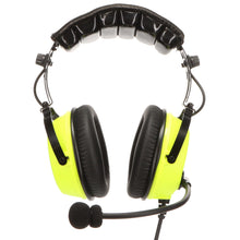
PilotMall.com Next Gen Sound Silencer ANR Aviation Headset with Bluetooth
2 reviewsRegular price $399.00Sale price $399.00 Regular priceUnit price / per$495.00 -
 NewVendor:Travelpro
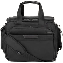
Travelpro Pilot Flight Bag - Ultimate Protection Flight Bag For Pilots
No reviewsRegular price $165.00Sale price $165.00 Regular priceUnit price / per -
 Vendor:Travelpro
Travelpro FlightCrew5 Multi-Purpose Tote: Durable, Organized Flight Bag with Laptop Pocket for Aviation Professionals
7 reviewsRegular price $115.00Sale price $115.00 Regular priceUnit price / per$170.00 -
 Vendor:David Clark
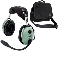
David Clark H10-13S Stereo Aviation Headset & Bag Combo: Unmatched Comfort & Superior Clarity for Pilots 40422G-01
16 reviewsRegular price $384.95Sale price $384.95 Regular priceUnit price / per$439.44 -
 Vendor:MyGoFlight
MyGoFlight Flight Bag PLC Pro: Pilot's Premium Ballistic Nylon Flight Bag
11 reviewsRegular price $329.00Sale price $329.00 Regular priceUnit price / per
Over 850,000 Orders Shipped
After 27 years in business and 25,000+ reviews, see what our aviation family has to say.
-
 FREE U.S. Shipping (on $100+)Only At Pilot Mall!
 -
 30 Day Money Back GuaranteeNo Hassle Returns
 -
 SHIPS TODAY (Order by 3 PM ET)Get It Faster!
- Choosing a selection results in a full page refresh.
- Opens in a new window.


