


FAA Lake Huron VFR Sectional Aeronautical Chart - 05/14/26 thru 07/09/26
10089
Benefits
Benefits
Shipping & Delivery
Shipping & Delivery
Returns
Returns
The official FAA Lake Huron sectional chart is the authoritative visual navigation map for pilots in the Great Lakes region, providing critical aeronautical information for safe flight planning near the US-Canada border.
Unmatched Cross-Border Coverage: This VFR sectional chart for Michigan offers unparalleled coverage, spanning both US and Canadian airspace around Lake Huron, eastern Michigan, and parts of Ontario. It's an essential tool for international flight operations.
Comprehensive Aeronautical Data for Safe Navigation
Pilots exploring "what airspace information is on Lake Huron sectional" will find a wealth of aeronautical navigation data. Expert FAA cartographers meticulously compile this full-color, foldable chart. It includes detailed airport information, runway lengths, lighting systems, and available services. Precise airspace boundaries help pilots maintain awareness of their aircraft's position and surroundings.
Regular Updates for Accurate Flight Planning
Covering the binational Lake Huron region at a 1:500,000 scale, this chart undergoes updates every 56 days. This ensures pilots have the most accurate aeronautical information. Whether you're a recreational pilot, a flight instructor, or a commercial operator, this chart addresses the need for situational awareness in unfamiliar territory while meeting regulatory requirements for international flights.
Ensure safe, compliant flights across the US-Canada border with the official FAA Lake Huron Sectional Chart, your essential guide for unparalleled accuracy and comprehensive VFR navigation. Get your latest edition now!
-
 SaleVendor:AeroNav Products
FAA Atlanta VFR Sectional Aeronautical Chart - 05/14/26 thru 07/09/26
Regular price $8.50Sale price $8.50 Regular priceUnit price per$9.75 -
 SaleVendor:AeroNav Products
FAA New York VFR Sectional Aeronautical Chart - 05/14/26 thru 07/09/26
Regular price $8.50Sale price $8.50 Regular priceUnit price per$9.75 -
 SaleVendor:AeroNav Products
FAA Detroit VFR Sectional Aeronautical Chart - 05/14/26 thru 07/09/26
Regular price $8.50Sale price $8.50 Regular priceUnit price per$9.75 -
 SaleVendor:AeroNav Products
FAA Jacksonville VFR Sectional Aeronautical Chart - 05/14/26 thru 07/09/26
Regular price $8.50Sale price $8.50 Regular priceUnit price per$9.75 -
 SaleVendor:AeroNav Products
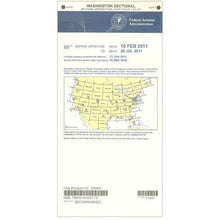
FAA Washington Sectional - 05/14/26 thru 07/09/26
Regular price $8.50Sale price $8.50 Regular priceUnit price per$9.75 -
 SaleVendor:AeroNav Products
FAA Miami VFR Sectional Aeronautical Chart - 05/14/26 thru 07/09/26
Regular price $8.50Sale price $8.50 Regular priceUnit price per$9.75 -
 SaleVendor:AeroNav Products
FAA Great Falls VFR Sectional Aeronautical Chart - 05/14/26 thru 07/09/26
Regular price $8.50Sale price $8.50 Regular priceUnit price per$9.75 -
 SaleVendor:AeroNav Products
FAA San Francisco VFR Sectional Aeronautical Chart - 05/14/26 thru 07/09/26
Regular price $8.50Sale price $8.50 Regular priceUnit price per$9.75 -
 SaleVendor:AeroNav Products
FAA Chicago VFR Sectional Aeronautical Chart - 05/14/26 thru 07/09/26
Regular price $8.50Sale price $8.50 Regular priceUnit price per$9.75 -
 SaleVendor:AeroNav Products
FAA Los Angeles VFR Sectional Aeronautical Chart - 05/14/26 thru 07/09/26
Regular price $8.50Sale price $8.50 Regular priceUnit price per$9.75


-
 FREE U.S. Shipping (on $100+)Save on outbound delivery!
 -
 4.8/5 StarsReviewed by 26,000+ Fellow Pilots
 -
 Expert Pilot SupportGear Tested by Real Pilots
 -
SHIPS TODAY (Order by 3 PM ET)Get It Faster!
- Choosing a selection results in a full page refresh.
- Opens in a new window.