

Description
The FAA's incredibly popular Sectional Aeronautical Charts are the primary series of navigational publications designed for aviators who fly by external visual reference. These foldable, full-color charts are loaded with valuable aviation data including airport info (runway lengths, lighting, elevation, services available, surface type, etc.); airspace dimensions; VHF and LF/MF navigational facilities (frequency, ID, and channel); landmarks; cities & towns; elevation/topographic info; ATC entities and associated contact/radio frequencies; bodies of water; obstructions; and much, much more.
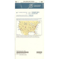
The Billings Sectional covers the airspace over much of Montana and North Dakota, as well as portions of South Dakota and Wyoming. Uses the standard 1:500,000 (6.86 nm per inch; 2.70 nm per cm) scale characteristic of sectional charts. Updated every six months. An affordable, info-packed source of relevant FAA data that should be in every aviator's flight bag.
The Billings Sectional covers the airspace over much of Montana and North Dakota, as well as portions of South Dakota and Wyoming. Uses the standard 1:500,000 (6.86 nm per inch; 2.70 nm per cm) scale characteristic of sectional charts. Updated every six months. An affordable, info-packed source of relevant FAA data that should be in every aviator's flight bag.
CHART