

Description
VFR flyers who aviate in the untamed environs of Western Alaska need a reliable source of aeronautical navigation data to help keep them safe during their operations in such a rugged, unforgiving region. Fortunately, the FAA's Nome Sectional Chart provides all the need-to-know aviation info to help them maintain their situational awareness from takeoff to touchdown. As with all charts in the FAA's Sectional series, this foldable, full-color chart is loaded with valuable aviation data including airport info (runway lengths, lighting, elevation, services available, surface type, etc.); airspace dimensions; VHF and LF/MF navigational facilities (frequency, ID, and channel); landmarks; cities & towns; elevation/topographic info; ATC entities and associated contact/radio frequencies; bodies of water; obstructions; and much, much more.
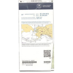
The Nome Sectional covers the central portion of Western Alaska, including the Seward Peninsula, part of Norton Sound, the Bering Strait, the International Date Line, and even a bit of the extreme eastern tip of Russia. Uses the standard 1:500,000 (6.86 nm per inch; 2.70 nm per cm) scale characteristic of sectional charts. The majority of sectionals are updated every six months, though several Alaska charts are revised annually. A high-caliber, data-packed source of essential aeronautical info that no pilot in the region can afford to fly without.
The Nome Sectional covers the central portion of Western Alaska, including the Seward Peninsula, part of Norton Sound, the Bering Strait, the International Date Line, and even a bit of the extreme eastern tip of Russia. Uses the standard 1:500,000 (6.86 nm per inch; 2.70 nm per cm) scale characteristic of sectional charts. The majority of sectionals are updated every six months, though several Alaska charts are revised annually. A high-caliber, data-packed source of essential aeronautical info that no pilot in the region can afford to fly without.
CHART