

-
 SaleVendor:AeroNav Products
FAA Chart Supplement SE (Airport/Facility Directory South East) - 05/14/26 thru 07/09/26
Regular price $7.50Sale price $7.50 Regular priceUnit price per$8.00 -
 SaleVendor:AeroNav Products
FAA Chart Supplement NE (Airport/Facility Directory North East) - 05/14/26 thru 07/09/26
Regular price $7.50Sale price $7.50 Regular priceUnit price per$8.00 -

Fresh from The Hangar
The latest from top aviation brands. -
 SaleVendor:AeroNav Products
FAA Atlanta VFR Sectional Aeronautical Chart - 05/14/26 thru 07/09/26
Regular price $8.50Sale price $8.50 Regular priceUnit price per$9.75 -
 SaleVendor:AeroNav Products
FAA Jacksonville VFR Sectional Aeronautical Chart - 05/14/26 thru 07/09/26
Regular price $8.50Sale price $8.50 Regular priceUnit price per$9.75 -
 SaleVendor:AeroNav Products
FAA New York VFR Sectional Aeronautical Chart - 05/14/26 thru 07/09/26
Regular price $8.50Sale price $8.50 Regular priceUnit price per$9.75 -
 SaleVendor:AeroNav Products
FAA Miami VFR Sectional Aeronautical Chart - 05/14/26 thru 07/09/26
Regular price $8.50Sale price $8.50 Regular priceUnit price per$9.75 -
 SaleVendor:AeroNav Products
FAA Seattle VFR Sectional Aeronautical Chart - 05/14/26 thru 07/09/26
Regular price $8.50Sale price $8.50 Regular priceUnit price per$9.75 -
 SaleVendor:AeroNav Products
FAA San Francisco VFR Sectional Aeronautical Chart - 05/14/26 thru 07/09/26
Regular price $8.50Sale price $8.50 Regular priceUnit price per$9.75 -
 SaleVendor:AeroNav Products
FAA Chart Supplement SW (Airport/Facility Directory South West) - 05/14/26 thru 07/09/26
Regular price $7.50Sale price $7.50 Regular priceUnit price per$8.00 -
 SaleVendor:AeroNav Products
FAA Chicago VFR Sectional Aeronautical Chart - 05/14/26 thru 07/09/26
Regular price $8.50Sale price $8.50 Regular priceUnit price per$9.75 -
 SaleVendor:AeroNav Products
FAA South East Vol 3 U.S. Terminal Procedures Publication Bound - 05/14/26 thru 07/09/26
Regular price $12.50Sale price $12.50 Regular priceUnit price per$13.00 -
 SaleVendor:AeroNav Products
FAA Los Angeles VFR Sectional Aeronautical Chart - 05/14/26 thru 07/09/26
Regular price $8.50Sale price $8.50 Regular priceUnit price per$9.75 -
 SaleVendor:AeroNav Products
FAA Washington Sectional - 05/14/26 thru 07/09/26
Regular price $8.50Sale price $8.50 Regular priceUnit price per$9.75 -
 SaleVendor:AeroNav Products
FAA L23/24 Instrument Flight Rules (IFR) Enroute Low Altitude Chart - 05/14/26 thru 07/09/26
Regular price $5.00Sale price $5.00 Regular priceUnit price per$5.25 -
 SaleVendor:AeroNav Products
FAA Chart Supplement EC (Airport/Facility Directory East Central) - 05/14/26 thru 07/09/26
Regular price $7.50Sale price $7.50 Regular priceUnit price per$8.00 -
 SaleVendor:AeroNav Products
FAA Dallas VFR Sectional Aeronautical Chart - 05/14/26 thru 07/09/26
Regular price $8.50Sale price $8.50 Regular priceUnit price per$9.75 -
 SaleVendor:AeroNav Products
FAA Kansas City VFR Sectional Aeronautical Chart - 05/14/26 thru 07/09/26
Regular price $8.50Sale price $8.50 Regular priceUnit price per$9.75 -
 SaleVendor:AeroNav Products
FAA Charlotte VFR Sectional Aeronautical Chart - 05/14/26 thru 07/09/26
Regular price $8.50Sale price $8.50 Regular priceUnit price per$9.75 -
 SaleVendor:AeroNav Products
FAA Detroit VFR Sectional Aeronautical Chart - 05/14/26 thru 07/09/26
Regular price $8.50Sale price $8.50 Regular priceUnit price per$9.75 -
 SaleVendor:AeroNav Products
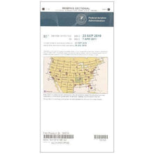
FAA Memphis VFR Sectional Aeronautical Chart - 05/14/26 thru 07/09/26
Regular price $8.50Sale price $8.50 Regular priceUnit price per$9.75 -
 SaleVendor:AeroNav Products
FAA Los Angeles VFR Terminal Area Chart - 05/14/26 thru 07/09/26
Regular price $5.99Sale price $5.99 Regular priceUnit price per$6.20 -
 SaleVendor:AeroNav Products
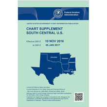
FAA Chart Supplement SC (Airport/Facility Directory South Central) - 05/14/26 thru 07/09/26
Regular price $7.50Sale price $7.50 Regular priceUnit price per$8.00 -
 SaleVendor:AeroNav Products
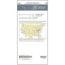
FAA Cincinnati VFR Sectional Aeronautical Chart - 05/14/26 thru 07/09/26
Regular price $8.50Sale price $8.50 Regular priceUnit price per$9.75 -
 SaleVendor:AeroNav Products
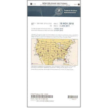
FAA New Orleans VFR Sectional Aeronautical Chart - 05/14/26 thru 07/09/26
Regular price $8.50Sale price $8.50 Regular priceUnit price per$9.75


FAA aeronautical charts: the official maps behind every flight plan
FAA aeronautical charts are the government-published maps that pilots use to navigate, plan routes, and stay clear of terrain and airspace. They fall into two broad families: VFR charts for flying by visual reference (sectionals, terminal area charts, and the chart supplement) and IFR charts for instrument flight (enroute low, enroute high, and terminal procedures). Pilot Mall carries the full AeroNav Products catalog across every region, all printed by the FAA's authorized producer and reissued on the current publication cycle so the chart you receive is the one in force. Pick the chart type that matches your flight rules, then narrow to the region you are flying.
FAA chart types at a glance
| Chart | Chart type | Scale | Primary use | Update cycle |
|---|---|---|---|---|
| FAA Atlanta VFR Sectional Aeronautical Chart | VFR sectional | 1:500,000 | VFR cross-country, terrain and airspace | 56-day cycle |
| FAA New York VFR Sectional Aeronautical Chart | VFR sectional | 1:500,000 | VFR cross-country, terrain and airspace | 56-day cycle |
| FAA Los Angeles VFR Sectional Aeronautical Chart | VFR sectional | 1:500,000 | VFR cross-country, terrain and airspace | 56-day cycle |
| FAA Chicago VFR Sectional Aeronautical Chart | VFR sectional | 1:500,000 | VFR cross-country, terrain and airspace | 56-day cycle |
| FAA Los Angeles VFR Terminal Area Chart | VFR terminal area | 1:250,000 | Detailed flying in busy Class B airspace | 56-day cycle |
| FAA Atlanta VFR Terminal Area Chart | VFR terminal area | 1:250,000 | Detailed flying in busy Class B airspace | 56-day cycle |
| FAA Tampa/Orlando VFR Terminal Area Chart | VFR terminal area | 1:250,000 | Detailed flying in busy Class B airspace | 56-day cycle |
| FAA San Francisco VFR Terminal Area Chart | VFR terminal area | 1:250,000 | Detailed flying in busy Class B airspace | 56-day cycle |
| FAA Chart Supplement SE (Airport/Facility Directory South East) | Chart supplement | Reference booklet | Runway data, frequencies, fuel, airport diagrams | 56-day cycle |
| FAA Chart Supplement NE (Airport/Facility Directory North East) | Chart supplement | Reference booklet | Runway data, frequencies, fuel, airport diagrams | 56-day cycle |
| FAA L23/24 IFR Enroute Low Altitude Chart | IFR enroute low | Enroute scale | Airways, fixes, and frequencies below 18,000 feet | 56-day cycle |
| FAA South East Vol 3 U.S. Terminal Procedures Publication Bound | IFR terminal procedures | Bound volume | Instrument approaches, SIDs, and STARs | 56-day cycle |
Click any chart for current pricing. Chart titles in our store carry the active effective dates, which change every cycle, so confirm the next effective date printed on the cover before you fly.
Types of FAA charts
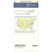
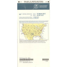
VFR sectional aeronautical charts
The sectional is the workhorse VFR chart, printed at a 1:500,000 scale (about 6.86 nautical miles per inch). It shows terrain elevation, airports, navaids, obstructions, and every class of airspace, which makes it the standard chart for visual cross-country planning and pilotage. Each named chart covers a region around a major city. Browse the full set under VFR sectional aeronautical charts.
VFR terminal area charts (TAC)
Terminal area charts zoom in to a 1:250,000 scale, giving you twice the detail of a sectional over the busy airspace surrounding major Class B airports. Pilots use a TAC to thread complex arrival and departure corridors with confidence. See the available cities under VFR terminal area charts.
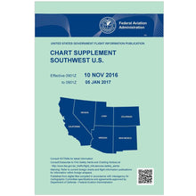
FAA chart supplements (formerly the AFD)
The Chart Supplement is the renamed Airport/Facility Directory. It is a regional booklet, published in seven volumes, that lists runway dimensions, communication and navaid frequencies, fuel availability, services, and airport diagrams for the airports in its coverage area. Find your region under FAA chart supplements.
IFR enroute charts (low and high)
IFR enroute charts replace terrain and landmarks with the airway system: victor and jet routes, fixes, minimum altitudes, and frequencies. Low altitude charts serve flight below 18,000 feet, while high altitude charts cover the jet-route structure above it. Shop IFR enroute low altitude charts and IFR enroute high altitude charts.
IFR terminal procedures publications
Terminal Procedures Publications are the bound booklets of instrument approach plates, standard instrument departures (SIDs), and standard terminal arrival routes (STARs) for a region. They are essential for flying any published IFR procedure. Browse them under IFR terminal procedures publications.
Alaska charts
Alaska has its own sectionals and supplements built for the state's vast distances and remote terrain, and some Alaska charts follow a longer validity cycle than the lower 48. If you are flying north, start with the dedicated Alaska charts collection.
How to choose the right FAA chart
Start with your flight rules. If you are flying VFR, a sectional covers your route, and you add a terminal area chart when your trip touches a major Class B metro area. If you are flying IFR, you need the enroute chart for your altitude band plus the terminal procedures volume for your destinations. In every case, carry the matching chart supplement for current airport and frequency data. Next, pick the region by the chart name, which is keyed to a major city, and confirm coverage reaches your departure, route, and destination. Finally, check that the chart is current by reading the effective date printed on the cover, since FAA VFR charts publish on a 56-day cycle. To keep your charts usable in flight, pair them with a kneeboard to hold them on your leg and a flight computer or plotter to measure courses and distances, and instrument students can round out their kit in IFR training products.
Why buy from Pilot Mall
- Genuine AeroNav Products charts: the same FAA-authorized charts you would buy direct, stocked across every region.
- Reprinted to the current cycle: charts are produced to the active 56-day publication cycle so you are flying the chart in force.
- Aviation only: we sell pilot gear and nothing else, so our team knows charts, regions, and what a flight plan actually needs.
- Trusted for 25-plus years: thousands of pilots rely on Pilot Mall for charts and cockpit equipment.
- Free U.S. shipping over $100: stock up on the charts and supplements you fly with most.
Frequently Asked Questions
What is an FAA aeronautical chart?
An FAA aeronautical chart is an official, government-published map pilots use to navigate and plan flights. VFR charts such as sectionals show terrain, airports, and airspace for visual flight, while IFR charts show airways, fixes, and procedures for instrument flight. Both are produced by the FAA's authorized chart maker.
What is the difference between a sectional chart and a terminal area chart?
A sectional chart is printed at 1:500,000 scale and covers a large region for general VFR navigation. A terminal area chart, or TAC, is printed at 1:250,000 scale, so it shows twice the detail over the busy Class B airspace around a major airport, making it easier to fly complex arrival and departure corridors.
How often are FAA sectional charts updated?
FAA VFR charts, including sectionals and terminal area charts, publish on a 56-day cycle that took effect on February 25, 2021. Some Alaska charts follow a longer validity period. Always confirm a chart is current by checking the next effective date printed on its cover before you fly.
What is an FAA Chart Supplement?
The Chart Supplement is the renamed Airport/Facility Directory (AFD). It is a regional booklet, published in seven volumes, that lists runway data, communication and navaid frequencies, fuel and services, and airport diagrams for the airports in its coverage area. It complements the maps you fly with rather than replacing them.
Are paper sectional charts required by the FAA?
For Part 91 flying, the FAA does not require paper charts, and Advisory Circular 91-78A allows an electronic flight bag to fully replace paper. Many pilots still carry current paper charts as a battery-free backup, and examiners often expect them on checkrides. Certain commercial operations have their own charting requirements.
Which sectional chart do I need?
Choose the sectional named for the major city nearest your route, then confirm its coverage reaches your departure, enroute, and destination airports. Longer cross-country flights often cross two or more sectionals, so carry each chart your route touches. For trips into busy metro airspace, add the matching terminal area chart.
