
-
 SaleVendor:AeroNav Products
FAA Atlanta VFR Sectional Aeronautical Chart - 05/14/26 thru 07/09/26
Regular price $8.50Sale price $8.50 Regular priceUnit price per$9.75 -
 SaleVendor:AeroNav Products
FAA New York VFR Sectional Aeronautical Chart - 05/14/26 thru 07/09/26
Regular price $8.50Sale price $8.50 Regular priceUnit price per$9.75 -

Fresh from The Hangar
The latest from top aviation brands. -
 SaleVendor:AeroNav Products
FAA Detroit VFR Sectional Aeronautical Chart - 05/14/26 thru 07/09/26
Regular price $8.50Sale price $8.50 Regular priceUnit price per$9.75 -
 SaleVendor:AeroNav Products
FAA Jacksonville VFR Sectional Aeronautical Chart - 05/14/26 thru 07/09/26
Regular price $8.50Sale price $8.50 Regular priceUnit price per$9.75 -
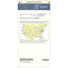 SaleVendor:AeroNav Products
FAA Washington Sectional - 05/14/26 thru 07/09/26
Regular price $8.50Sale price $8.50 Regular priceUnit price per$9.75 -
 SaleVendor:AeroNav Products
FAA San Francisco VFR Sectional Aeronautical Chart - 05/14/26 thru 07/09/26
Regular price $8.50Sale price $8.50 Regular priceUnit price per$9.75 -
 SaleVendor:AeroNav Products
FAA El Paso VFR Sectional Aeronautical Chart - 05/14/26 thru 07/09/26
Regular price $8.50Sale price $8.50 Regular priceUnit price per$9.75 -
 SaleVendor:AeroNav Products
FAA Chicago VFR Sectional Aeronautical Chart - 05/14/26 thru 07/09/26
Regular price $8.50Sale price $8.50 Regular priceUnit price per$9.75 -
 SaleVendor:AeroNav Products
FAA Miami VFR Sectional Aeronautical Chart - 05/14/26 thru 07/09/26
Regular price $8.50Sale price $8.50 Regular priceUnit price per$9.75 -
 SaleVendor:AeroNav Products
FAA Los Angeles VFR Sectional Aeronautical Chart - 05/14/26 thru 07/09/26
Regular price $8.50Sale price $8.50 Regular priceUnit price per$9.75 -
 SaleVendor:AeroNav Products
FAA Great Falls VFR Sectional Aeronautical Chart - 05/14/26 thru 07/09/26
Regular price $8.50Sale price $8.50 Regular priceUnit price per$9.75 -
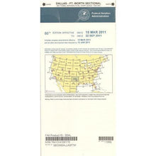 SaleVendor:AeroNav Products
FAA Dallas VFR Sectional Aeronautical Chart - 05/14/26 thru 07/09/26
Regular price $8.50Sale price $8.50 Regular priceUnit price per$9.75 -
 SaleVendor:AeroNav Products
FAA Seattle VFR Sectional Aeronautical Chart - 05/14/26 thru 07/09/26
Regular price $8.50Sale price $8.50 Regular priceUnit price per$9.75 -
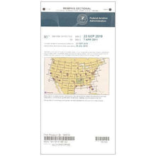 SaleVendor:AeroNav Products
FAA Memphis VFR Sectional Aeronautical Chart - 05/14/26 thru 07/09/26
Regular price $8.50Sale price $8.50 Regular priceUnit price per$9.75 -
 SaleVendor:AeroNav Products
FAA Lake Huron VFR Sectional Aeronautical Chart - 05/14/26 thru 07/09/26
Regular price $8.50Sale price $8.50 Regular priceUnit price per$9.75 -
 SaleVendor:AeroNav Products
FAA Charlotte VFR Sectional Aeronautical Chart - 05/14/26 thru 07/09/26
Regular price $8.50Sale price $8.50 Regular priceUnit price per$9.75 -
 SaleVendor:AeroNav Products
FAA St Louis VFR Sectional Aeronautical Chart - 05/14/26 thru 07/09/26
Regular price $8.50Sale price $8.50 Regular priceUnit price per$9.75
Your cart is empty :(
Continue shopping
Fresh from The Hangar
The latest from top aviation brands.
Your cart


